Arizona Trail Hike: Mile 0 - 52
Arizona Trail Hike: Mile 0 - 52
Hello from the trail! My goal of hiking 5000 miles in 2026 begins with the Arizona National Scenic Trail. This is a great hike to fit in before the typical hiking season and I am so thankful to be out here!
So far, so good. There have been some pains, as with any start of a thru hike, but overall things have been going smoothly.
Arizona Trail Hike Mile 0-52 Summary
Statistics:
Days: 3
Full hiking days: 3
Zeroes: 0
Neros: 0
Total Trail Miles Covered: 52.9
Bonus Miles: 4.3
Total Elevation Gain: 10,680 ft
Total Elevation Loss: 12,588 ft
Highlights:
Starting another thru hike!
Exploring Arizona as I had never really hiked there before
Lowlights:
Pains of starting another thru hike… primarily blisters
Lack of training lead to extreme muscle soreness
Lack of other hikers has made this a solitary experience thus far
Interesting water sources
Arizona Trail Hike: Detailed Version
Day 0 + 00:
I flew to Tucson, Arizona and all of my flight logistics and coordination worked out perfectly. I was even able to get into my hotel room in Tucson with early check-in, which was lovely after an early morning leaving Michigan.
After sorting my things out in the hotel, I created my final box to be sent from Tucson because it was a short turnaround window and it wouldn’t make it had it been sent from Michigan. Unfortunately, I realized that it was Presidents’ Day and I was unable to send the box so much like my past 2 to June 19th federal holidays, I was going to have to carry a few extra days of food.
As I was chatting with Bobcat (from the PCT) on the phone on the eve of another thru-hike; which apparently is a tradition now because we did the same thing before the Appalachian Trail, I got a text and a subsequent call from my Shuttle service that was bringing me to the Mexican board of the following day. There were some ugly weather that was blowing in and they recommended that I bump back a day to start because day one on the Arizona Trail goes high in elevation. Therefore there could’ve been a lot of snow in addition to the wind and rain. My first section of the PCT had similar conditions except I chose to go out and nearly got hypothermia. If it wasn’t for a friend who had started the trail with me for the first few days, I would still be in a vault toilet bathroom, shivering.
Despite my energy and desire to get onto the trail, I made the decision to officially bump back a day. So the following day, I was able to send the original box because it was no longer a federal holiday and do some other chores. But mostly, I laid around in a hotel room and relaxed before my impending thru-hike.
Day 1: Mile 0 - 13.1
Trail Daily Miles: 13.1
Total Miles: 15.4
Elevation Gain: 5138 ft
Elevation Loss: 4755 ft
Weather: Sun, Cold, Wind
Overall Day Sentiment: Rough Start
I woke up excited for the day and thankfully my hotel served breakfast starting at 6:00am as my shuttle service came around 6:30am.
It was a shorter ride than I expected to the border and it was made very pleasant by Mama Bear, who runs Finding True North the Shuttle company that I used, and Snake, a seasoned thru-hiker. It was a welcomed start to begin the trail in addition to all of the great information that Mama Bear gave me.
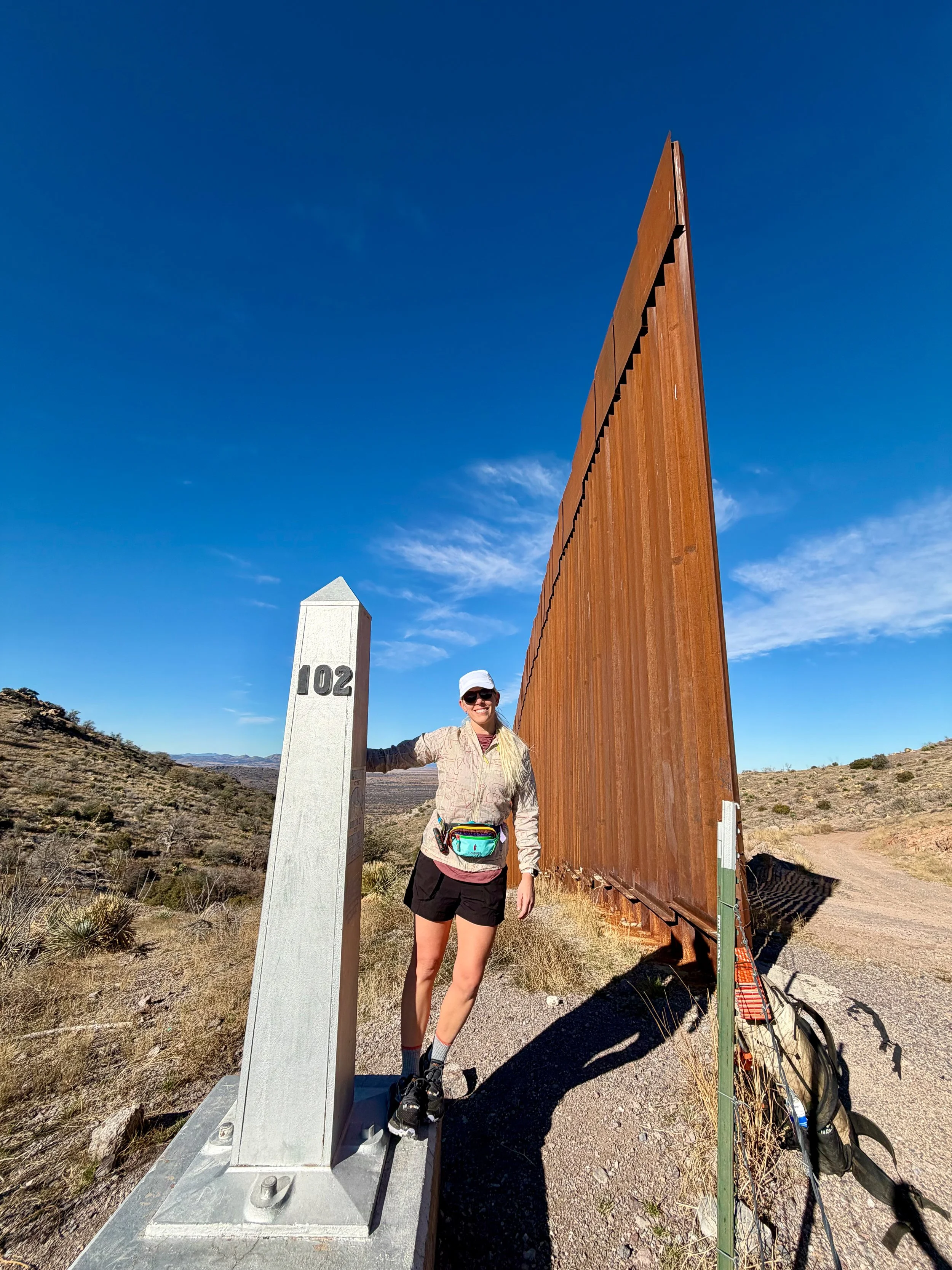
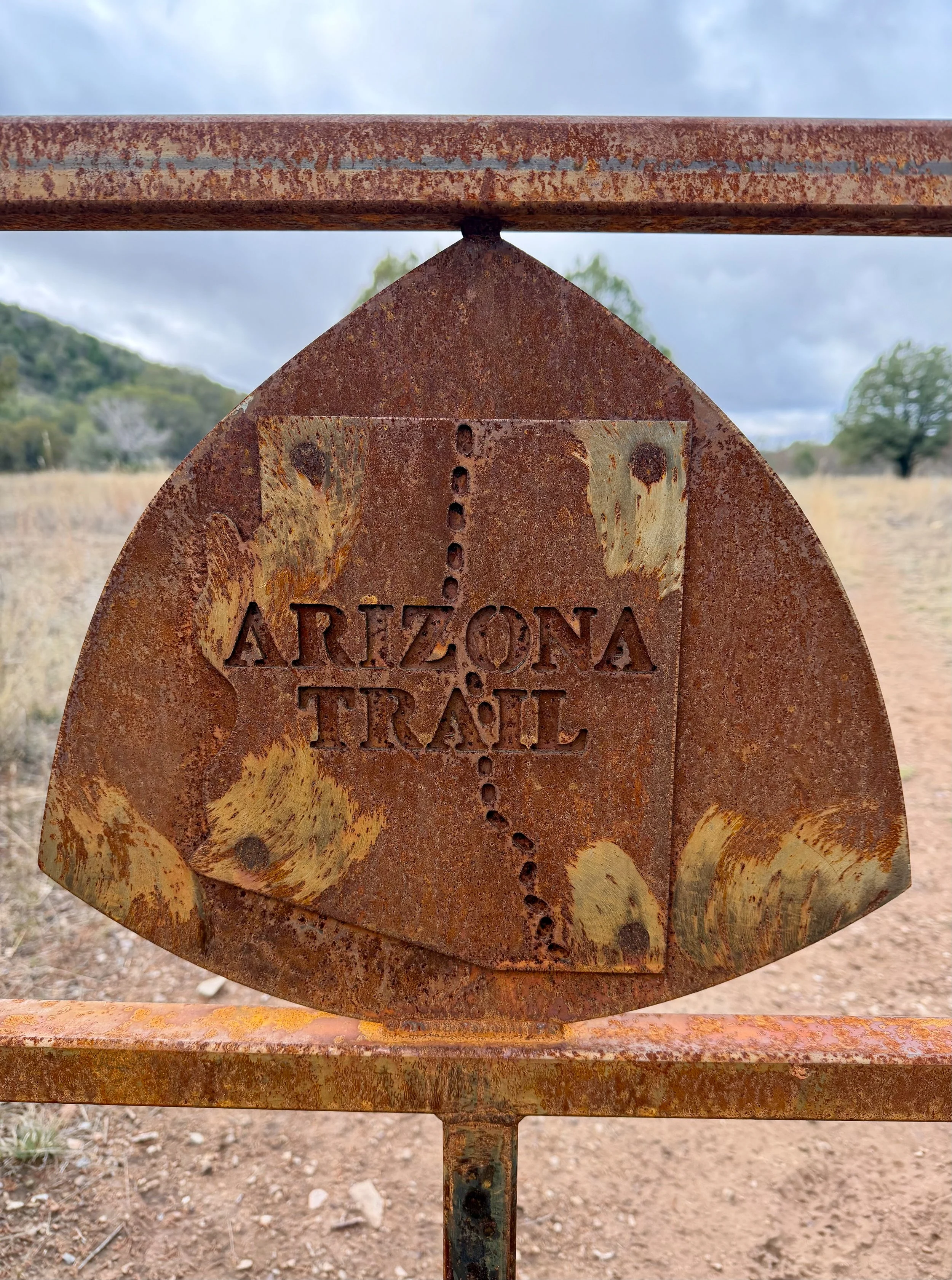
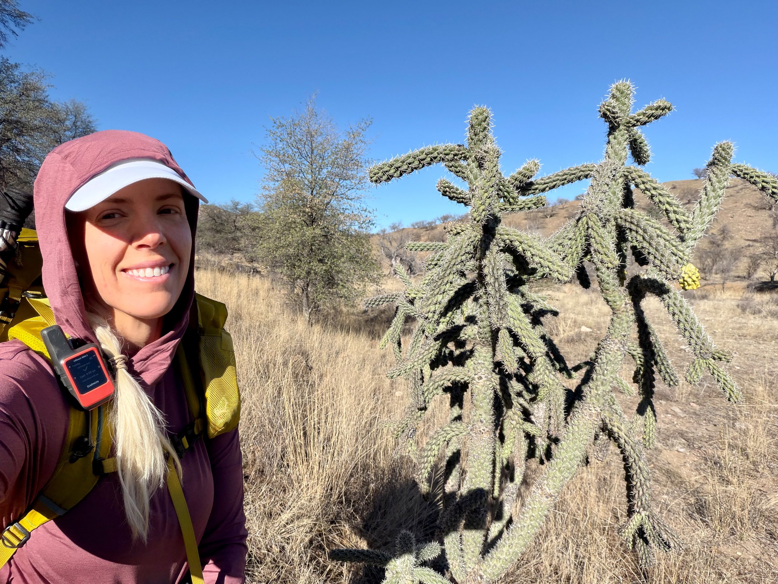
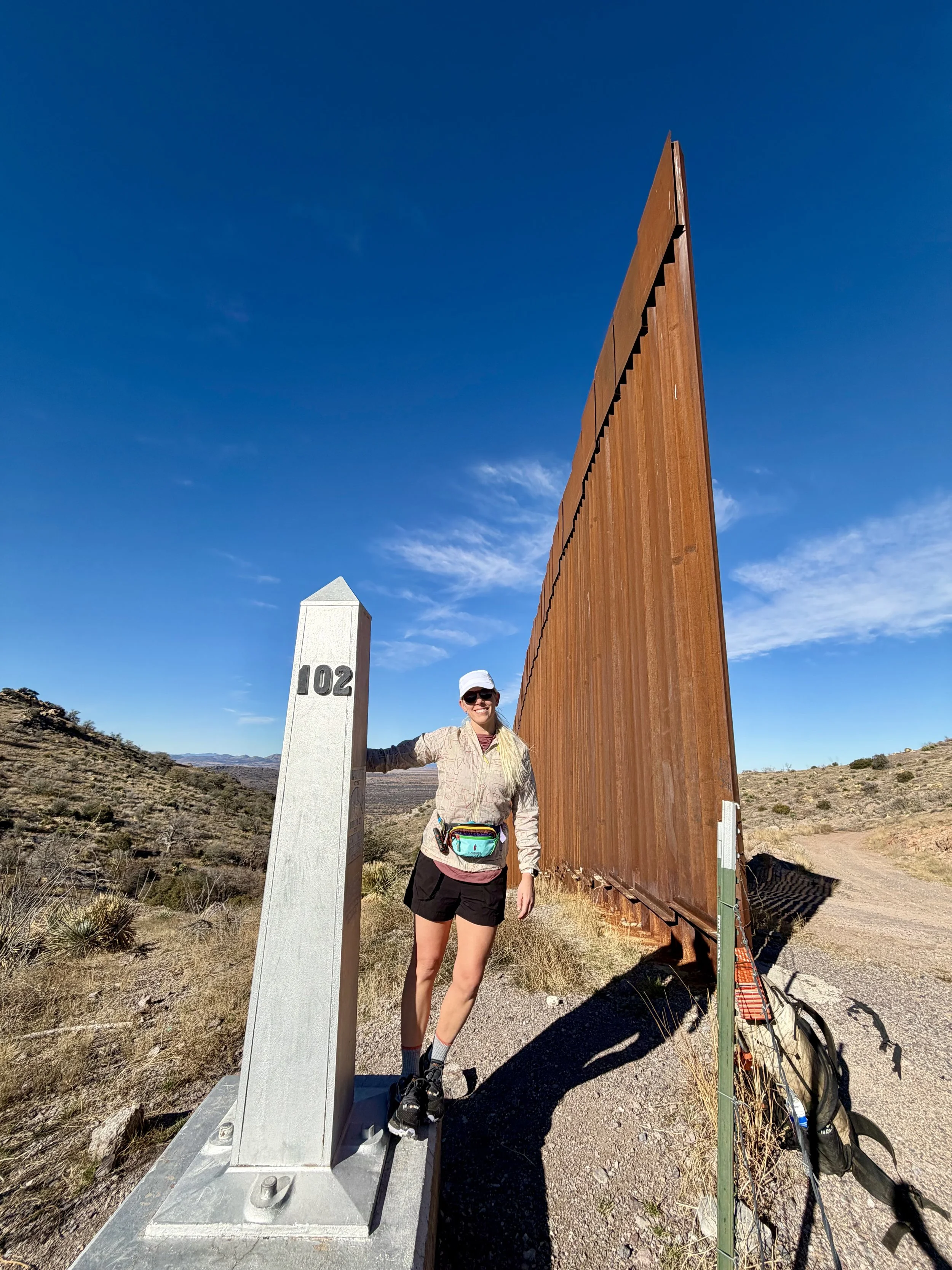
We started at Montezuma Pass, which is about 1.8 miles away from the Mexican border. Snake and I hiked together down to the border to see the terminus. There was a border official there, and technically the Arizona Trail monument is on the other side of barbed wire, therefore inaccessible. There is a gap in the wire where Arizona Trail hikers go through to touch the terminus. The border official gave Snake and I the go ahead to cross under the barrier and take a few pictures with it.
**So any pictures that I have taken on the other side of the barbed wire or fence to touch the official terminus was approved by a border official.
We then trudged the 1.8 miles back uphill to Montezuma Pass where I had left my pack tucked behind a building. Why bring extra weight if I didn’t need to?
From here, I began to ascend toward Miller Peak in the Miller Peak Wilderness. Montezuma Pass is located at 6500 feet while Miller Peak Junction along the Arizona Trail tops out at 9100 feet. I had not been an elevation since my DNF of the Colorado Trail Bike Route in August, so coming from 500 feet in Michigan, starting to hike at 6500 feet, then up to 9100 feet was a bit of a rough start.
In addition to the elevation gain in a relatively short time span, it was also wildly windy. I’m not new to desert wind. I expected it based on previous desert experience, but there were some serious gusts. At least it was sunny, but it was cold for the majority of the hiking day made worse by the wind.
I was going slow. I had not been training as much as I perhaps should have been, but Michigan is covered in snow made any outdoor paths inaccessible due to their emulation of ice rinks. In fact, I had been quite sedentary since my marathon that I completed in October. So this is my first day back with a full pack, hiking any sort of actual miles, and being at elevation all rolled into one day.
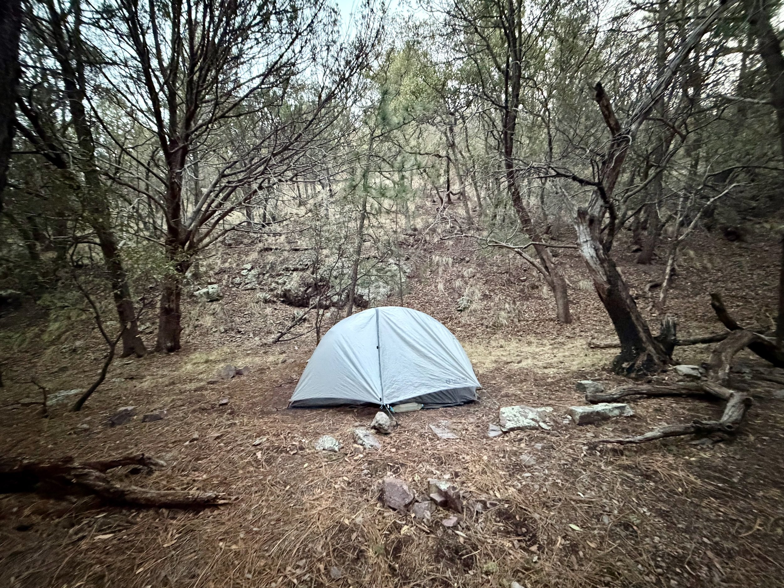
I originally was planning to only go past bathtub spring, but there was no real well situated campsites with the wind situation so I had to go a few miles further than I was expecting. This meant more elevation gain than I was prepared for, but what really got to me was the steep descent to my camping area. It was a quad killer.
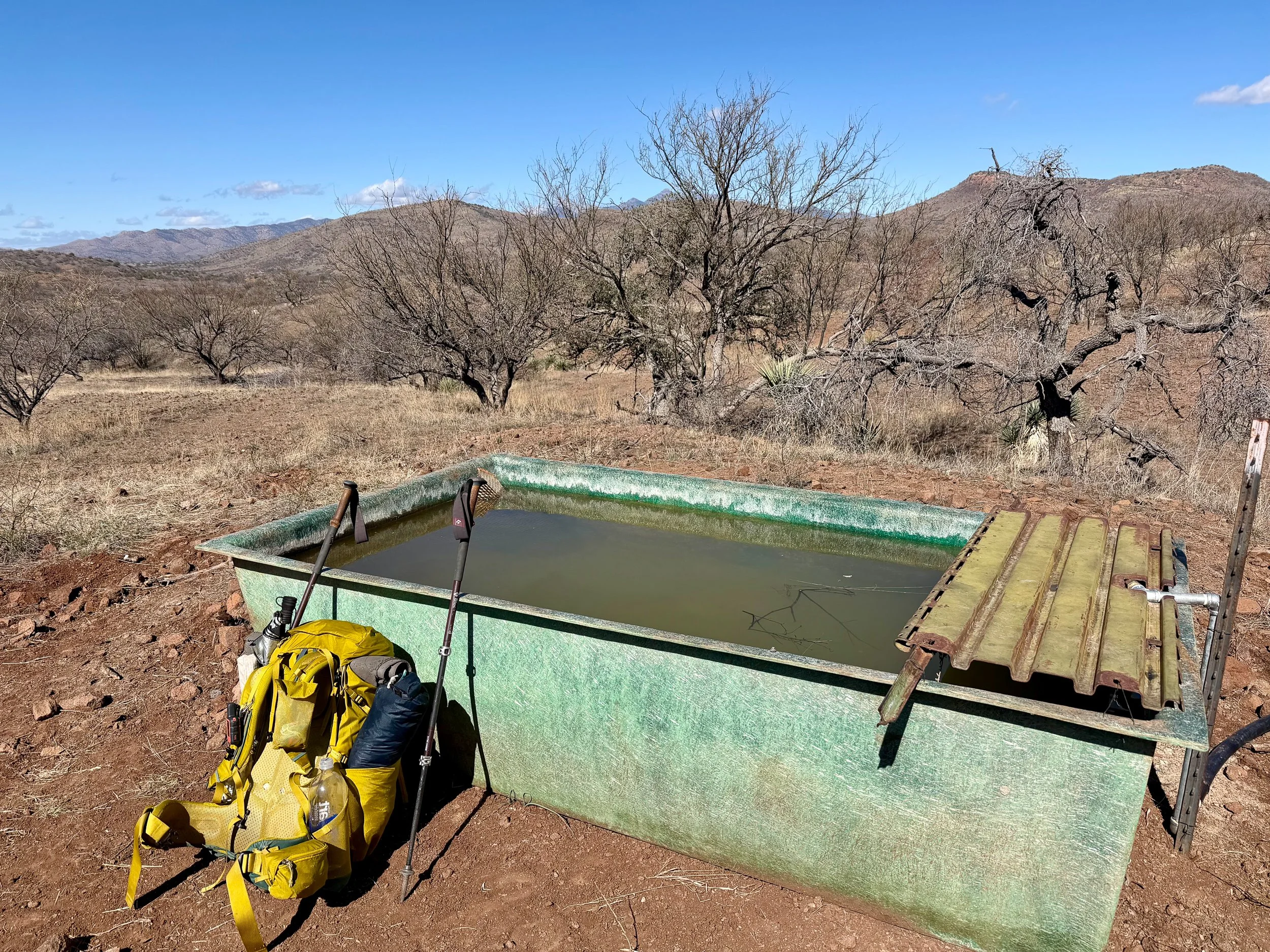
Once there, I grabbed water from the pitiful water source that was nearby. When it is cold and windy, I am not motivated drink water therefore I was dehydrated. I was so cold in fact that I set up my tent, slipped into my bed clothes and into my sleeping bag and just shivered for an hour.
At one point I said out loud “I think I just want a normal life” and I’m thankful that no one was around to hear me. Also I have had a “normal life” in the past and it didn’t work out so well for me.
I passed out just after dinner finally somewhat warm in my bag. I have a 10° bag with me and though it did get down around 35°, I should’ve been just fine. I was just chilled to the bone from the wind and dehydration. I slept roughly 11 hours.
Day 2: Mile 13.1 - 34.6
Trail Daily Miles: 21.5
Elevation Gain: 2913 ft
Elevation Loss: 4482 ft
Weather: Chilly, Sun, Wind
Overall Day Sentiment: Blisters + Sandstorms?
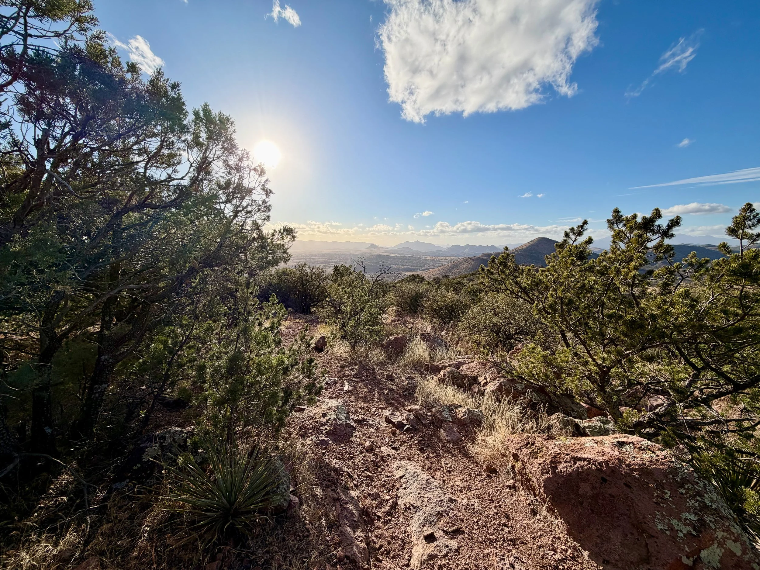
One would think that you could be rested after sleeping around 11 hours, but not so much. I continued down the descent of Miller Peak for quite some time. This ended up being a beautiful canyon that was special to see as the sun was rising and touching different parts, illuminating the variety of rocks and geological features.
Cruising along lead to Parker Canyon and I stopped for a quick break. It was roughly 14.5 miles to Canelo Pass trailhead, which was around my goal for what I wanted to do for the day. There were open views amongst the scrub brush and long grasses. It reminded me so much of the scenery in South Africa specifically in the Addo Elephant National Park.
The climbs, though on my mapping application did not look too steep, they sure felt steep. My legs were feeling it from the day prior, and of course blisters are already popped up. At the top of one of the climbs I had lunch and had a bit of service so I contacted friends and family to let them know how my first full day on the trail was going. One friend asked me if I was enjoying it and I didn’t have a concrete answer yet because of my mini meltdown the night before where I just wanted to a normal life.
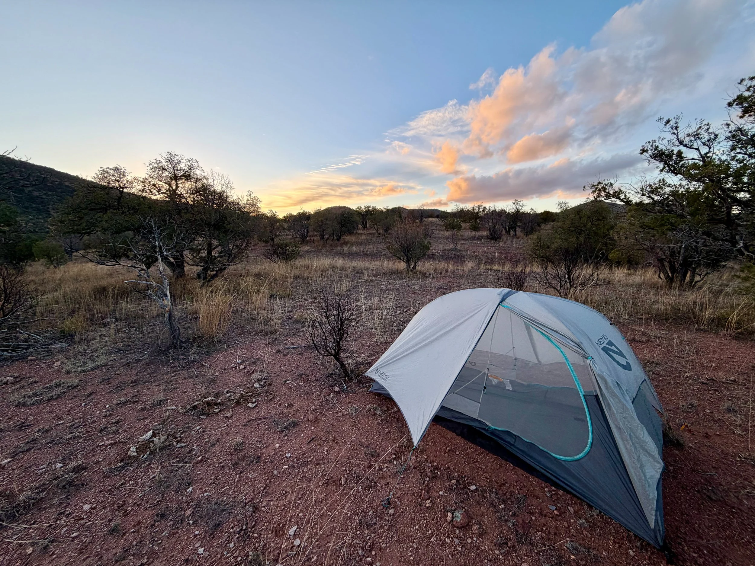
After lunch, I realized that I was running out of daylight at 2:15pm and I was not gonna be able to make my originally desired site 9 miles ahead when the sun sets at 6pm. So I continued on and truly trudged to the Canelo Pass Trailhead. And though there was a great campsite right at the trailhead I’ve heard that cars drive by late and I didn’t want headlights to wake me up. Up slightly further on the trail I went into flat open desert.
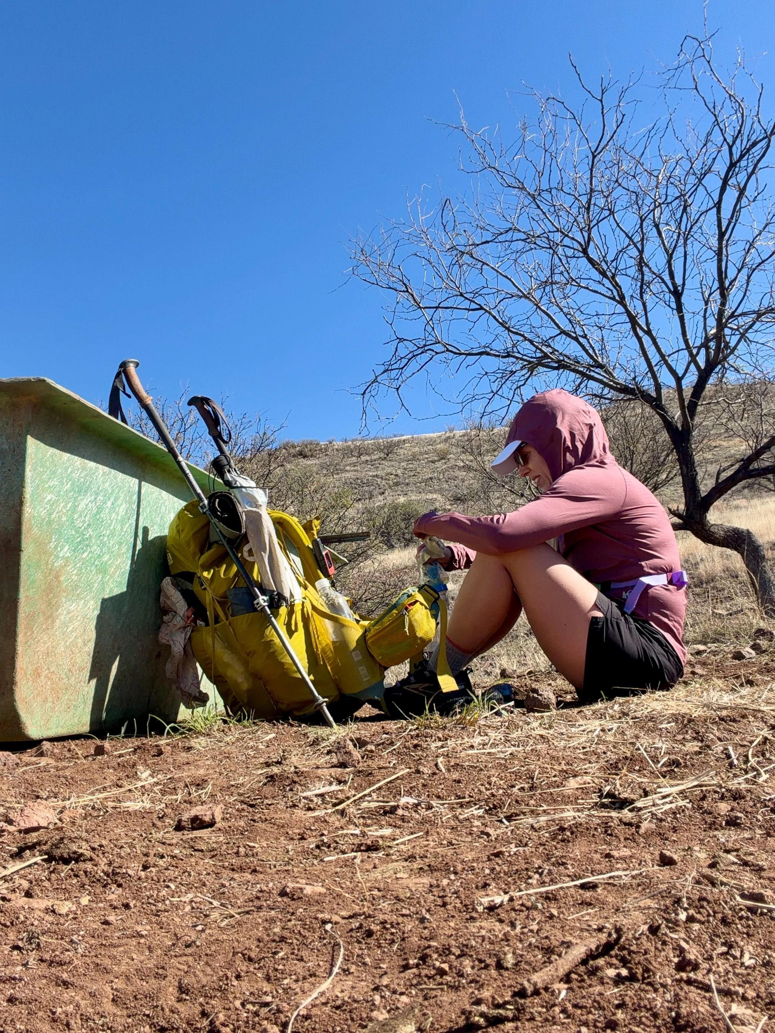
As I set up my tent, I took off my socks to look at what blister damage I had done over the day and oh boy. Some trail surgeries were required to alleviate the pressure on all of my blisters. I began to make dinner and the wind picked up and started blowing sand everywhere. I had had a few of these nights at the PCT in the desert where, even though I had my rain fly down essentially blocking some of the wind, sand was still blown under the rain fly and fine enough to fit through the mesh of my tent. I fell asleep, completely tucked in to my quilt with my head covered to not get sandblasted throughout the evening.
That sounds good in theory, and I covered everything up in my tent to make sure that they’re was not a sand getting into my clothes, but me being tucked all the way in to 10° bag on a much warmer night left me sweltering inside. So I guess pick your poison; sandblasted or sweltering?
Day 3: Mile 34.6 - 52.9
Trail Daily Miles: 18.3
Total Daily Miles: 20.3
Elevation Gain: 2629 ft
Elevation Loss: 3351 ft
Weather: Sun
Overall Day Sentiment: Patagonia is lovely!
Early takeoff, immediate climb, beautiful fields, wrong direction, bluff charged by cow, got into Patagonia, terrasol, chores, good sleep
Today was my first town day and nothing motivates me like the thought of town food, showers, and laundry. I had an early set off just after sunrise and that lended itself to amazing views over the Canelo Pass area. The higher I climbed, the more it put a smile on my face. It’s in these moments that I wish I had go back to my friend from a day prior and say yes, I am enjoying it.
The miles cruised on by until I got to a low lying area near a river. I had essentially been walking on a 2 Track Road for several of those. Near a river, there were a lot of cow hoof prints and the ground just didn’t look like a trail. So I had continued to go straight on the road as I had been doing and about 20 minutes into this adventure and several hundred feet of climbing I realized … oops I don’t think this is the trail. My mapping application confirmed this. So I frustratingly turned around realize that I had about a mile and a half out of my way with several hundred feet of gain and wasted 45 minutes for nothing. My early morning essentially was negated.
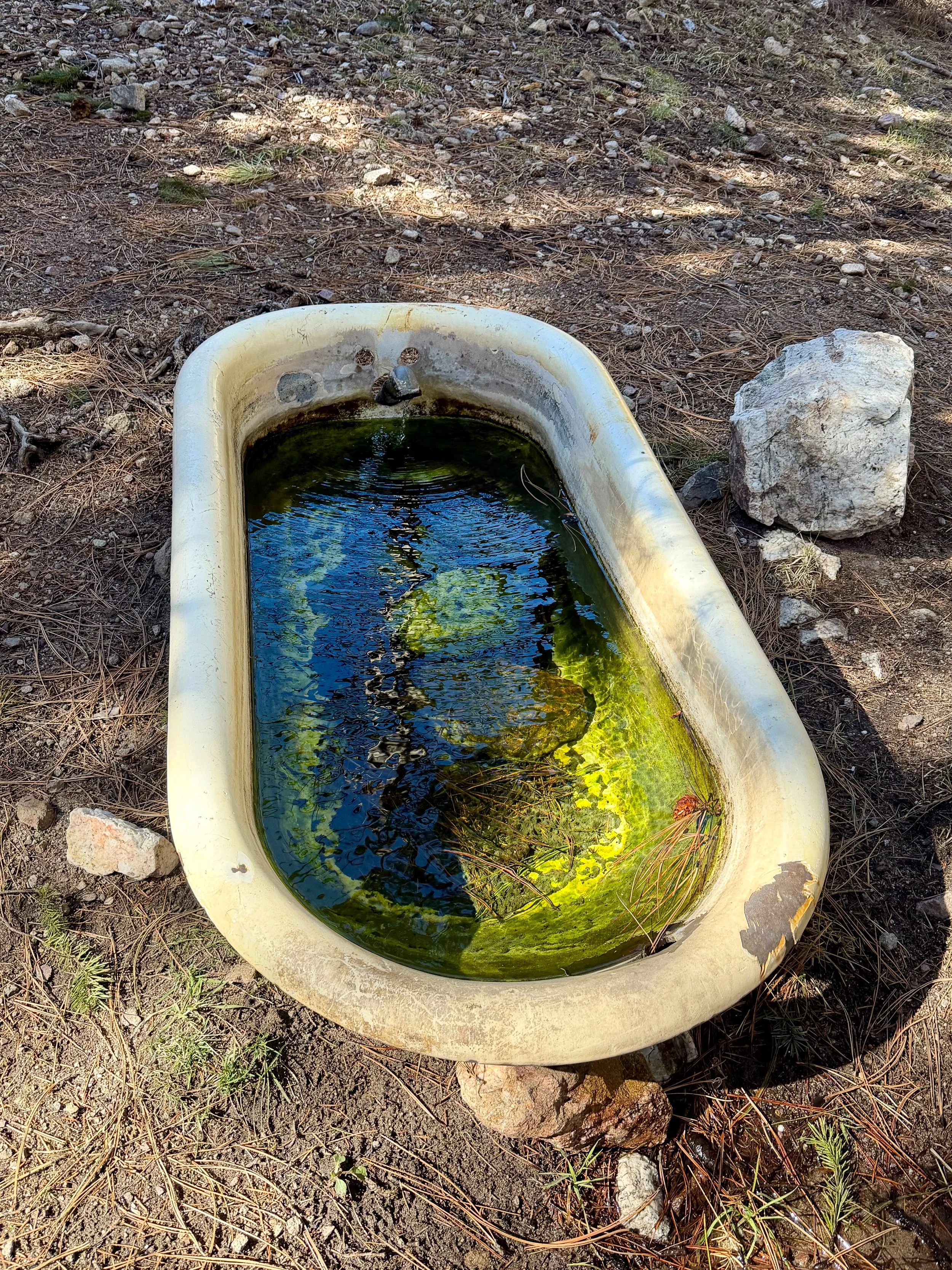
Luckily, the next sections were somewhat flat or on a downgrade, heading towards town. Once closer to town, I stumbled upon the aforementioned cows that I had been seeing nonstop evidence of. The herd was all mothers and calves and they were close to the trail. And of course, as any good mother does try to protect her babies. So I end up getting bluff charged and having to run away from cows. That that was not the predator I thought I was gonna have to deal with on this trail. I also had to use their cow trough for water… that was a new experience.
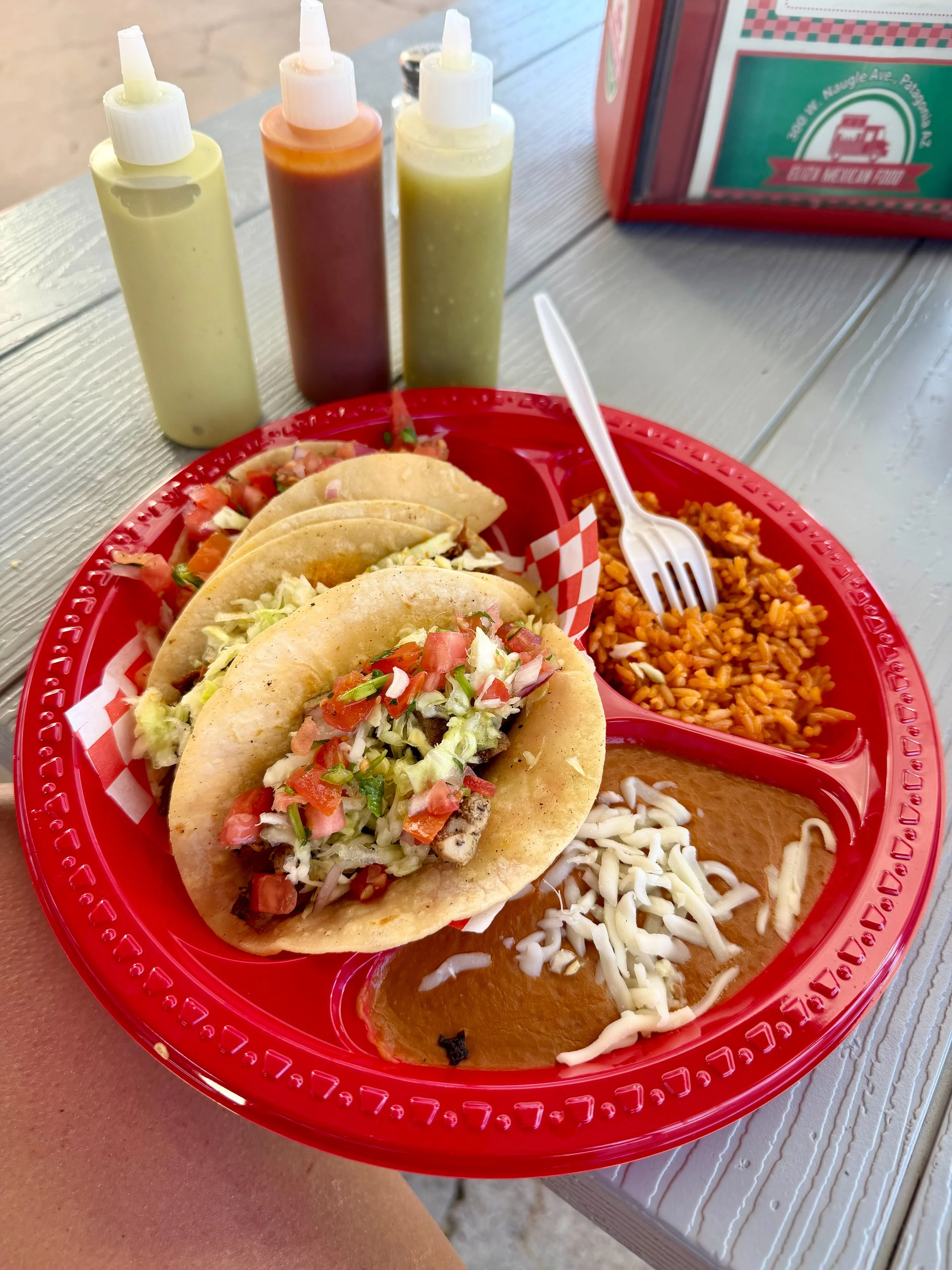
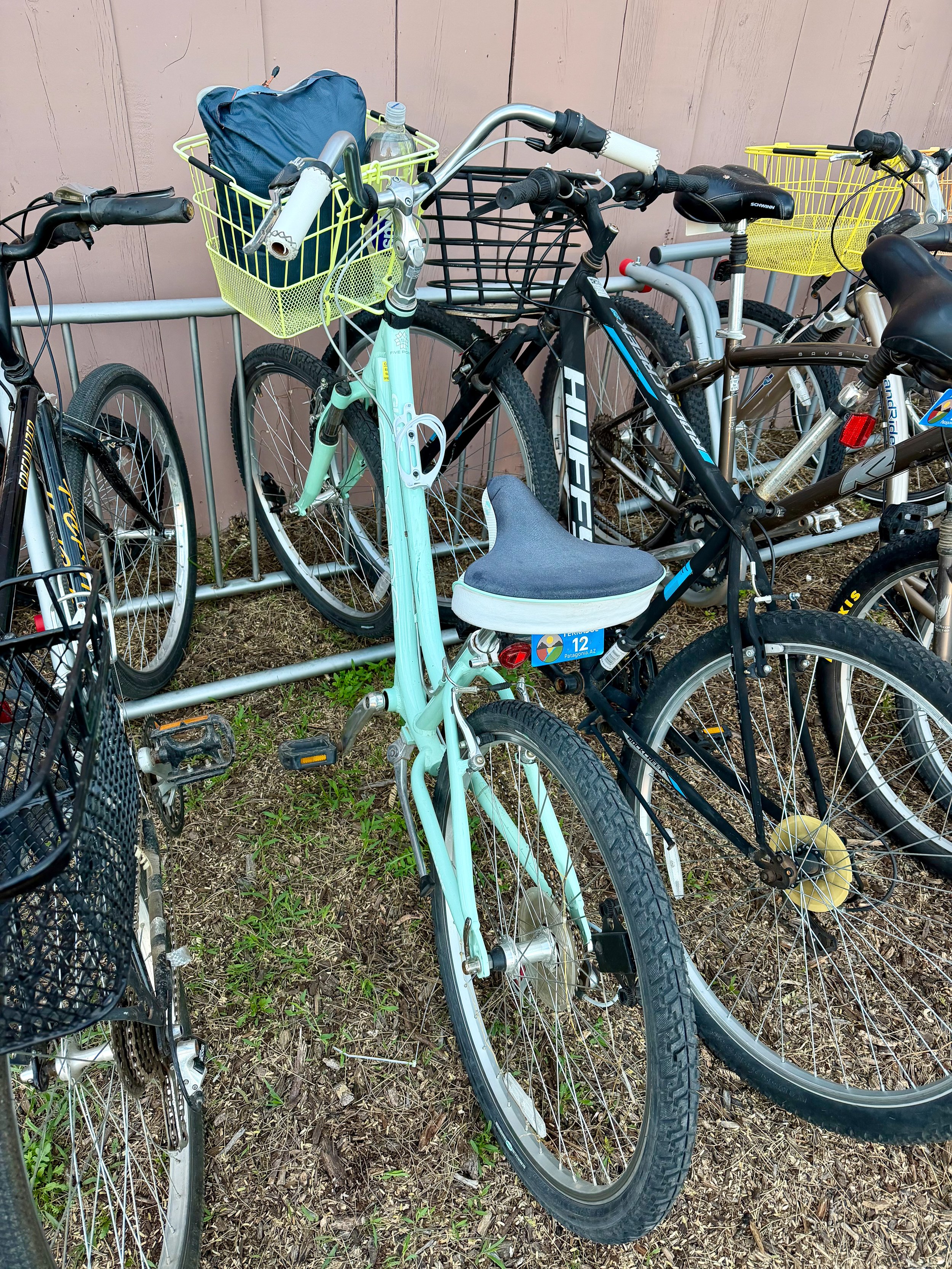
I’ve been in contact with Mary from Terrasol, the hostel in Patagonia, about shuttling me into town as it would’ve been a 5 mile road walk or hitchhike. We met each other at the perfect time and she took me into town into her little slice of heaven. This is a hiker/biker/outdoor recreation heaven. She has a great set up and has everything that hikers and bikers need. She has loaner bikes for you to go into town to run your errands as she’s about a half a mile out of town. I took a bike with a basket, went and did my resupply, and had some delicious Mexican food. Don’t worry I also got Mexican food to go for later.
Once I got back, I showered, put on some comfy cotton loaner clothes for the night and then took the bike next-door to the RV park to do laundry. The funny part of this is that the sun had set while I was doing laundry so I rode the bike with my basket of clothes back into Terrasol with my headlamp. While people were having a bonfire I just rolled in from the dark.
As I had already set up my tent and my sleep system, I was able to just cuddle in with my fresh laundry for the night. It was becoming very chilly so I slept in my electronics and water filter and had a great night sleep.