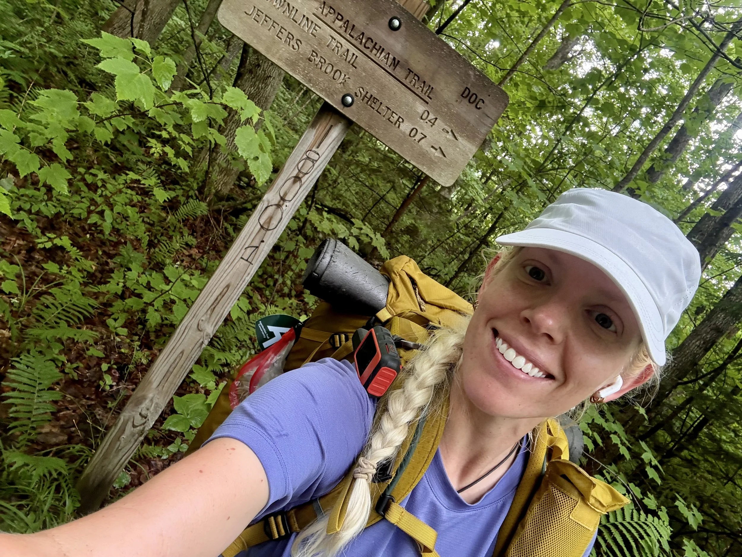
Appalachian Trail Hike: New Hampshire - Mile 1755 - 1915
Appalachian Trail Hike: New Hampshire - Mile 1755 - 1915
Hello! New Hampshire had been talked about on trail since the beginning. The White Mountains are a beacon to look forward to when you are in the dense woodlands of the South. Arriving at them and hiking through them gave me a whole new appreciation for those who have completed the AT in the past. This section pushed my body harder than any other hiking I have done (hello, over 8k feet of gain in a day!). Unfortunately pushing myself physically and mentally manifesting in another emergency double zero due to illness. Because of this, I had to release my expectations that I could complete this in 100 days.
Thru-hiking is a rollercoaster and New Hampshire embodied this.
Appalachian Trail Hike: New Hampshire Summary
Statistics:
Days: 9
Full hiking days: 6
Zeroes: 3
Neros: 0
Total Trail Miles Covered: 120.9
Total Elevation Gain: 34,399 ft
Total Elevation Loss: 30,313 ft
Highlights:
New Hampshire delivered on views and had the ridge lines I hoped for.
Making it through the White Mountains.
Seeing my dear PCT friend, Prick, again!
Lowlights:
Giving up on my 100-day goal.
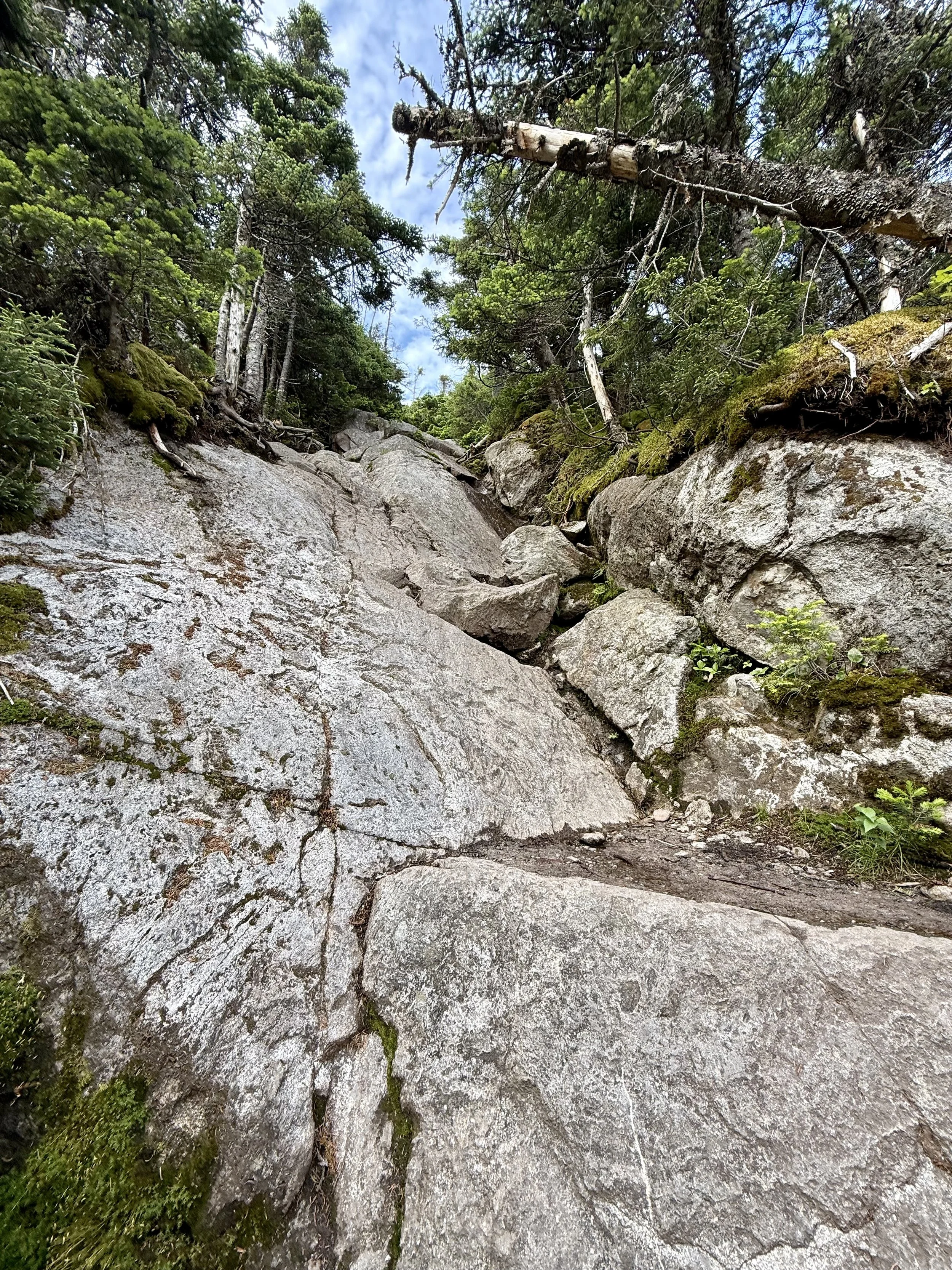
Tough, tough hiking with rock climbing mixed in.
Getting sick again and needing to be on antibiotics.
The heatwave was brutal!
Nearly quitting.
Appalachian Trail Hike: New Hampshire Detailed Version
Day 82: Mile 1757.9 - 1788.3
Trail Daily Miles: 30.4
Elevation Gain: 5824 ft
Elevation Loss: 4600 ft
Weather: Sun, Bugs
Overall Day Sentiment: Long day, long day
Despite being cozy at the kind Trail Angel’s house, I had to head out for the day. Another Trail Angel from the original list of those that live in the Hanover, New Hampshire area gave George and I a ride back to the trail early in the morning. With the delay from my illness in Vermont, the last two states had to be done quickly.
As to be expected in New Hampshire, there was much up and down for the day. I listened to a fantastic audiobook for the majority of the day, so it overall passed by quickly. There were two potential stopping points for the day and George had already set up at the Hexacuba shelter - the first one. I made the decision to continue on another 5 miles despite that meaning I would have a late arrival time.
As if he was an apparition, George appeared and also continued on for the next 5 miles to the second stopping point. I knew the following day was going to be a tough one with Mount Moosilauke on the docket. The campsite was near a dilapidated stone farmhouse with the water source being a bit of a trek down the trail. I had completely run out of water working to get to the campsite before dark, so I had to sit for a bit near the stream and attempt to catch up on hydration. The bugs were terrible near and far from the water source, which had become my new normal.
Day 83: Mile 1788.3 - 1808
Trail Daily Miles: 19.7
Elevation Gain: 6309 ft
Elevation Loss: 5552 ft
Weather: Rain, Wind
Overall Day Sentiment: I’m booking a flight home and quitting this thing.
Knowing what was to come, I got up early despite my late bedtime and began hiking. It downpoured rain for the first few hours of the day. Though I have consistently hiked in sincere rainfall, it still is not particularly fun.
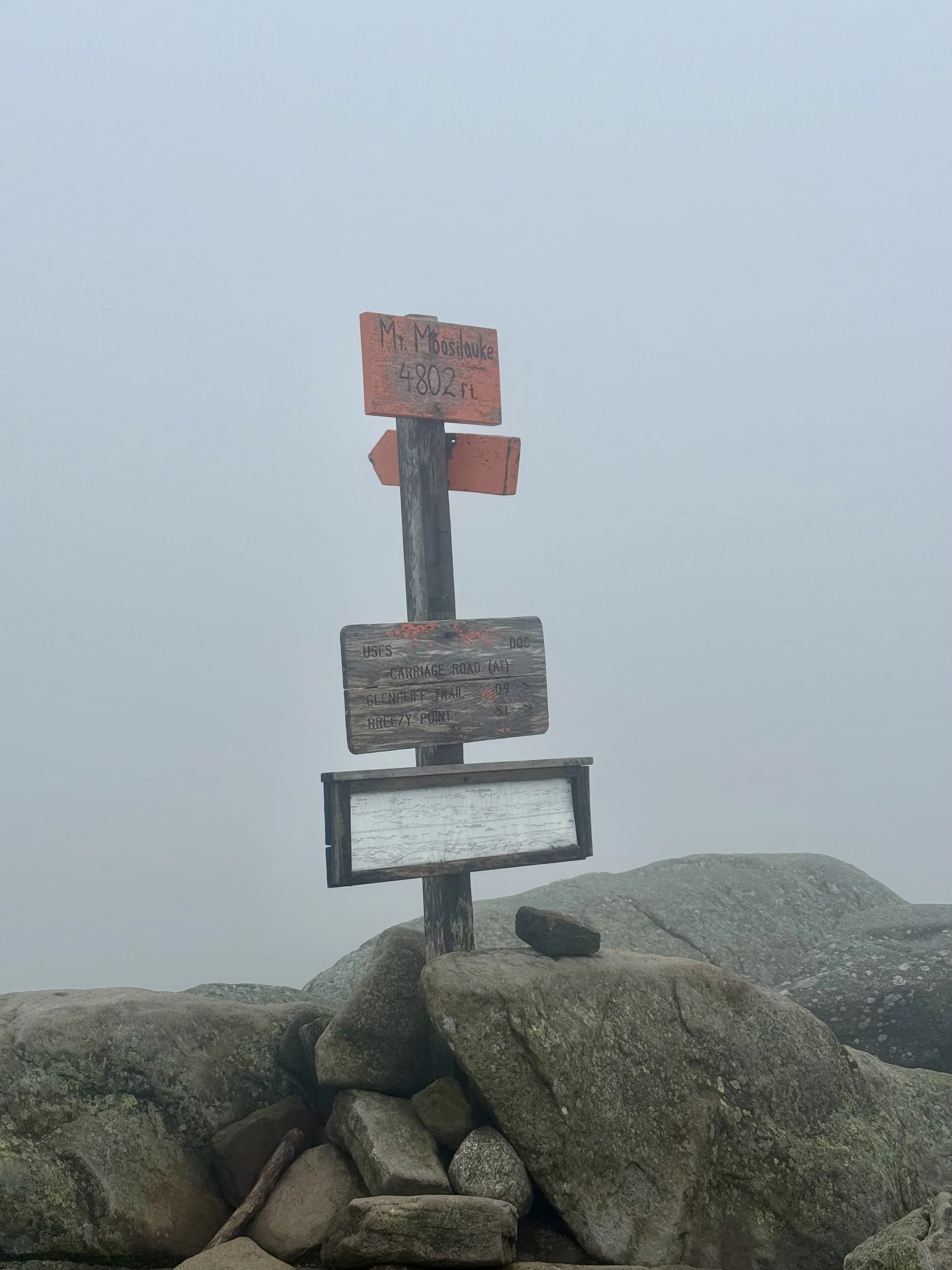
Just before the Mount Moosilauke climb, I passed 1800 miles - another accomplishment! Mount Moosilauke would quickly show me that crossing the 1800 mile mark meant nothing and I was still a novice hiker. This ascent is roughly 4,000 ft primarily up a giant stone staircase. This is one of the first 4k foot peaks in the area and offers amazing views. Well… it would if the weather cooperated.
Once I got the summit of the mountain after many false summits, it was completely socked in with clouds and strong winds. I got knocked over a few times directly into the revegetation zones demarcated with a thin twine fence. It felt like insult to injury being absolutely exhausted from this climb only to be blown over instead of getting views.
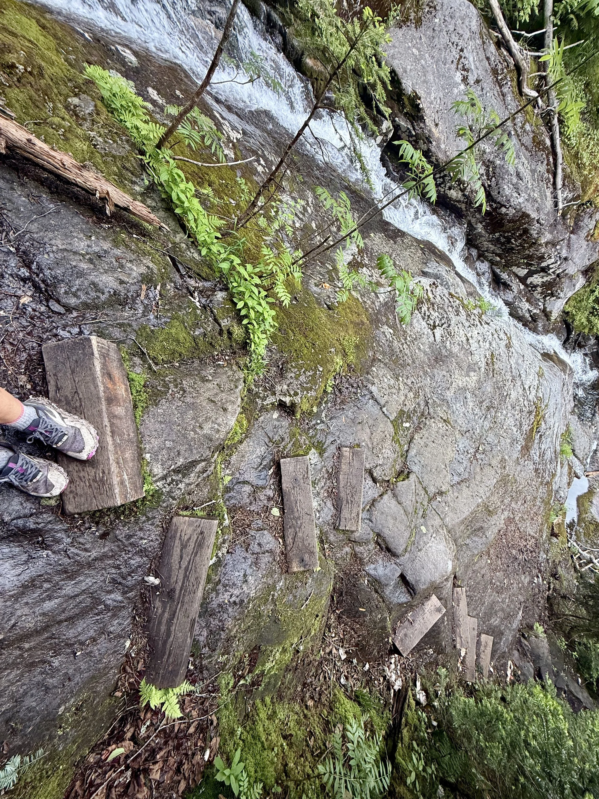
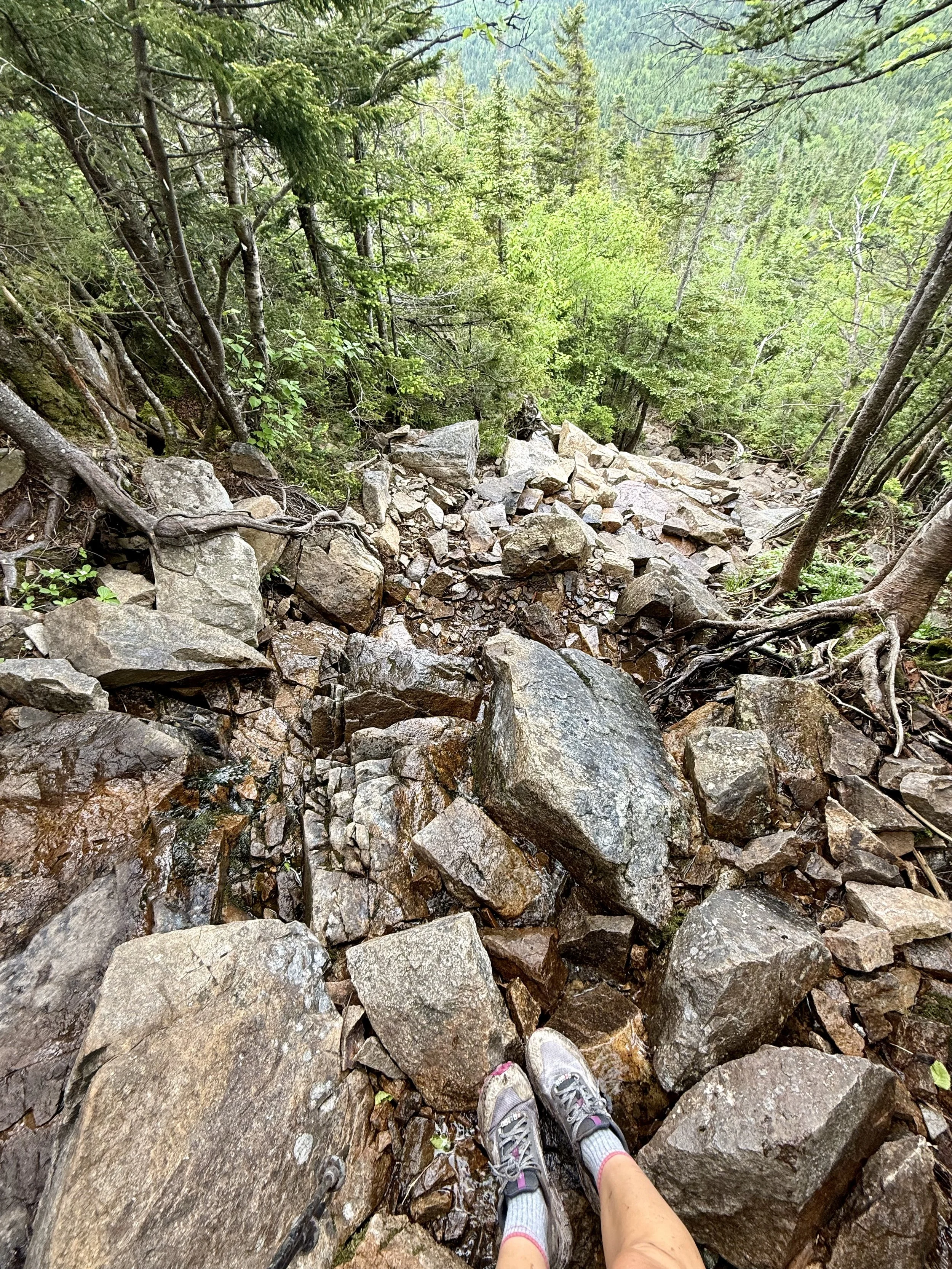
Little did I know, the descent was going to be equally challenging. I was excited to get out of the wind with the coverage from trees, but was greeted with another obstacle - rocks. The AT joins with the Beaver Brook trail at this point and I had falsely thought that this meant there would be a beautiful babbling brook to look at while going down stone stairs. Except, the trail WAS the brook. With the rain from the past few days, this meant the trail/rocks were a waterfall unto themselves.
This is one of the only points in time (up until this part of the hike) that I contemplated quitting. I sat on a rock and looked at flights. I had gotten over 1800 miles in and I had enough of the east coast. George and I planned to stay at a hostel this night so at least I knew that I could look at flights from better WiFi, so I kept on going. I averaged about 55min/mile on this descent and cried most of the way. No one was around to see that my snot rockets were melting into the river that was the trail.
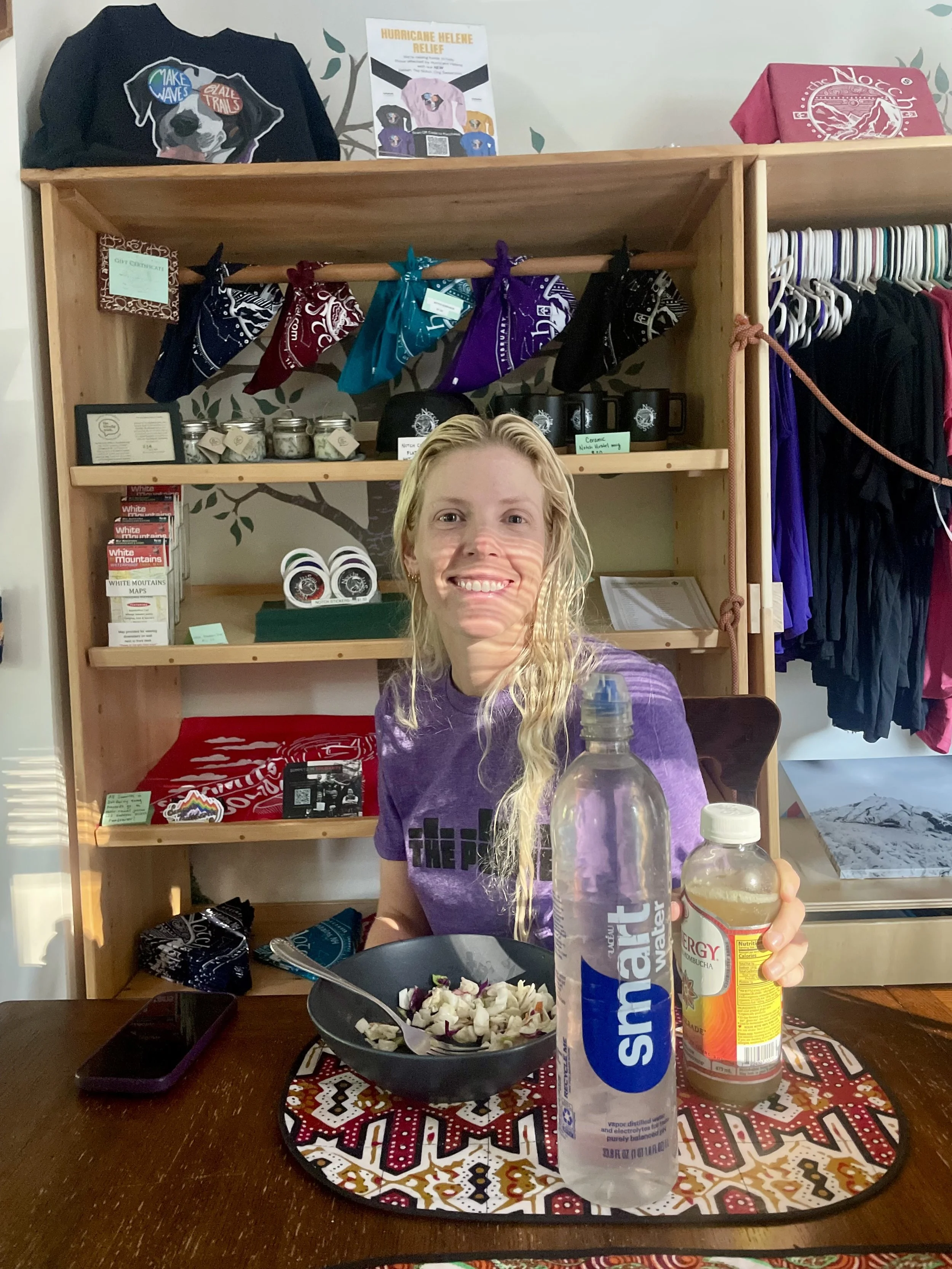
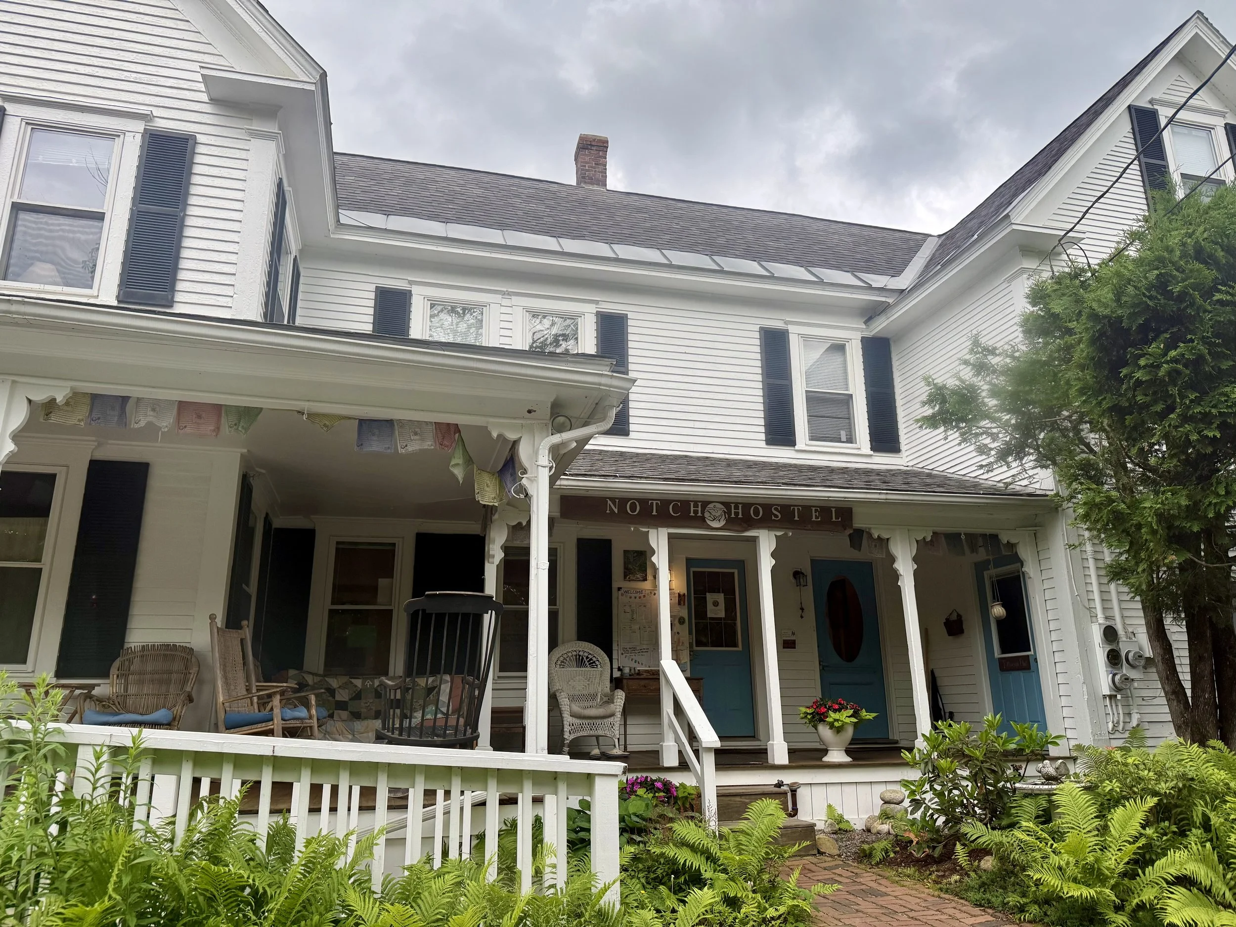
I eventually got down and started chatting with a couple from Boston who were on a tour of the beautiful sites in the area. They gave me a ride to the Notch Hostel where George was waiting for me. When I arrived - I was in a state. I continued to cry on and off and was just completely overwhelmed. Within 20 minutes of my arrival, the shuttle to the grocery store into town was going so I needed to go. Apologies to those who had to smell me or even interact with me while I was in this headspace.
George and I grabbed a few groceries but went to the Mexican restaurant next door. I got a margarita roughly the size of my head to lower the adrenaline. This is not the coping mechanism I recommend but my schedule was dictated by others and a shower/fetal position cry had not yet been available to me.
Once back at the hostel, I got settled in for the night and decided to do a slackpack the following day. This meant we would get a ride to the trailhead, hike the day, and get picked up at the following trailhead for another night at the hostel. Despite a loud snorer and a late arrival in the dorm room, I slept hard after such a trying day.
Day 84: Mile 1808 - 1825.3
Trail Daily Miles: 17.3
Elevation Gain: 4703 ft
Elevation Loss: 5246 ft
Weather: Hot, Sun
Overall Day Sentiment: Thankful for a Slackpack
Equipped with my much smaller daypack, as opposed to my full backpack, I was feeling excited for a simple 17 mile day. As I waited for the shuttle to take me to the first trailhead, other hostel visitors waiting or the shuttle gathered. It turns out I had met one of them on the PCT last year! Unfortunately, this person had a known substance issue while on that trail and it had obviously carried over to this trail as well. More on that later.
The heatwave that had been promised for more than a week fully arrived. The humidity made it feel as if I was swimming rather than hiking. The initial ascent was somewhat gradual and in the trees, so at least it blocked this direct sunlight.
Then I got to the point in the day of this hike that the Notch Hostel had been warning hikers about. It was mostly rock climbing aka there was a lot of vertical gain. There was 1 mile specifically in the day going up South Kinsman that I climbed over 1200 feet in a mile all on rocks. Hand over hand, vertical climbs. The funny part about this was looking at my Garmin watch statistics later and seeing that I had burned exactly 250 cal in that one singular mile. That is a whole full size snicker bar that I burned in 1 mile. This is why thru-hiking day in and day out allows for such a flexible diet.
In direct contrast with the day prior, I had sweeping views from both Kinsmans, which felt like a reward for Mount Moosilauke. There were a number of day hikers as well and it made me question why people love the White Mountains so much because they are terribly difficult.
I had a shuttle coming at 4:00pm and I realized I was a bit behind schedule due to the elevation gain. Luckily, the last few miles of the day were relatively accessible and flatter than I had been experiencing. In addition, the footing was also good so I had to jog a few parts of this to make up the time. Again, I was very thankful for a lighter and smaller pack that allowed this to be a bit easier.
Even though there was some confusion about the shuttle pick ups I did get picked up on time at the drop off spot. There’s about a mile bike path from the Appalachian Trail to where there’s a convenient parking area for folks. Along this well traversed bike path was the aforementioned hiker from the PCT last year and that had been at the hostel this morning. He was passed out, laying in the middle of the bike path with his tent strewn about, and it looked like his pack had exploded. It was heartbreaking to see. George had already notified the visitor center located at this trailhead about the situation. There were going to be first responders going to make sure that he was okay.
We quickly ran to the grocery store and got things to make a proper meal as there was a full kitchen available at our disposal. My guilty pleasure is always gluten-free macaroni cheese - so between that, a rotisserie chicken, some greens, and a batch of brownies it was a delicious evening in a multitude of ways.
Day 85: Mile 1825.3
Trail Daily Miles: 0
Elevation Gain: 0
Elevation Loss: 0
Weather: Hot, Dangerously Hot
Overall Day Sentiment: A restful and needed zero day
I woke up ready to hit the trail early - well as early as possible with the provided shuttles from The Notch hostel - but was already greeted with over 90 degree heat at 7:00am. It was slated to be upwards of 100 degrees with the humidity making it feel 105+ degrees (heat index). At this point, I made the tough (but also easy?) decision to take an emergency zero day. That much heat while being above treeline is just not safe.
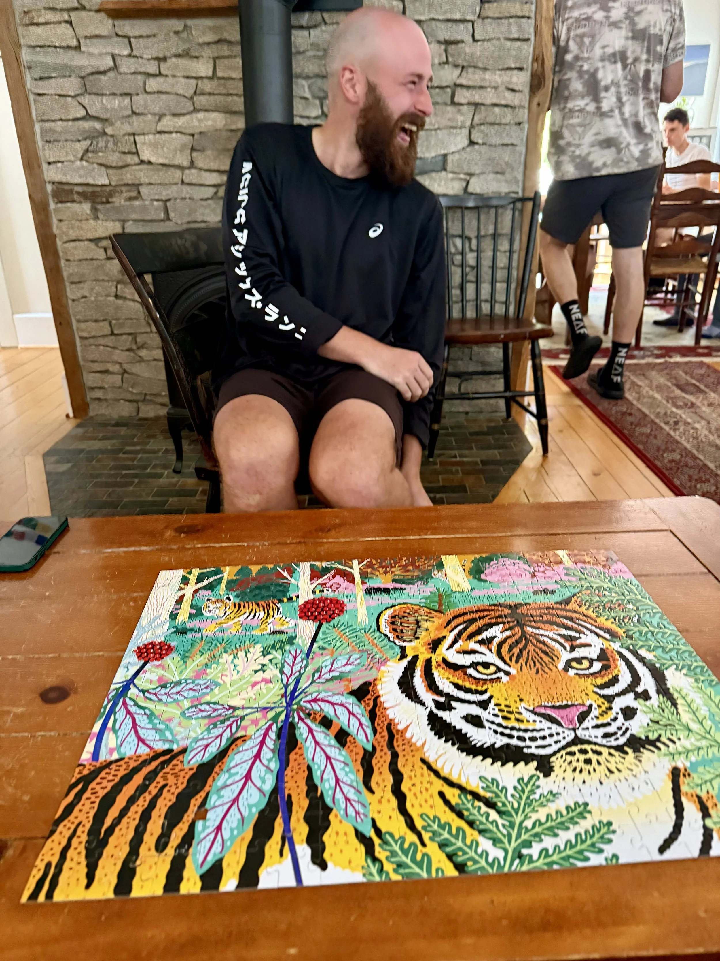
George and I hung out at the Notch Hostel the entire day. After a lazy morning in bed with air conditioning, I was able to chat with family and friends and complete a puzzle. This ended up being a gift of a rest day after a tough hike/climb the day prior.
Day 86: Mile 1825.3 - 1842.7
Trail Daily Miles: 17.4
Elevation Gain: 8364 ft
Elevation Loss: 5179 ft
Weather: Hot, Sun
Overall Day Sentiment: Over 8000 ft of gain?
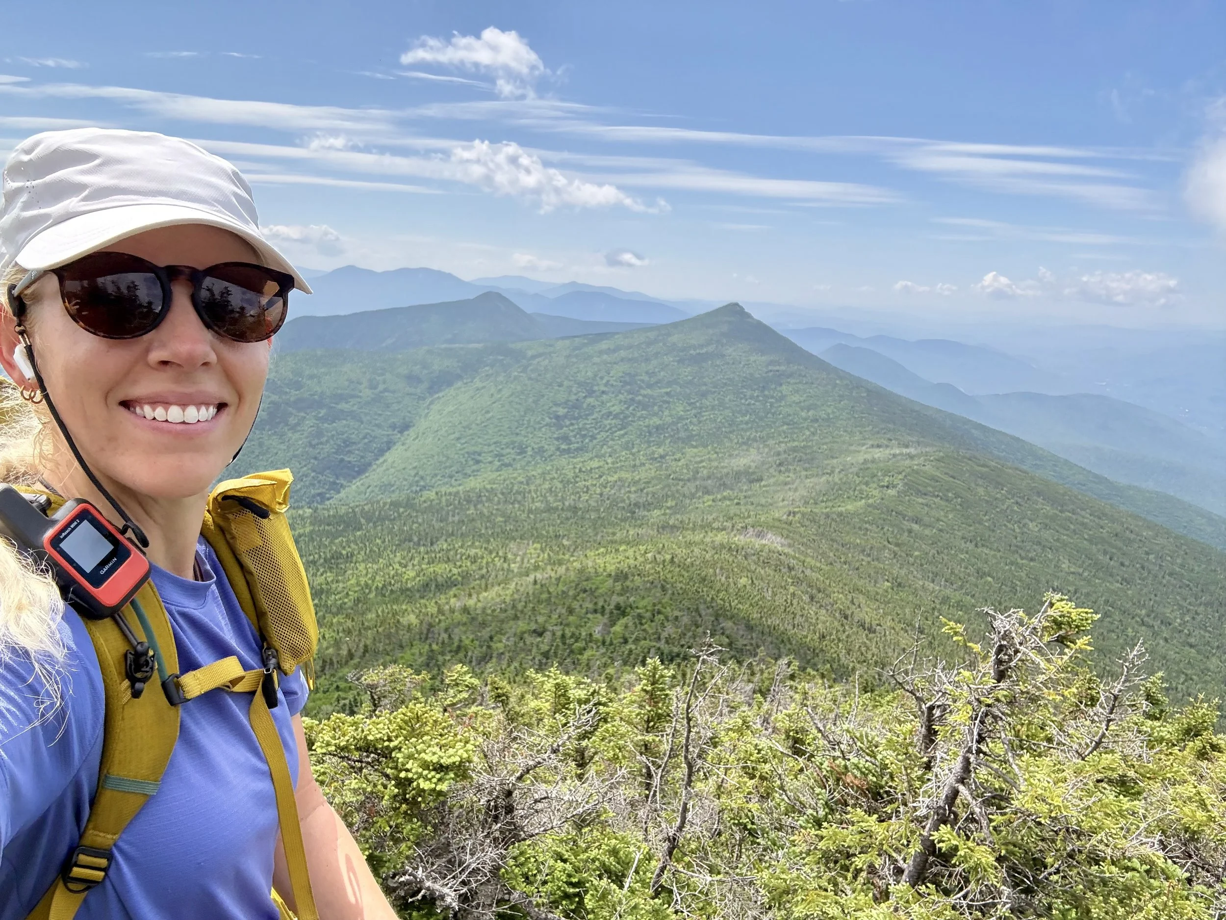
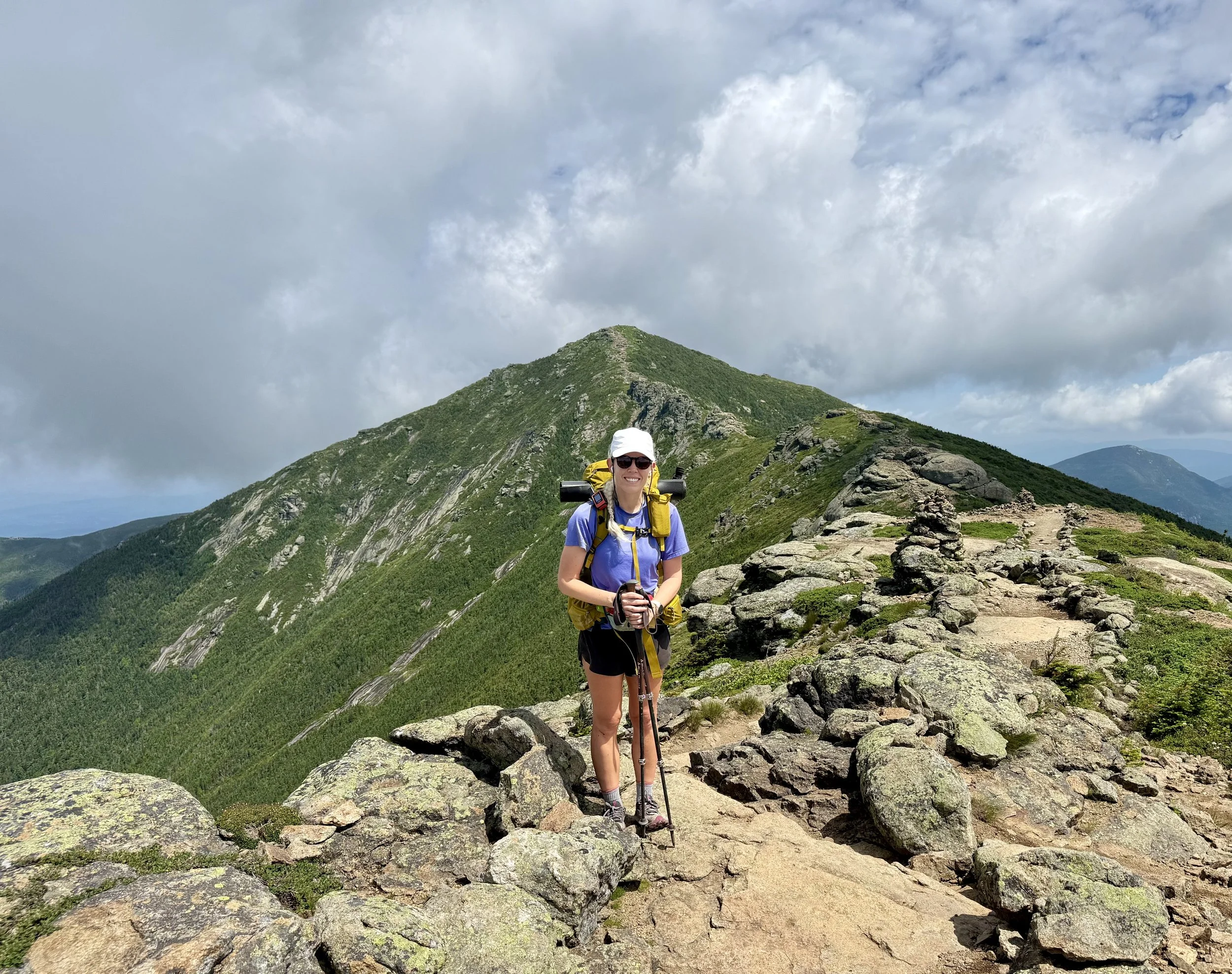
This was the day that I finally left the Notch Hostel after three nights of being somewhat vortexed there. The shuttle brought me back to the spot where I left off 2 days ago and it was Franconia Ridge day. My dear friend Prick from the PCT lives in the area and this is his most frequented spots, so I was looking forward to seeing what his hometurf look like. It was a sincere climb to get up to the ridgeline, but once you got up, I was told they were sweeping views.
The incline was not as bad as I had expected because I was basing all my assumptions of New Hampshire on Mount Moosilauke and the Kinsman. It was actually a pleasurable climb and the ridgeline views delivered. It was sunny and clear enough that I was able to see for miles. I was also able to see some of the Presidential range in the distance which was my target area for the next several days. There were a ton of families and day hikers up on the ridge, which made sense because it was a gorgeous day.
These views came with the cost, though as even a short mileage day this would be my most elevation gain of the entire trail. Camping in the White Mountains is a bit more difficult because you are not supposed to camp anywhere but in designated sites - ideally within the AMC hiking club designations. This limited the distance per day that George and I could go so we chose the shorter route and my gosh… I am thankful for that. I ended up staying at the Guyote area on a platform tent site that does cost money.
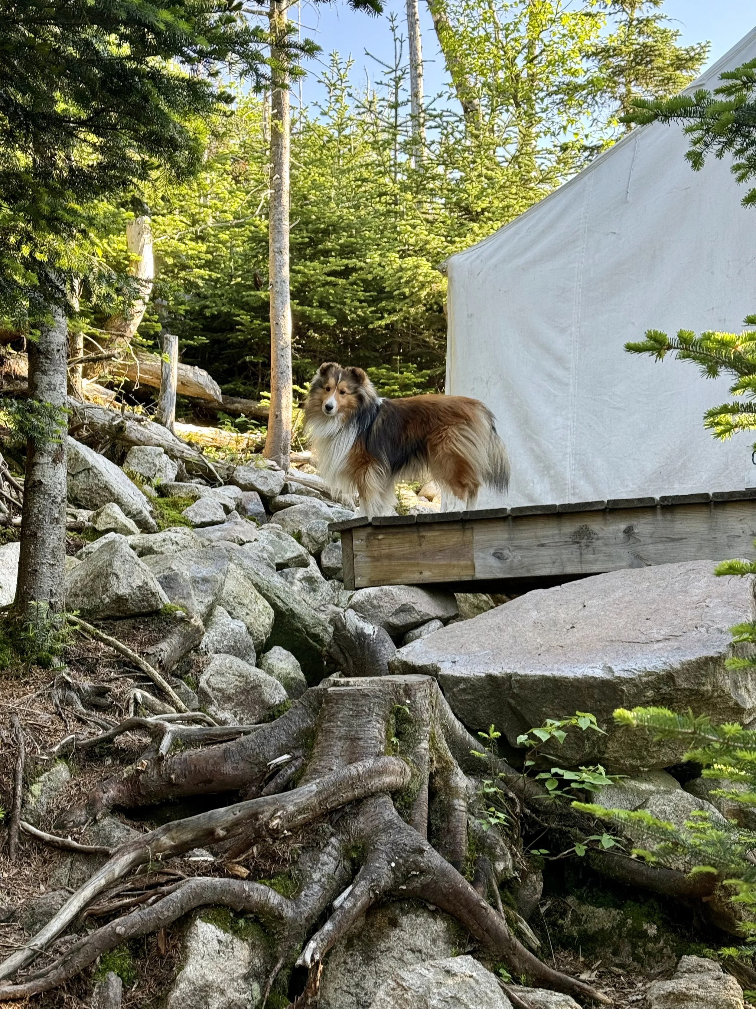
George had already set up his tent on the platform and though it was a tight squeeze, we were able to share it with our two tents. The camp host had a very cute Shetland dog that had me painfully missing Roo, my trail name namesake, but it was good to get some dog time. As mentioned this was the most elevation gain I had ever done in one day and it was only over the course of about 17 miles. I was proud of what my body did, but I was tired.
*Note that my mapping application said that the day should have around 7000 feet of gain - they were extremely incorrect.
Day 87: Mile 1842.7 - 1861.7
Trail Daily Miles: 19
Elevation Gain: 4553 ft
Elevation Loss: 4868 ft
Weather: Sun
Overall Day Sentiment: The rock climbing…
It was an early morning, leaving the Guyote area as I knew more difficult climbs were ahead. Though mileage was a little bit more than the day prior, I was crossing my fingers that FarOut, the mapping application I use, was a bit more accurate in predicting what the actual elevation gain would be.
This was a mixture of a day of sincere rock, climbing again, and then one glorious flat mile. I try my best to limit how much I’m listening to music, podcast, or audiobooks to focus on nature, but this was definitely a podcast day. There were several large climbs and I finally ended up taking an actual 45 minute break for lunch at the bottom of the climb near a large river. I had gotten in the habit of eating while walking rather than actually sitting down and giving my body any sort of rest.
I then continued up the climb and ended up listening to a Backpacker Radio podcast episode about someone’s Appalachian Trail thru-hike where they happened to be discussing how difficult the White Mountains are. It was a very meta moment and it did have me giggling on and off. I also felt validated because this person had hiked an inordinate amount of miles and said that the AT going through the White Mountains was terribly difficult. So I’m not completely weak?
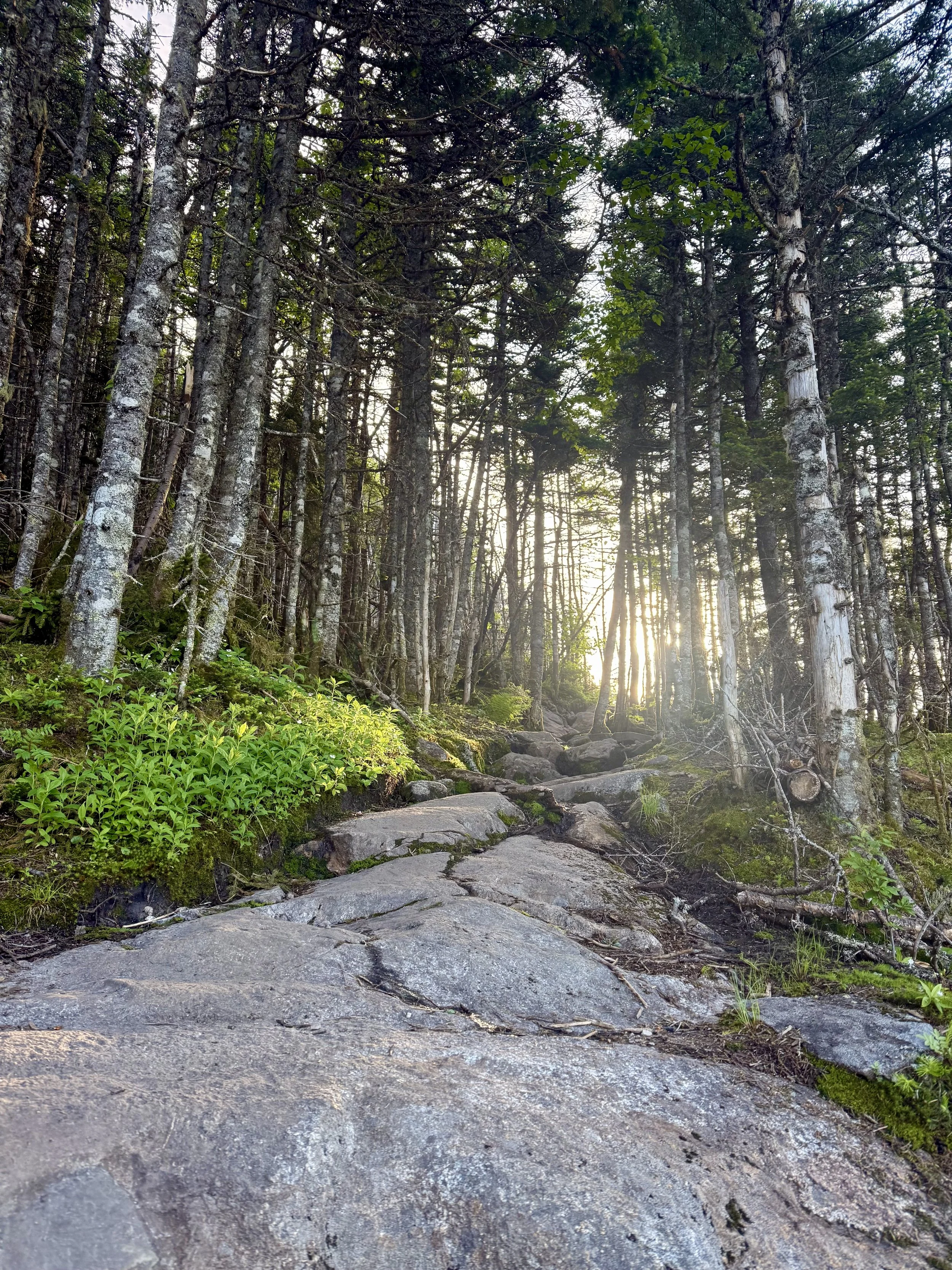
Some of the trail was not intuitive so I kept getting turned around as New Hampshire sincerely lacked some white blazes marking the trail. And when there was a bit of technical climbing among the rocks, it was difficult to figure out. There were some great views up on the ridge after these difficult climbs, though which felt like a treat.
I arrived at the Mitzpah shelter area specifically the Nauman campsite, which George reserved us another platform as again this was an AMC hiking area. There was a quirky campsite host who provided a lot of laughs. Both of our tents snuggly fit on the platform again, though it did take effort to make sure we didn’t trip any of the guylines that had created an obstacle course for us.
Day 88: Mile 1861.7 - 1878.8
Trail Daily Miles: 17.1
Elevation Gain: 4646 ft
Elevation Loss: 4868 ft
Weather: Sun
Overall Day Sentiment: Happy to have done Mount Washington and see Prick!
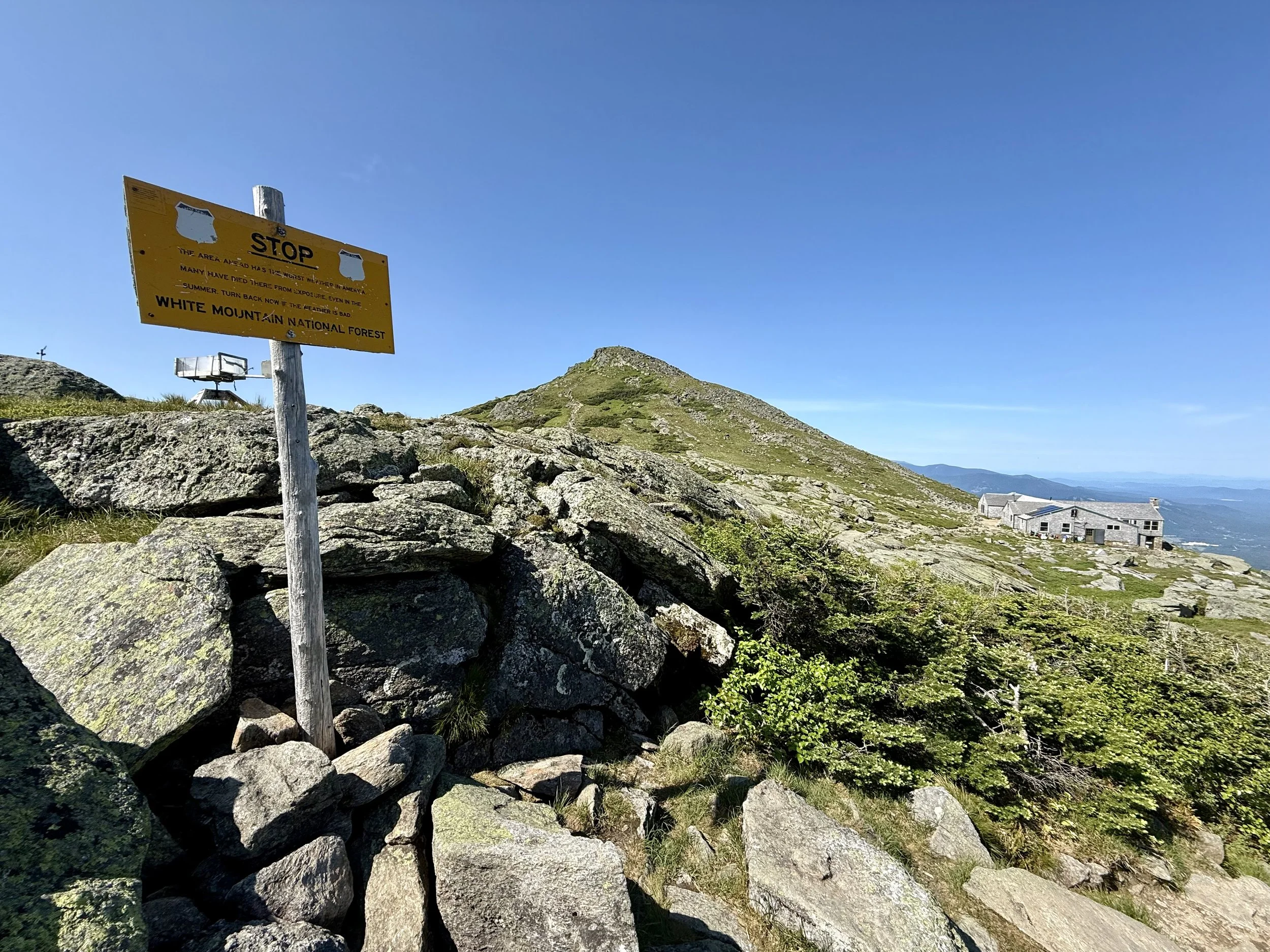
This was a monumental day on the trail. Though we had entered the Presidential range the day before, I was slated to go up Mount Washington. Additionally, later in the day, Prick was going to hike up and meet me and then bring us back to his place for the night.
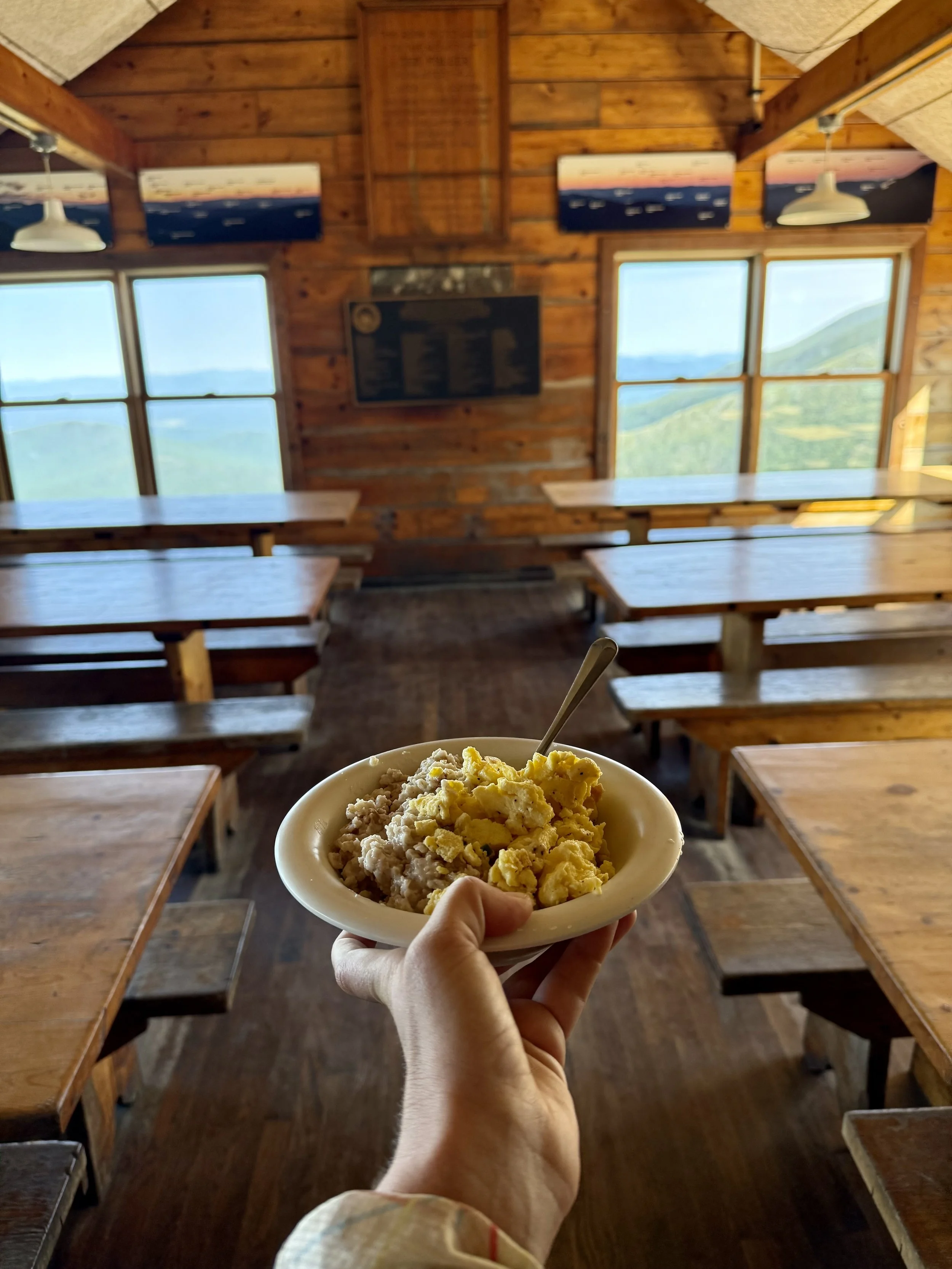
Mount Washington is known for wild and unpredictable weather. It has some of the most violative weather in the world between wind gusts and sudden weather changes. As I was packing up my tent, there was not a cloud in the sky, and it looked to be a beautiful day. It was a relatively short hike to another AMC hut, Lake of the Clouds, where George and I were hoping to get some breakfast. These huts cater to those who would like to go hut to hut in the White Mountains. This includes an overnight stay in a bed, meals, and shower - which in retrospect would be the best way to do this section. But if you are a thru-hiker and you arrive after the allotted breakfast time, sometimes there’s leftovers, which was the case on this day score! I was able to have eggs and oatmeal in the middle of the backcountry. There are also hiker boxes which provide free items to hikers that other hikers left behind. There was a hut to hut hiker who got rid of approximately 10 dehydrated meals because they were too heavy in their pack so we also hit the jackpot there. I got all the gluten-free ones and George grabbed the rest.
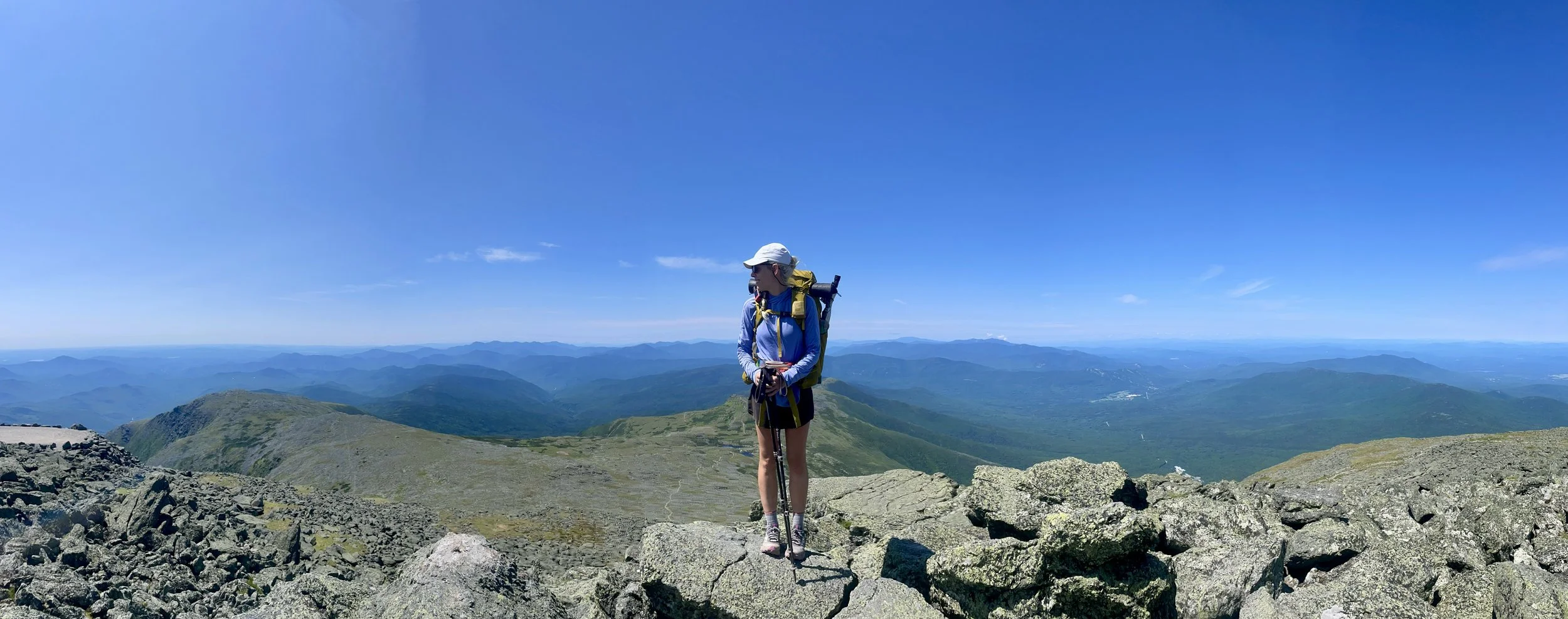
From this hut to the top of Mount Washington was not too far, but did have a bit of elevation. This was all above tree line, so the views were incredible. George and I hiked together, which is different than the majority of our hiking days where he goes ahead. Mount Washington is a special milestone for AT thru-hikers.
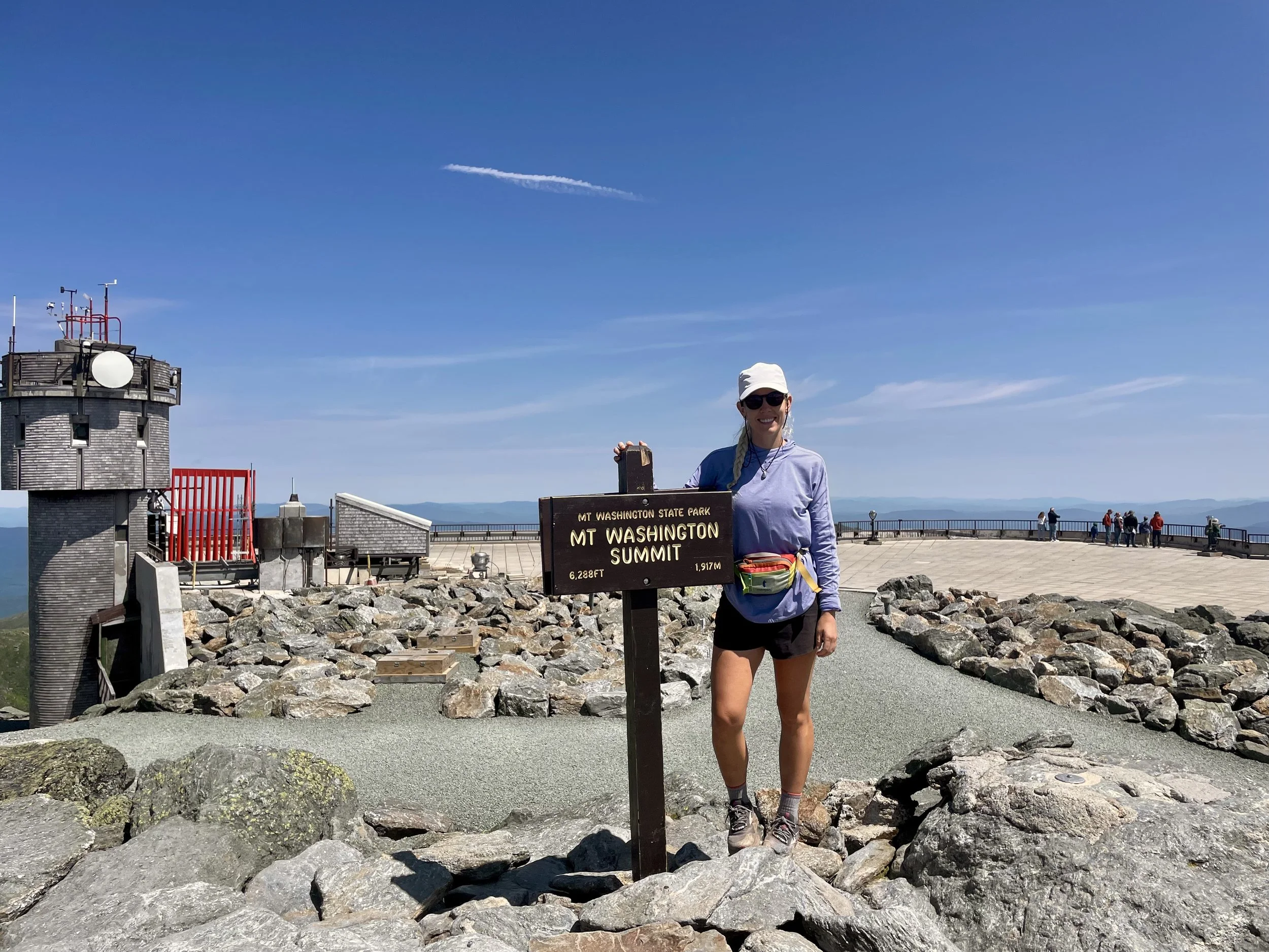
Arriving at the summit was pleasant as it was warm and calm wind day. There were many people at the summit as there is both a cog train and a road tor drive up. There was a visitor center and a café which was a bit overwhelming coming out of the woods into a very touristy area.
As we were wrapping up, I saw a large group of people setting up for something and it turns out this was the support crew for John Kelley, who was attempting at fastest known time one of the Appalachian Trail. Talking with his support crew was pretty amazing and seen all the work that went into a task such as this. I saw him get up to the top of Mount Washington, which felt like another monumental thing as he was just over a month in and already in New Hampshire!
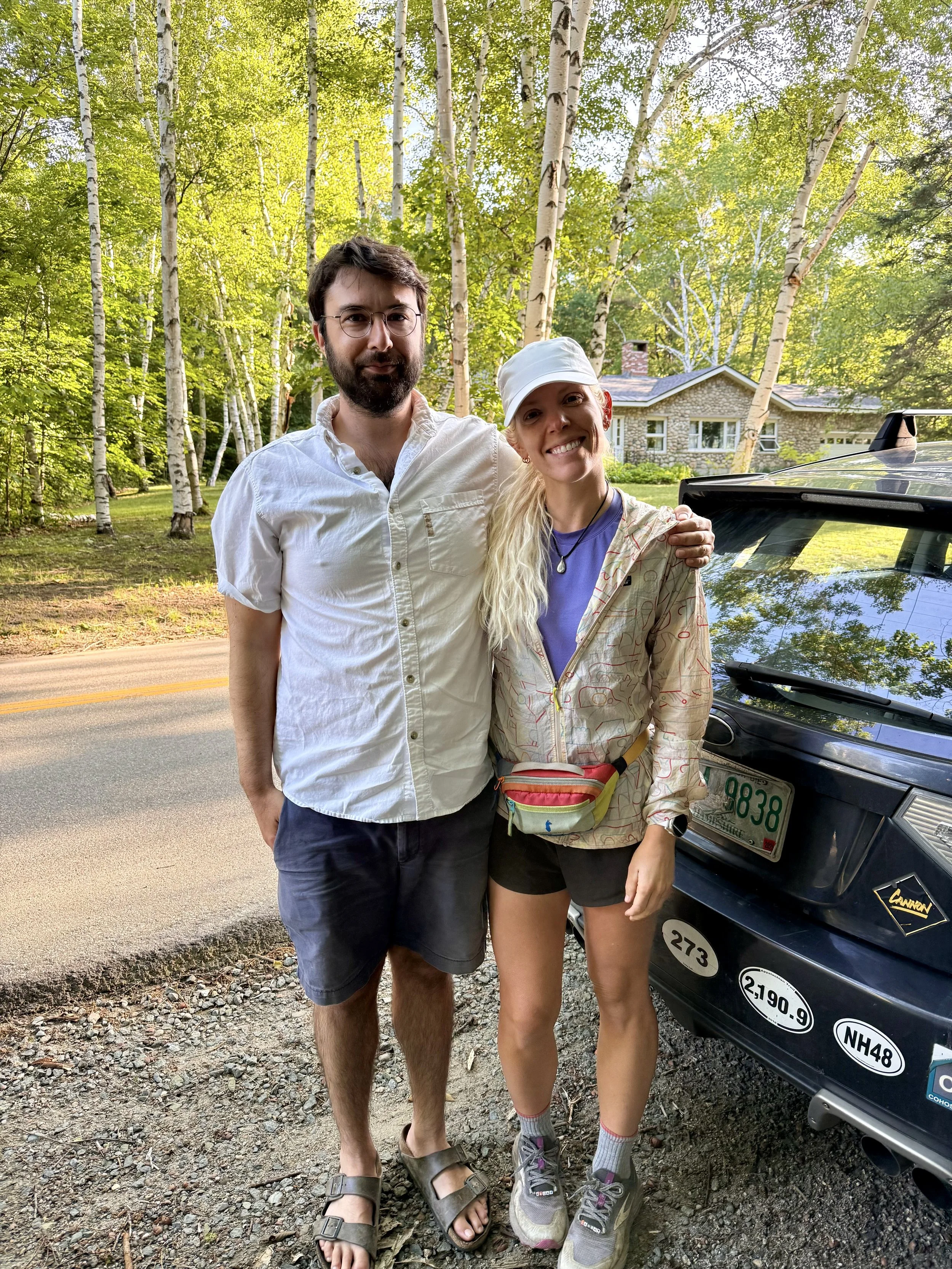
George and I finally continued on and I perhaps did not realize how much more elevation gain/loss was in the day. The plan was for Prick to hike up to meet us but he had to wait for several hours because I was several hours behind. To be honest the last 20% of the day was terrible for me. Coming down Mount Madison was a giant boulder field and my legs were fatigued from a few days prior, but the primary issue was I felt like I had no ankle mobility. Poor Prick and George got a sight of me in a state when I got to the meeting spot. But both of these people had seen me for literally thousands of miles of thru-hiking, so it was a safe space.
A bridge on the Appalachian Trail was out and the ATC recommended a detour and because I am a rule follower we got off at the Osgood trail head and planned to skip around the closed section. Prick took us out to a brewery and I celebrated both seeing him and doing the Presidential’s with two margaritas. We then got back to Prick’s place late and I was so thankful to be sleeping in a bed that night.
Day 89 & 90: Mile 1878.8
Trail Daily Miles: 0
Elevation Gain: 0
Elevation Loss: 0
Weather: Who knows?
Overall Day Sentiment: Sick again?
The original plan was to have Prick drop us back off from the same spot as the day prior and start hiking again mid morning. Unfortunately, I woke up and immediately knew that I was sick again. My lower back hurt and it was painful to urinate - classic symptoms of urinary tract infection. I guess that’s what I get for living outside peeing in the woods, using a reusable pee cloth, amongst the humidity that makes my clothes constantly wet.
Luckily, I was in town and Prick was able to drive into urgent care so I could get antibiotics ASAP. The doctor there knew how badly I wanted to get back on trail so not only did I get a 10 day course of antibiotics, but I also got two antibiotic shots in each of my butt. This can be sometimes a bit demoralizing, but in a funny turn of events that actually became one of my favorite interactions from the trail.
As I am bent over with my pants pulled down, the nurse touches where she is about to give me the first shot and says, “you need to relax your glute muscle”.
I said “But it is relaxed.”
She started giggling and said “My God, climbing all those mountains really have done a number on your muscles back here.”
It was a compliment in the highest. <3
We did a resupply and got breakfast and got Thai food that night and I had a relaxing day lounging at Prick’s house. Unfortunately, I woke up the next morning and I was still feeling like ill so it became another emergency double zero. Bless George’s patience by waiting for me as my body started falling apart.
This is also the moment where I realized the 100day goal was no longer attainable. I tried to make a plan for quite some time, but there was no way that I could finish all of Maine in 10 days. So perhaps for the first time on this trail I actually listened to my body, gave it the rest that it needed, and silenced to my brain that had thoughts of failure incessantly bouncing around in it.