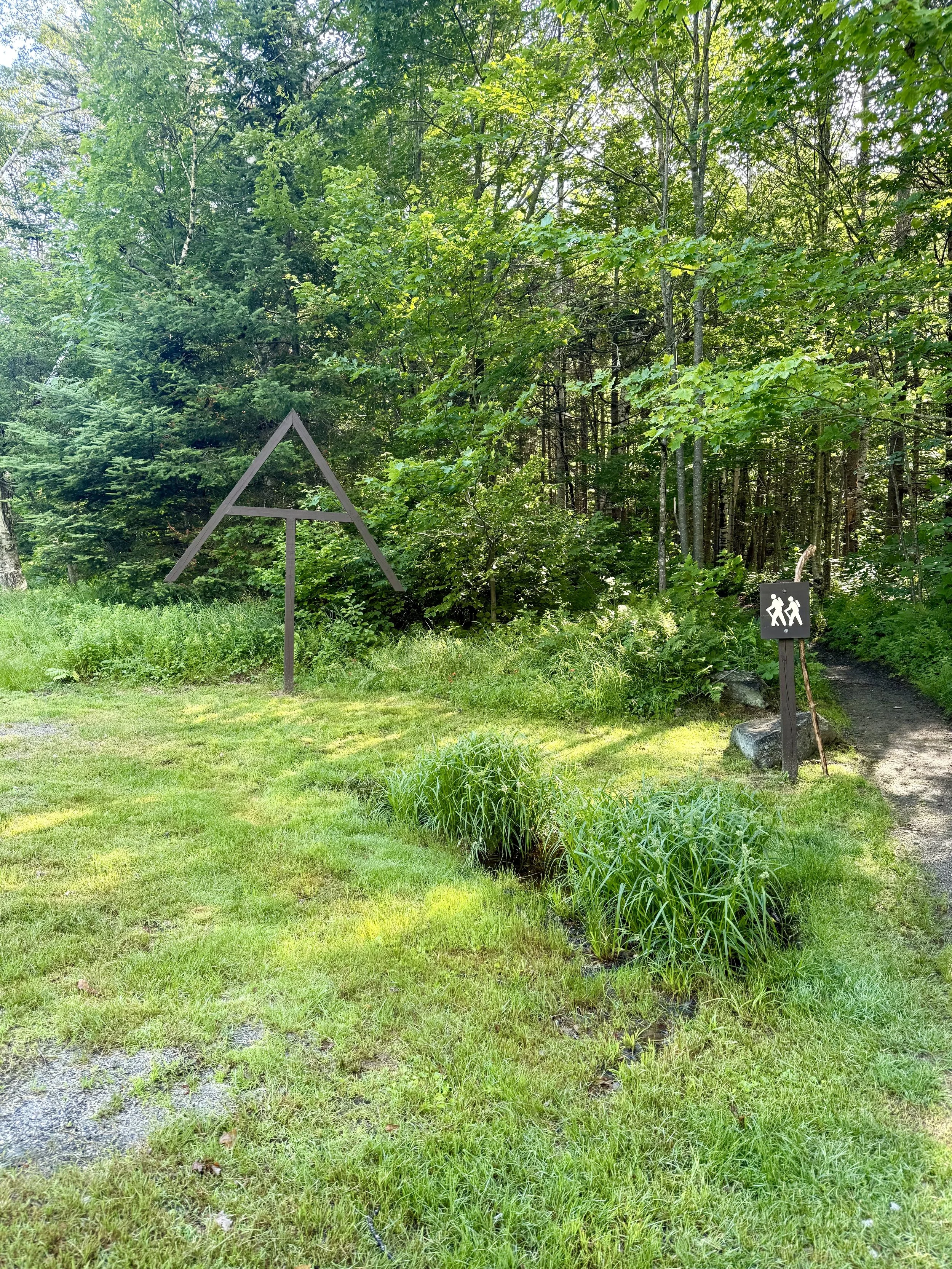
Appalachian Trail Hike: Maine (Part 1) - Mile 1915 - 2083
Appalachian Trail Hike: Maine - Mile 1915 - 2083
Hello all! Arriving in Maine was a surreal experience. To know that I had been through 13 other states at this point, arriving in my final one was an accomplishment. I didn’t realize what a challenge Maine hiking would be though. Everyone had hyped the White Mountains of New Hampshire up enough that I thought the trail would get easier afterwards - I was very wrong. The heat, bugs, weather made Maine one final gauntlet to pass. But the hostels and the people were beacons that added sunshine to dreary days.
Appalachian Trail Hike: Maine Summary
Statistics:
Days: 8
Full hiking days: 8
Zeroes: 0
Neros: 0
Total Trail Miles Covered: 150.7
Total Elevation Gain: 37,254 ft
Total Elevation Loss: 37,093 ft
Highlights:
Great July 4th celebration.
3 wonderful hostels made the tough days better.
Meeting great folks in my last final push.
Arriving in Maine, knowing the end was close!
Mahoosuc Notch was a fun jungle gym.
Lowlights:
The increase in rugged terrain caught me completely off guard.
The bugs, the heat, the thunderstorms. Conditions made me ready to be done.
Did I mention I was tired?
Appalachian Trail Hike: Maine Detailed Version
Day 91: Mile 1900 - 1921.6
Trail Daily Miles: 21.6
Elevation Gain: 7001 ft
Elevation Loss: 5685 ft
Weather: Sun, Bugs
Overall Day Sentiment: Maine! The last state!
I finally made it back on trail after the emergency double zero due to another illness. Luckily, I have been able to stay with a friend, Prick from the PCT, to recuperate and although I was not feeling 100% at this point, it was time to get back on trail. With another eight days of antibiotics on hand, Prick dropped George and I off ahead of where we had gotten off trail. As mentioned before, there was a bridge out, and the ATC had directed people off the trail to an alternate which I had taken. Based on how I was feeling and the loss of time with my illness, Prick dropped us off about 20 miles north of where we had gotten off trail. I love thru-hiking and logging miles, but I am no purist. I do not need to see every White Blaze on the Appalachian Trail to know that I hiked it. There’s a common saying “hike your own “hike“ in the thru-hiking community and though sometimes I roll my eyes at this this was me opting into ‘hiking my own hike.’
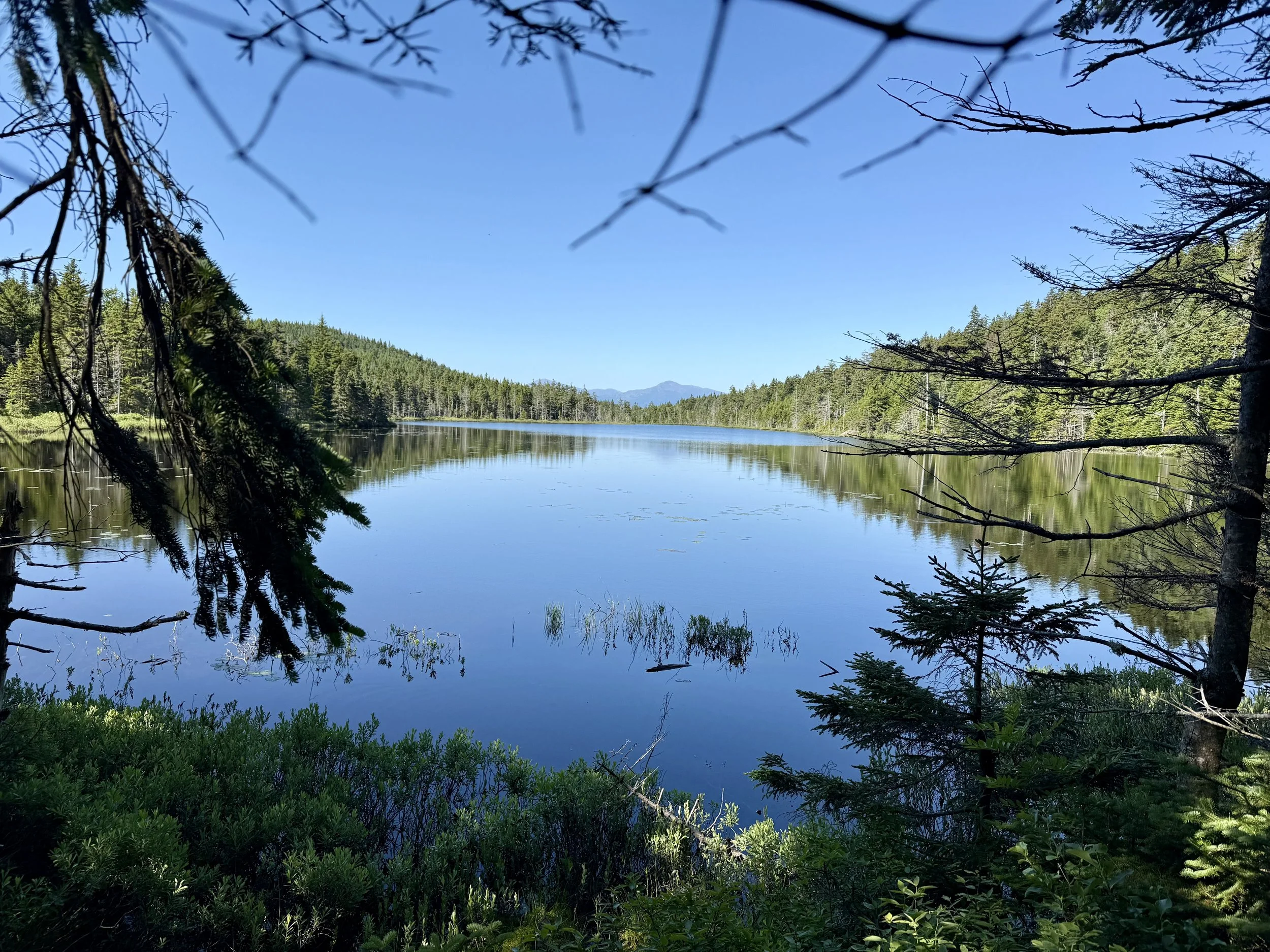
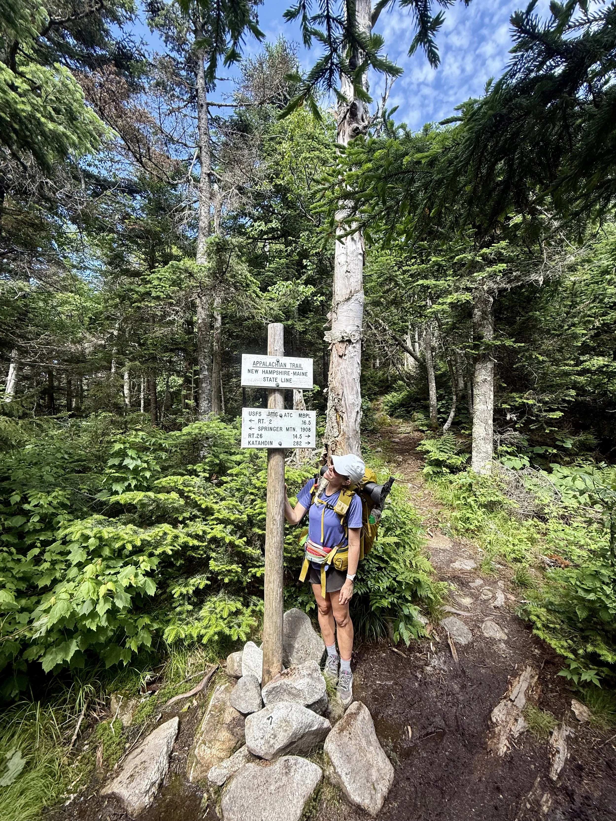
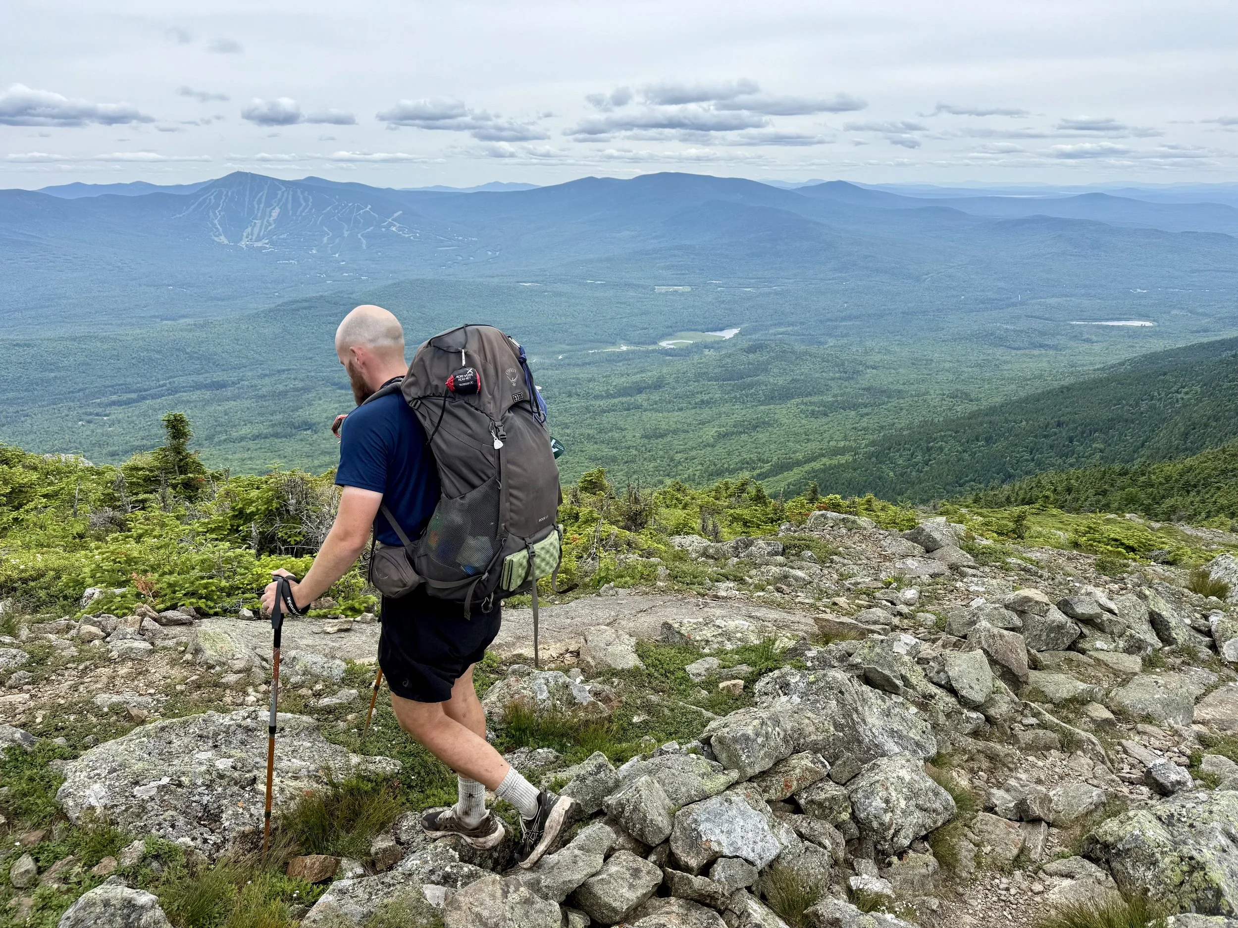
The Maine border was not too far from the point of where I had gotten back on trail. After having a quick and lovely break at Dream Lake (which did feel like a dream) it was only a few miles until the border of my final state. Of course New Hampshire could not go out without a few more climbs on rocks. One rock in particular, I slammed my shin into an a goose egg quickly formed. You can see it on my right shin in the pictures down below with me next to the New Hampshire/Maine border sign. Even months later – now – that part of my shin is still sensitive to the touch.
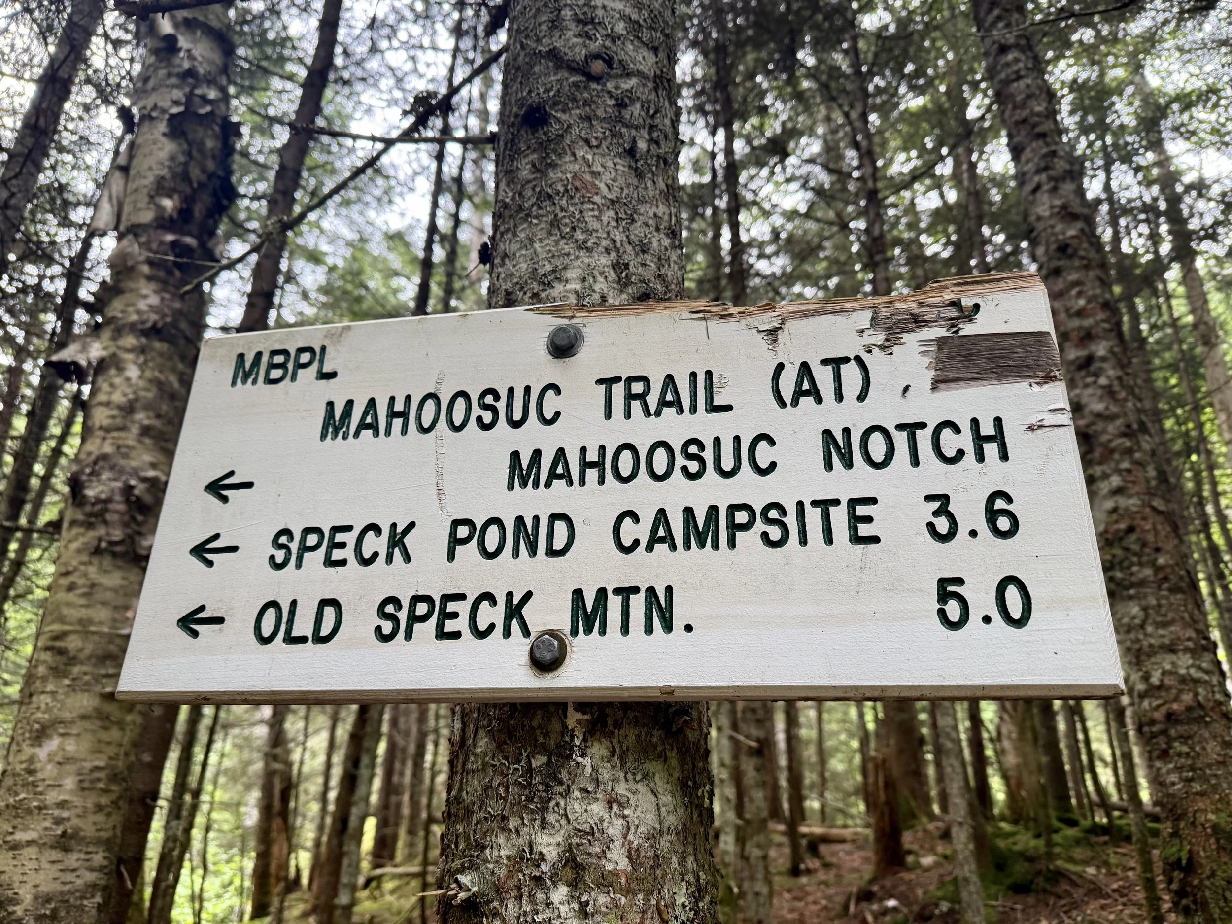
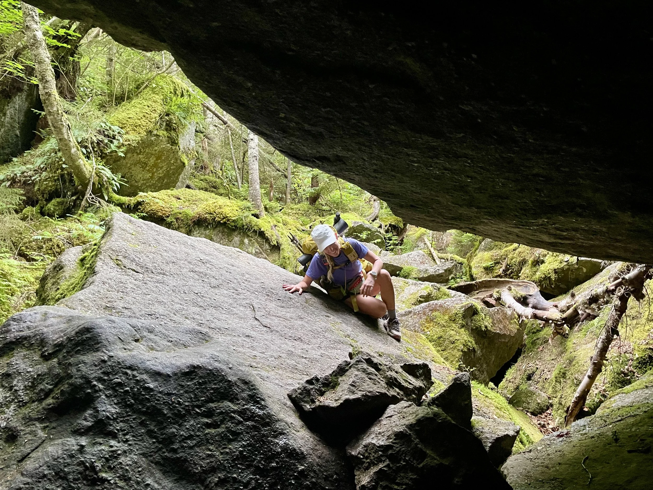
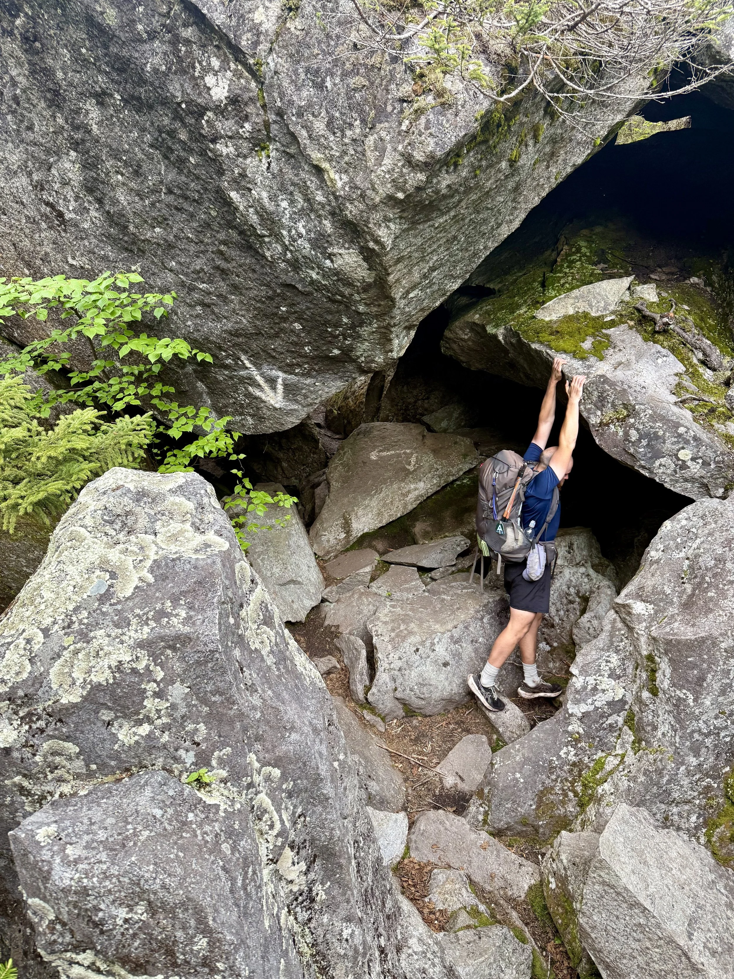
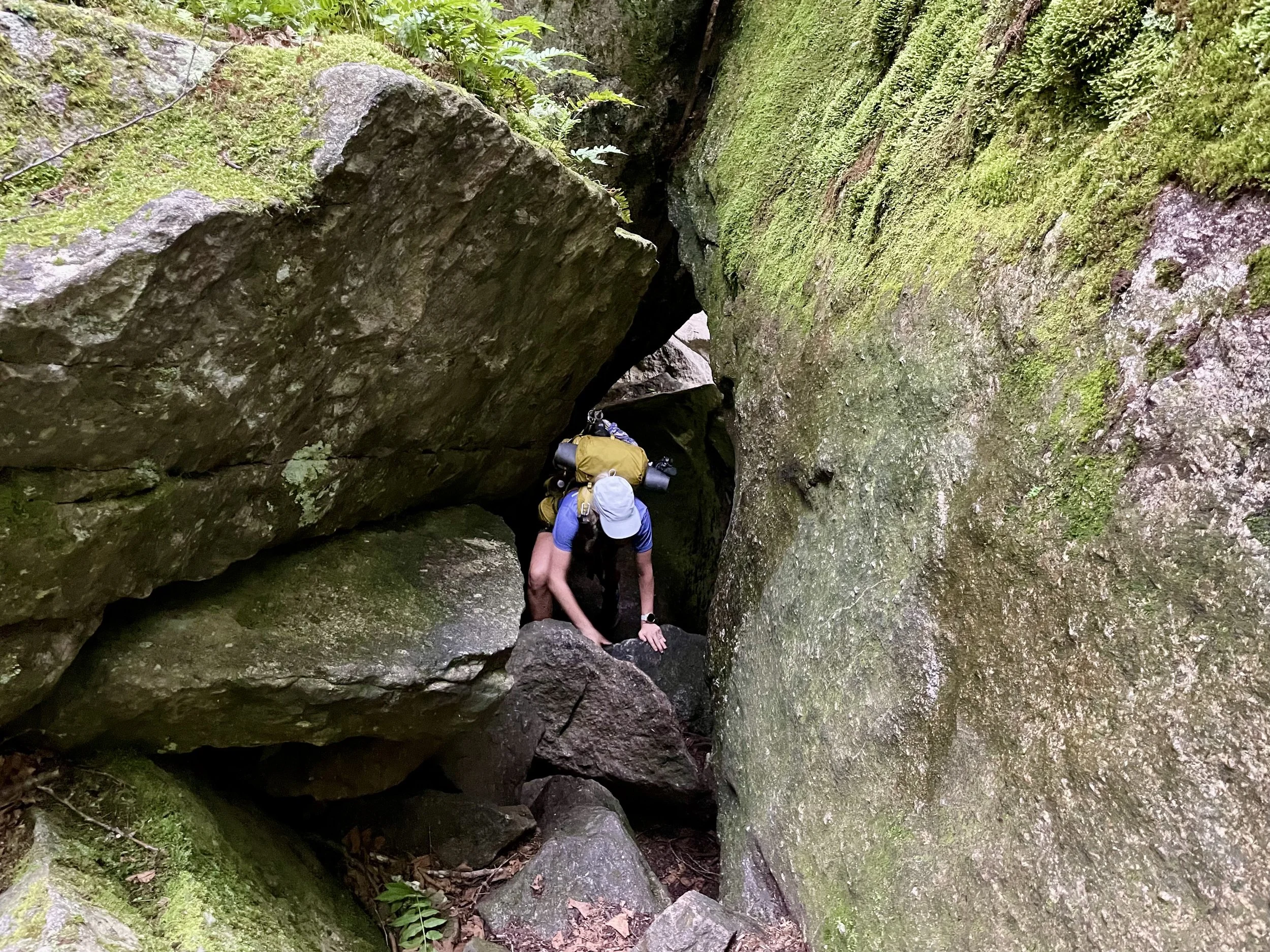
Our goal for the day was to get to a shelter that was just before the Mahoosuc Notch. This is the “slowest mile “on the entire Appalachian Trail because it is bouldering through a ravine of rocks. So by getting close to it, George and I could allow ample time to go through it the next morning.
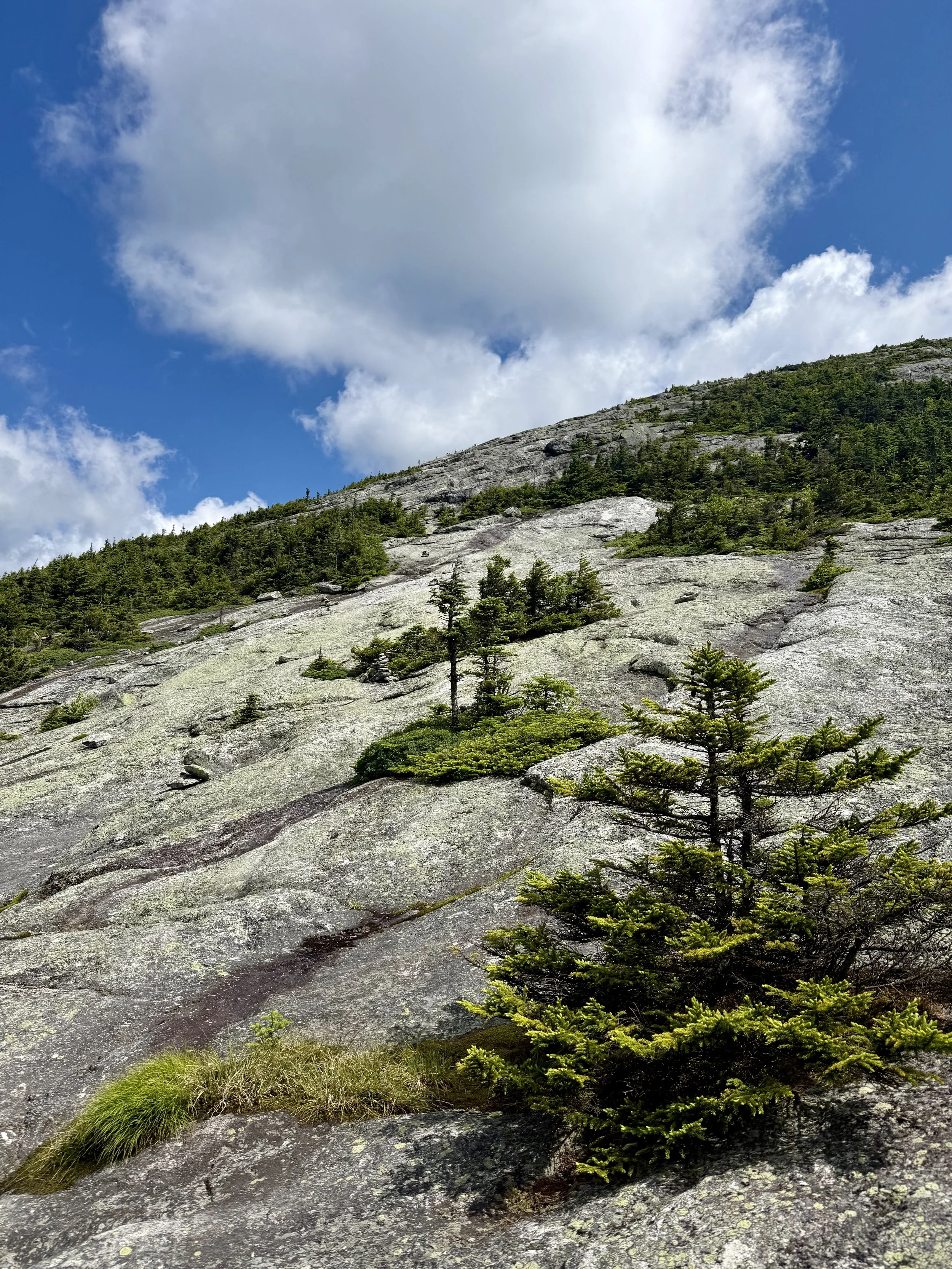
The Alpine bogs continued into Maine from Vermont and New Hampshire luckily, with some board walks provided for footing…but other times it was a rickety log crossing. The trail did change from state to state though. It had more white blazes, which New Hampshire lacked, but the trail was more rugged somehow. Rocks, roots, bogs, and more obstacles made it feel like a ‘Tough Mudder’ race rather than a walk in the woods.
On my last climb of the day, there was a large group, around 15 teenage boys, with two adult camp counselors. I chatted with them at the top of the climb and realized that they were going to be at the same tent site/shelter as I was. Nervous about ensuring I got a site, I hurried off and arrived seeing that there were again tent platforms much like going through the White Mountains. George had gotten us a tent platform with his tent already set up. I set up my tent and sleep system and went down a steep path to grab water while fighting off a terrible amount of bugs.
With the bug situation, George and I have gotten into a habit of sitting in my tent and watching the great British Bake Off while we watched the swarms of bugs dance outside the mesh. As he was getting into my tent on the platform, which was precariously close to the edge, he stumbled on a guyline and tumbled off the side of the platform wall…while still in my tent. I’m unsure how my tent did not completely rip because of how tight I had tied the lines as it is a tension tent, but it remained intact. The same could not be said for George’s back, which was being balanced on a root off the side of the platform. Insult to injury, all of my items completely collapsed on him. I dug him out of the items and could not stop the absolute giggle fit that happened. It is still one of my funniest moments of the trail and a giggle fit ensues when I think about too much about it.
The group of young boys and their chaperones made it to the tent area and luckily there was a group tent platform that they all fit on. It was an experience to hear teenage boys be teenage boys, not listening to any authority for several hours. Thankfully, they quieted it by 11:00pm.
Day 92: Mile 1921.6 - 1931.1
Trail Daily Miles: 9.5
Elevation Gain: 2943 ft
Elevation Loss: 4453 ft
Weather: Hot, Rain
Overall Day Sentiment: Mahoosuc Notch was a fun jungle gym.
Today was Mahoosuc Notch day so George and I got up early and I felt 0% guilty for clamoring around putting my stuff away loudly while the group of teenage boys was nearby. We set off and wondered what the slowest mile on the AT would actually look like. It was a hot and muggy day so I was thankful for the early start.
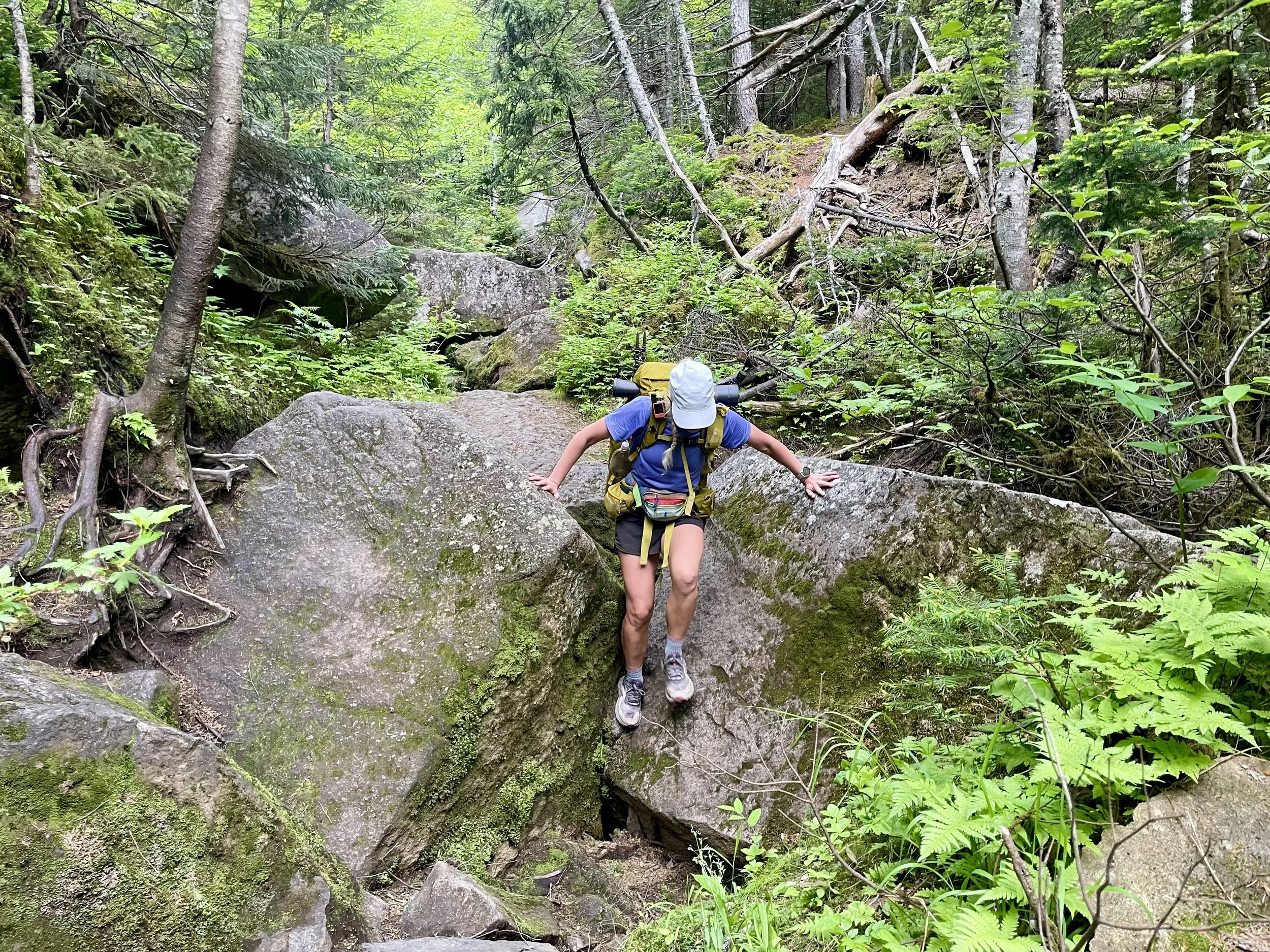
We arrived at the west side of the notch and began our trek through. This actually turned out to be one of my favorite sections of the trail. This might come as a surprise because I have been grumpy about most other rock formations, but because I have prepped myself that this was going to be a slow section it felt just like a jungle gym. It also was an AT staple, another right of passage along the trail. Though the overall air temperature was hot and muggy - in between the rocks, there were still heaps of snow, lending itself to feel like air-conditioning pooling out of crevices, which was an added bonus.
There were several times where the trail would have markers or arrows, pointing into tunnel-like features in which most hikers go through and takeoff their packs. But George and I kept seeing that there were easier ways above these tunnels, and so we would just climb up. We made it through the notch with our packs never leaving our back.
We also completed the notch just as it started down pouring. With the dexterity and balance needed to get through the notch, I was thankful that we did it while the rocks were dry. When we started going up the Mahoosuc Arm, which is the climb directly after the notch that’s when we realize the day was going to be even slower than we expected. We stopped to get water while there was a deluge, looked at each other, and then proceeded to look at FarOut (our mapping application) and found a hostel for the night. We called and they had availability for the two of us and planned a time for them to pick us up. Knowing that I was going to be dry and clean later on this day made the rest of this hard, hiking day, tolerable.
The Mahoosuc Arm and the subsequent mountain of Old Speck proved to be difficult, especially in the rain. There were swaths of slanted rock with few grips or holds, which were made all the more difficult with the rain. There were several inclines in which I had to grab roots that lined the side of the trail to haul myself up.
We got to graft a notch, and Dougie from The Knoll Hostel was waiting for us. I had only done 9.5 miles for the day with limited actual elevation gain, but it took over 9.5 hours. If this was what Maine was like for the remainder of the trail, I was in for a rude awakening.
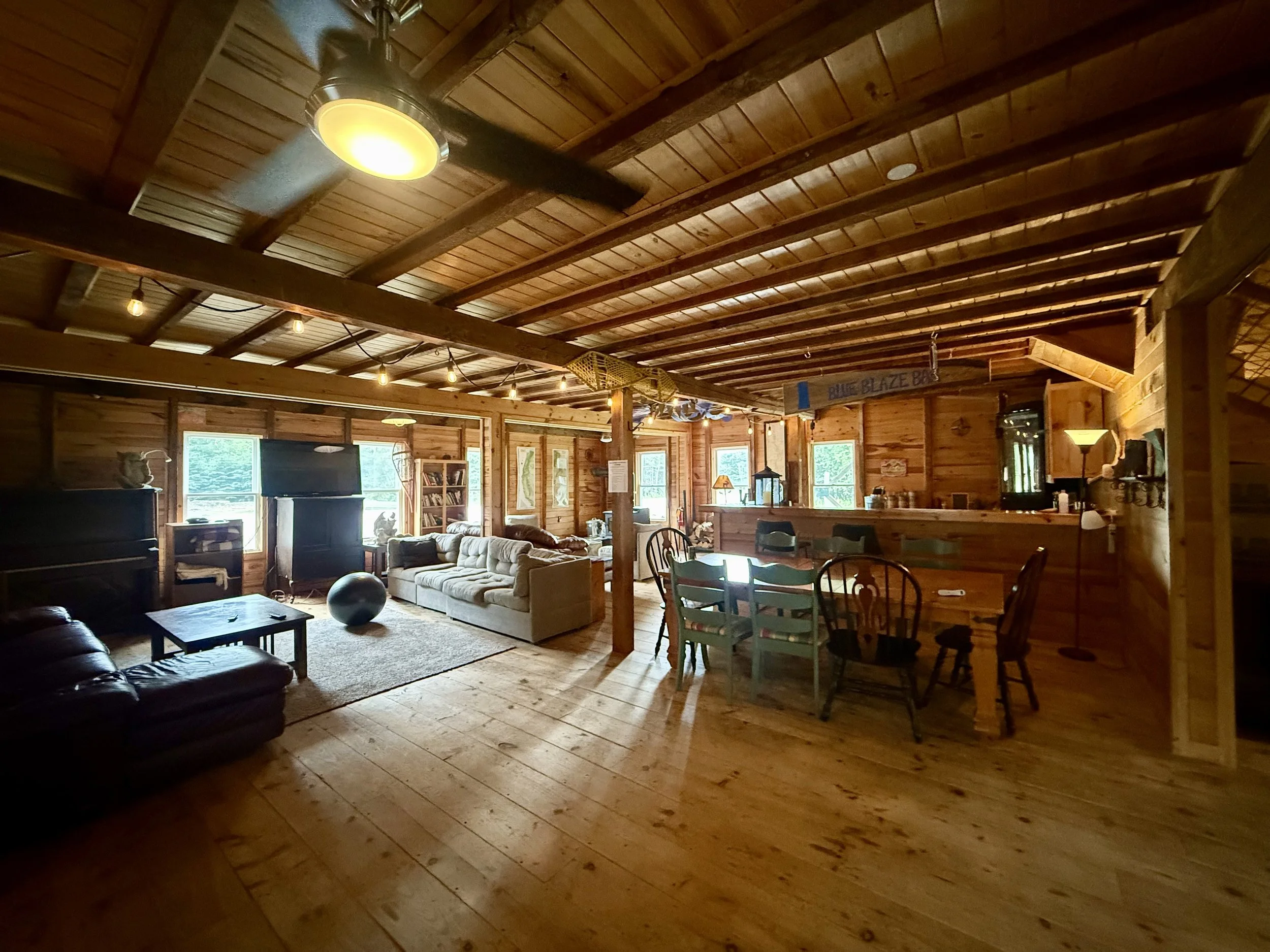
We got to The Knoll Hostel and it was heaven on earth. Dougie and Homespun, the proprietors of the hostel, were just kind people. They were hikers, knew what hikers needed, and had everything readily accessible. There was a glorious outdoor shower that hikers from previous season built. Despite that it had been raining the whole day while I was hiking, it was beautiful and sunny once I arrived. An outdoor shower after such an arduous day, with a face full of sunshine, was just what I needed.
There were other folks at the hostel and we all had a communal dinner. After dinner, George and I spent time in the converted garage which is one of the most comfortable hiker lounges I’ve ever been in to chatter with these kind people. This is a relatively new hostel and I would 10 out of 10 recommend.
Day 93: Mile 1931.1 - 1947.4
Trail Daily Miles: 16.3
Elevation Gain: 5542 ft
Elevation Loss: 4406 ft
Weather: Sun, Hot, Bugs
Overall Day Sentiment: Southbounders galore!
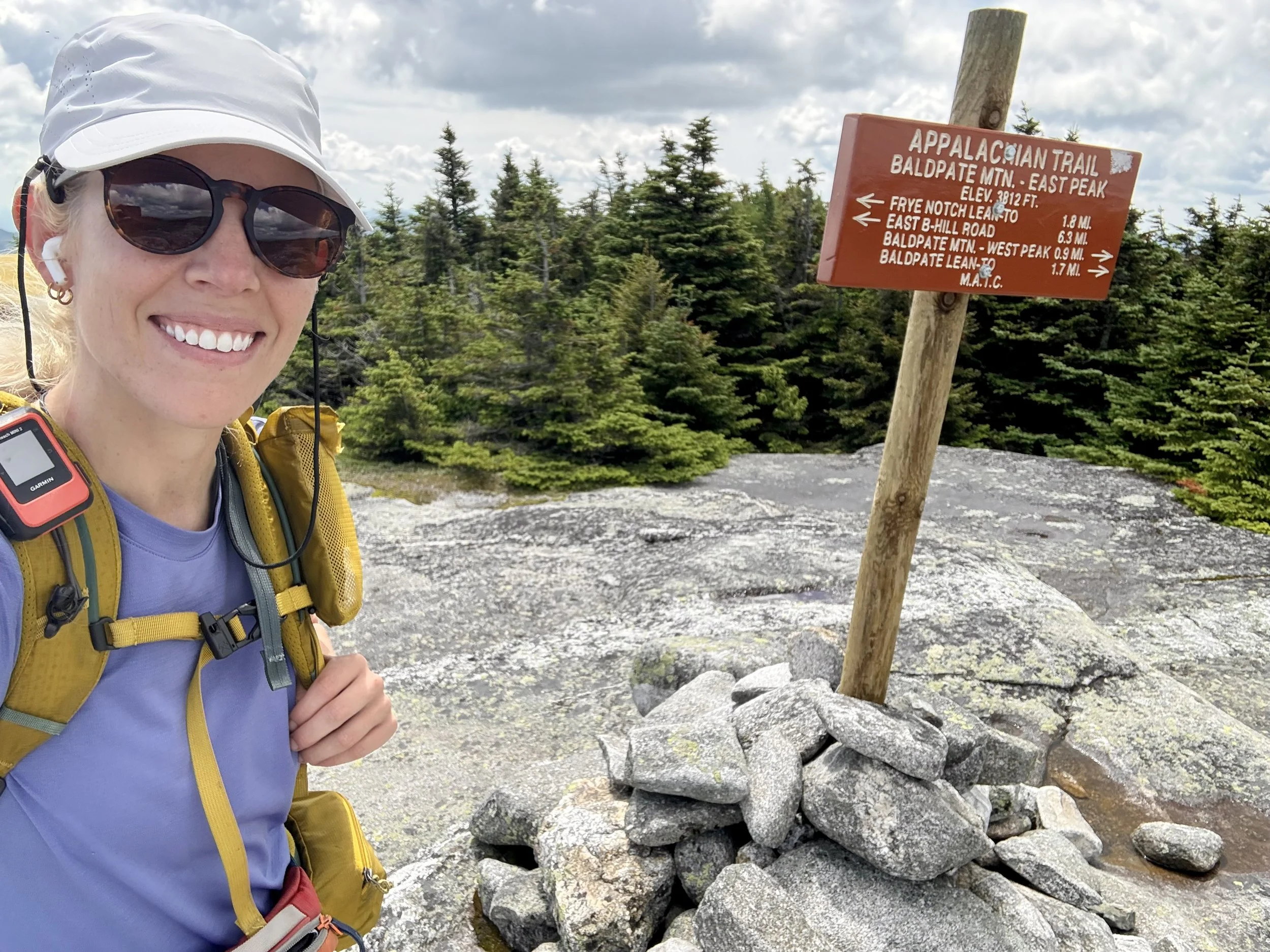
We got a ride back to Grafton Notch and headed out to tackle the Baldpates. I was gifted clear skies as the view from the top - I had been told, something special. These peaks made you work for the views as they were straight up and straight down. I was also so thankful that the rocks were relatively dry as compared to the day prior because of the harsh degreed angle. Despite the rock being dry, I still went from tree well to tree well to make sure that if I did slip, I would hit a tree before I would go careening down the slanted rocks. The treads on my shoes left little to be desired - oops.
The views were beautiful from the top made better by intersecting with southbound hikers. They were still in the process of working on their trail legs in the rugged Maine region but I assured them that it would prep them perfectly for the remainder of the trail. In direct contrast, I felt as though my legs were bone deep tired and that no amount of zeros while on trail could actually be enough to rest them.
The remainder of the day somewhat flew by after the peaks. There were some cruisey miles leading up to the shelter where I had planned to stay. A few of these miles were in dense forests that screamed ‘Moose Habitat!’ to me, but alas no moose sightings yet.
Once I arrived, George was there already set up and had been chatting into a southbound hiker. The three of us ate dinner while the southbound hiker asked a multitude of questions. It was fun to connect with someone so new in their journey while I was only about 10 days away from finishing mine.
Day 94: Mile 1947.4 - 1963.8
Trail Daily Miles: 15.5
Elevation Gain: 4970 ft
Elevation Loss: 5697 ft
Weather: Thunderstorms, Bugs
Overall Day Sentiment: Hiding from lightning is no fun.
It was slated to rain most of this day and although we didn’t plan for too many miles it was still difficult to motivate to hike in the rain. The day had several climbs and at the highest climb of the day was Bemis Mountain, it started to thunderstorm. I don’t mind hiking in rain, snow, or hail but when thunder and lightning start getting involved…especially when I know I’m going to be above tree line on exposed rock I get very nervous.
At the height of the thunderstorm (based on radar and my observations) I had to begin running across the top of this open area and get down below tree line. I had several more tiny climbs for the day that would lead to open balds, so I finally had to sit down for nearly an hour to wait out the lightning. No surprise but sitting down for an hour in the middle of the day, meanwhile the rocks are getting terribly wet and the trail to flood slowed me down.
Once the lightning had subsided, I continued hiking and got to the open balds. Overall, the trail had a decent amount of rock cairns and white blazes that led you in the correct direction. But there were a few times in which the trail was so underwater while I was being beaten with sideways wind and rain that it was hard to see which direction I was going. Crossing my fingers toes, etc. that my phone was waterproof, I had to check my phone in the inclement weather in order to see the actual trail. It felt a bit like a maze up there, and I got no views because it was socked in with the clouds.
So much water was in my shoes that my insoles started rolling up, creating a very uncomfortable situation for my feet. I stopped to handle it a few times, but it was to no avail as it was too wet. I finally started the last descent and got to where George was camped near a river. He had been there for several hours, which was nothing new based on our hiking speeds, but I was cursing the lightning for forcing an extended break.
In the background of the last few days, the bugs had been terrible, and I was just completely covered with bug spray. After sweating profusely, using an obscene amount of bug spray, and my clothes already suctioned to my body already - I decided to go for a dip in the river nearby. One thing about thru-hiking is that you sure do get comfortable with yourself and the possibility of people seeing you in all different situations.
Day 95: Mile 1963.8 - 1977.9
Trail Daily Miles: 14.1
Elevation Gain: 2954 ft
Elevation Loss: 2830 ft
Weather: Sun, Hot, Bugs
Overall Day Sentiment: A holiday to remember!
This was a planned shortish day as it was July 4th and I wanted to make sure I got to a hostel. With less elevation gain than we had been seeing in combination with less miles, the day went quick to get us to a main road crossing.
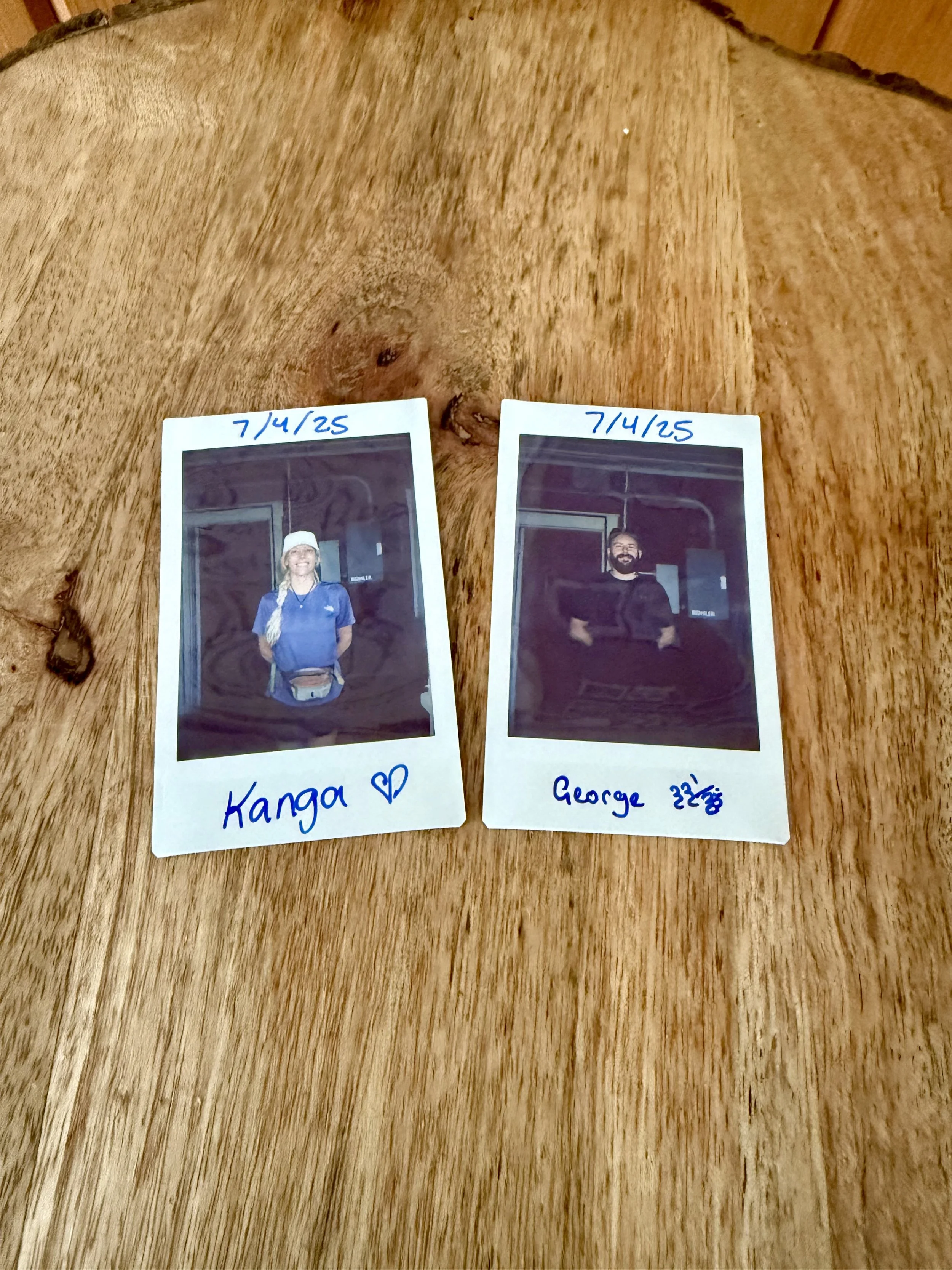
Calling around, I discovered that there was plenty of room available at The Maine Roadhouse which had been another hostel I had been hearing about for sometime. It had just changed ownership and recently opened so I was excited to see this trail staple. They were also hosting a Fourth of July celebration and there were some fun other hikers - and even a paddling couple - there. A quick resupply, laundry, and baking treats, it was good afternoon.
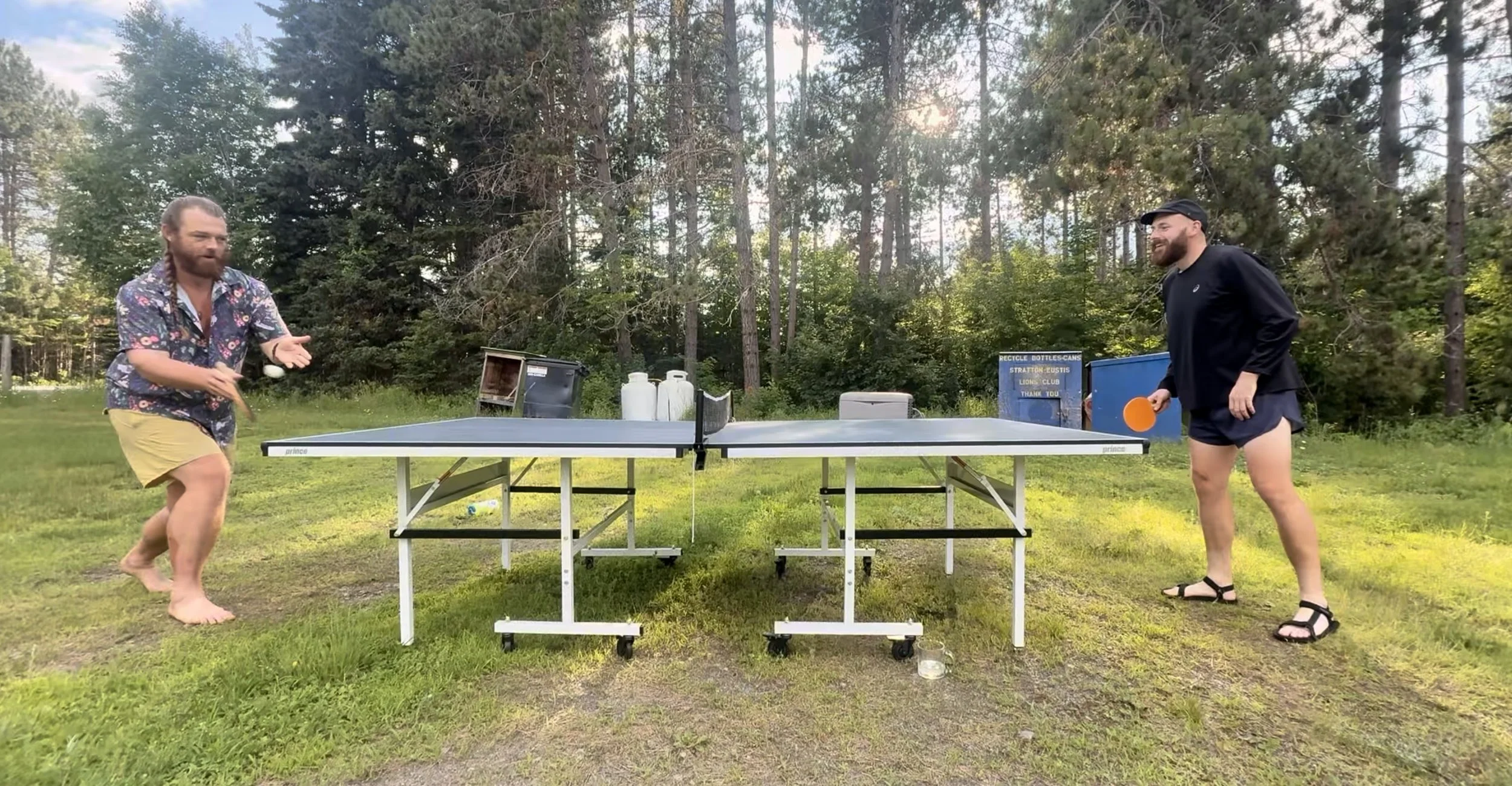
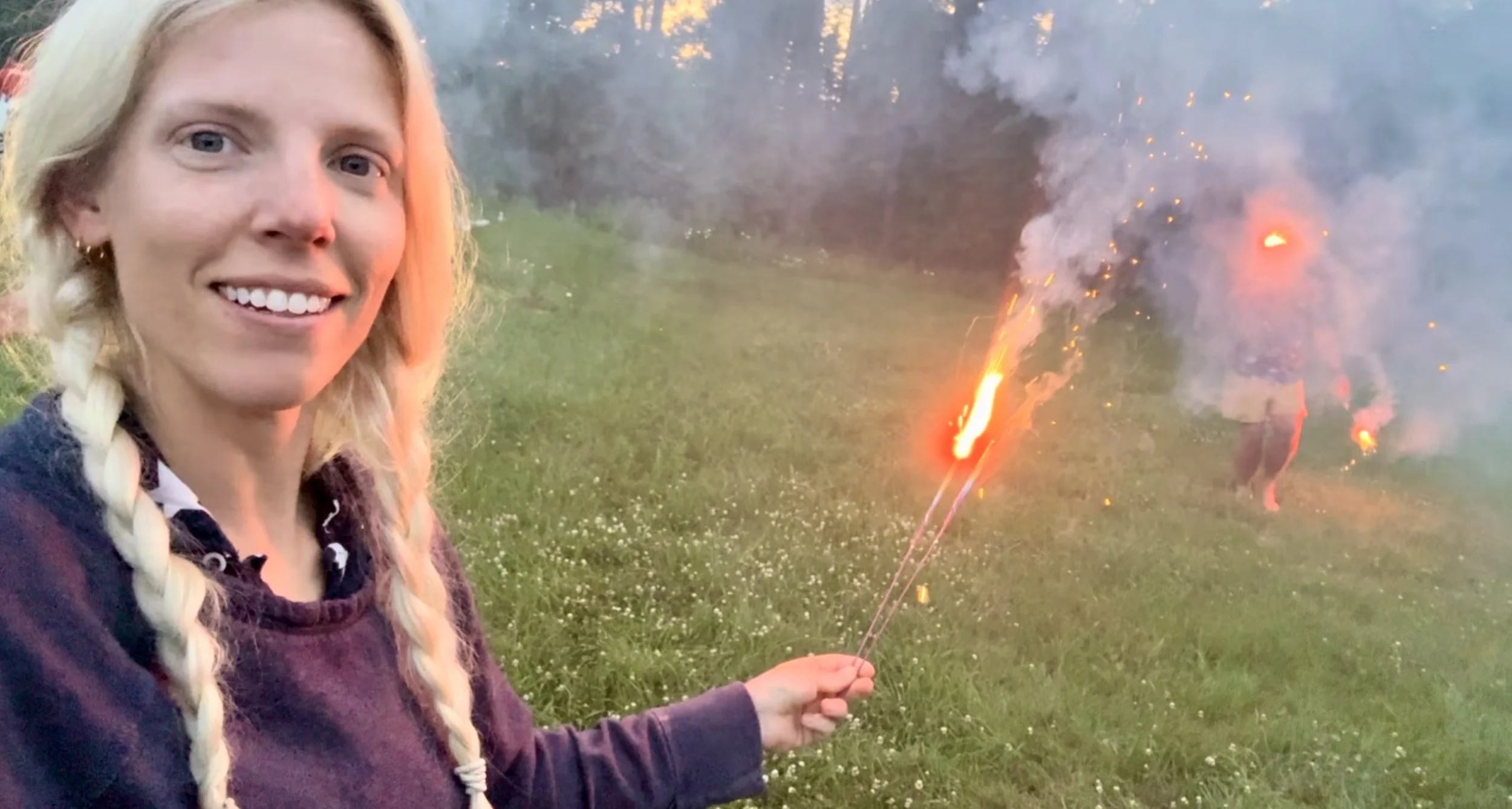
Even with the mosquito situation, there was a wonderful cookout, bonfire, s’mores, an outdoor ping-pong tournament, and of course many many sparkles. As George is English, this was fun to see him celebrate such a painfully American holiday.
Day 96: Mile 2010.1 - 2028.1
Trail Daily Miles: 18
Elevation Gain: 5157 ft
Elevation Loss: 5376 ft
Weather: Sun
Overall Day Sentiment: Happy I only had one drink the day prior
I woke up refreshed, while George already had his sunglasses on inside. A hangover is not something I typically deal with on trail and waking up fresh is my main reason. But with the end in reach, I became less motivated to hike long days. We had gotten a hitch to The Maine Roadhouse from a main road, but the hostel was going to drop us off at a different road. This would mean skipping about 30 miles on trail and my body decided that was a good idea.
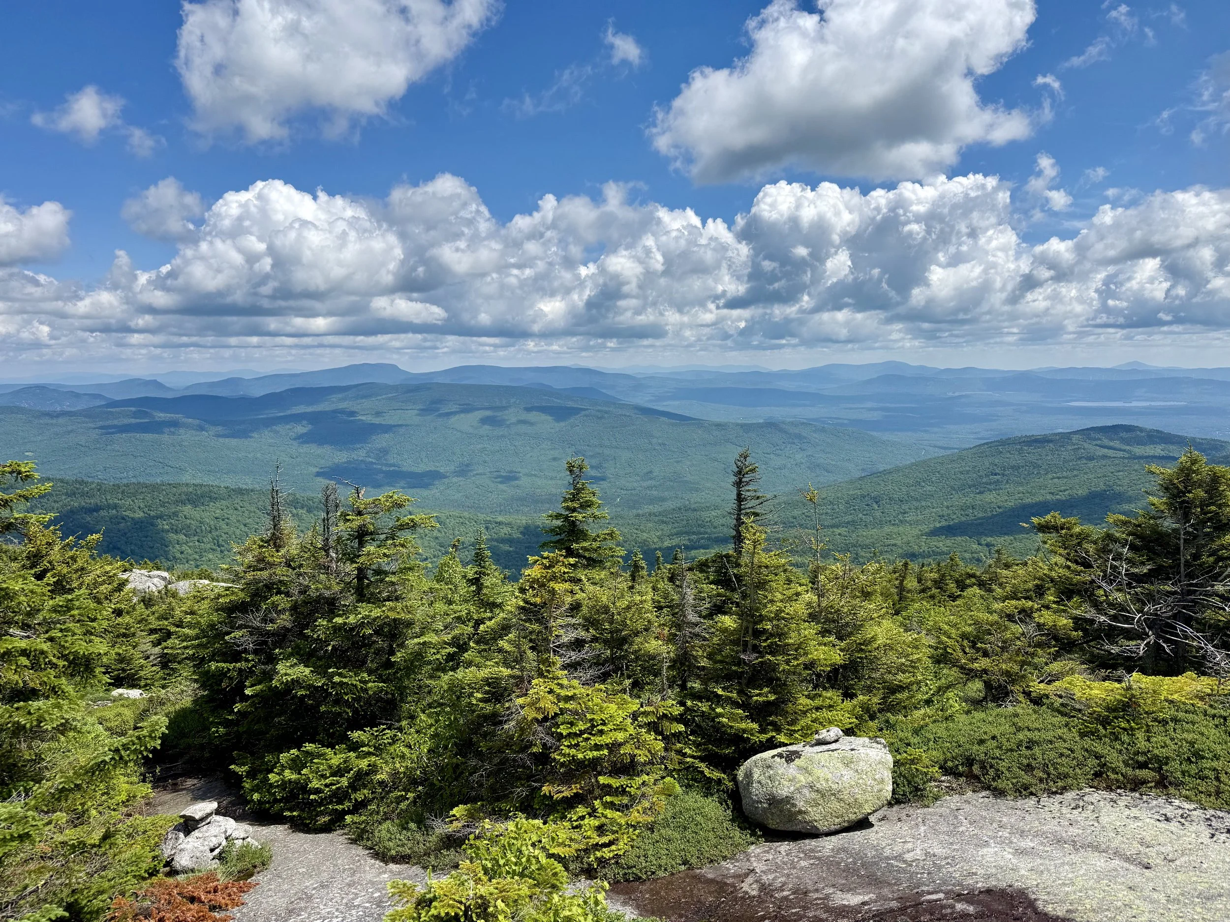
After a few snacks in my bed and a large breakfast, several of us were dropped off at this trailhead, and we continued north into the Bigelow peaks. These were some of the last big climbs before we got to the final climb of Mount Katahdin. George and I hike together for a while (as he was moving slower) and enjoyed the views at the top. It was a great lunch spot and I was thankful that the weather cooperated.
The plan was to camp at a lake that night to set up for a large river crossing that would take place the next day. George went ahead and I reverted back to my slow Appalachian Trail hiking pace due to the obstacles.
There were some smoother miles, but I was still very thankful to arrive at the campsite for the night. Once I set up my tent, I joined George on a rocky beach on the lake where I quick rinsed off in the lake before settling into having dinner with a view.
There was a boat on the water filled with four 50 to 60-year-olds. They must not have realized how much their voices were traveling over the water as they were chatting about some pretty controversial topics. When they pass by and engaged in conversation with us, we called them out on some of their conversation topics and opinions, and had a pretty good laugh with them about it. They were good sports and I think it was eye-opening for them as well.
It was an early night talking into the tense because we had to start hiking around 5:00am.
Day 97: Mile 2028.1 - 2059.1
Trail Daily Miles: 31
Elevation Gain: 4810 ft
Elevation Loss: 5004 ft
Weather: Sun
Overall Day Sentiment: Thankful for new trail friends + ferries
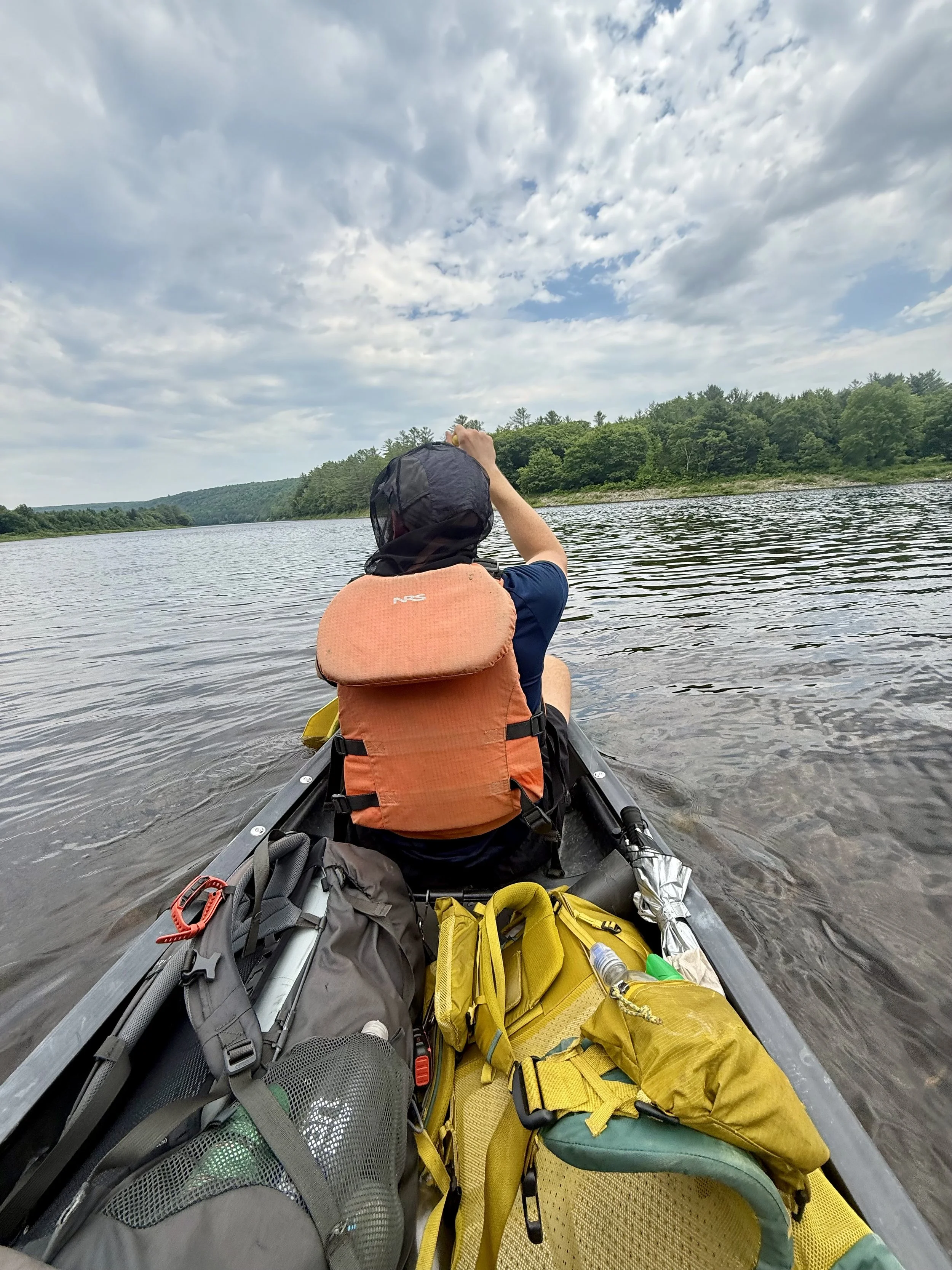
The early hiking time came much too quickly and we sat off on the trail just after 5:00am. There is an infamous river crossing on the Kennebec river in which there is a canoe that offers ferries. But this canoe runs from a strict set of hours from 9:00am - 2:00pm. It was about 18 miles until we got to the river so I had to do 18 miles before 1:45pm. This would’ve been very easy on the Pacific Crest Trail for me, but on the Appalachian Trail… my time per mile never ceased to amaze me.
We zoomed there in time and got across the river. This brought me back to the ferry service across the Nolichucky River way down in Erwin, Tennessee. It was a great moment of reflection to see how far I had come from there and to be thankful that George was still with me even from all that way.
Once we got across the river, there had been rumors of a food truck not far off trail and because it was around 1:00pm with 18 miles under our belts, I had to go visit it. When we were eating our lunch, another group of hikers came through, Hydro, Seconds and Thumper came through and we chatted with them. Hydro‘s dad was visiting and being a Trail Angel and spread the love to us as well.
We decided to camp together later on that night. After a long day on trail, we all set up near a road and went swimming in a lake. Skinny-dipping is just plain fun after a long day of sweating and bug spray. Nothing like meeting three new friends and having them see all of you on the first day!
I was thankful to meet such a great group of people so late in the hike and we would continue to see them for the remainder of our days on the trail.
Day 98: Mile 2059.1 - 2083.8
Trail Daily Miles: 24.7
Elevation Gain: 3877 ft
Elevation Loss: 3642 ft
Weather: Sun, Hot
Overall Day Sentiment: The last town stop.
After a long day the day prior, we were getting to the trail legend town of Monson, Maine. This is the last major stop before the finish. There was limited amount of elevation gain for this day, so it was just a matter of plugging away some miles.
With an early departure time and some easier miles, I arrived in Monson mid to late afternoon. I went to Shaw‘s Hiker Hostel, which is a now trail famous spot and always listed as one of the best hostels along the entire Appalachian Trail. Once I arrived, I quickly figured out why.
Everything was organized and there was a gear shop on site that has really niche backpacking and ultra light things. In addition, the kindness from these folks who run it, Poet and Hippie Chick is just unparalleled.
After a resupply and picking up my package that had been delivered there, I settled in for a very monumental task. I booked my flight back to Michigan. This was exciting, but also meant that I had an official deadline to finish the hike. I guess this was good motivation to power through!
George and I had also decided that we were going to do more outdoor activities after finishing the Appalachian Trail together so he booked a flight to Michigan too. Ending a thru-hike and not knowing what comes next can be very overwhelming so to know that there were other things to look forward to in the summer, made finishing the Appalachian Trail a little bit easier
The rest of the night I felt like I was tied up with some other chores. At the end of the night as I was laying in my twin size bed, it turned out to be a pleasurable evening.
I would start the 100-mile Wilderness the next day.