Pacific Crest Trail Hike: OR & WA Section K -Mile 2466 - 2593
Pacific Crest Trail Hike: OR & WA Section K - Mile 2466 - 2593
Your eyes do not deceive you nor are you misremembering that I did the Pacific Crest Trail in 2024 NOT in 2025.
After completing the Appalachian Trail in July 2025, I had plans to head back to the West Coast to fill in fire miles with my PCT trail bestie, Bags. We were able to officially complete the PCT in 2024 by jumping to Harts Pass and tapping the Canadian border. But we missed from Steven’s Pass to Hart’s Pass - ~160 miles due to wildfires in the area. This is notably one of the most beautiful sections of the entire PCT so it was with disappointment that we were unable to hike through it. This section is also known for grueling climbs that held the most ascent per mile of any other section on the trail (yes, even the Sierra!).
With some planning and flexibility, myself and my Appalachian Trail friend George drove from Michigan to Bags’ residence in Oregon. Along the way, I attended a Rodeo in Montana, visited three national parks, mountain biked in Oregon, kayaked in Northern Michigan, and more. It was a great Americana roadtrip.
Once in Oregon, I camped at Santiam Pass near Bend, Oregon on the PCT! I had previously camped in this exact spot after my 40-mile day that also coincides with the 2000 mile marker. It felt like a warm embrace to be back on the trail that helped shape me into who I am today.
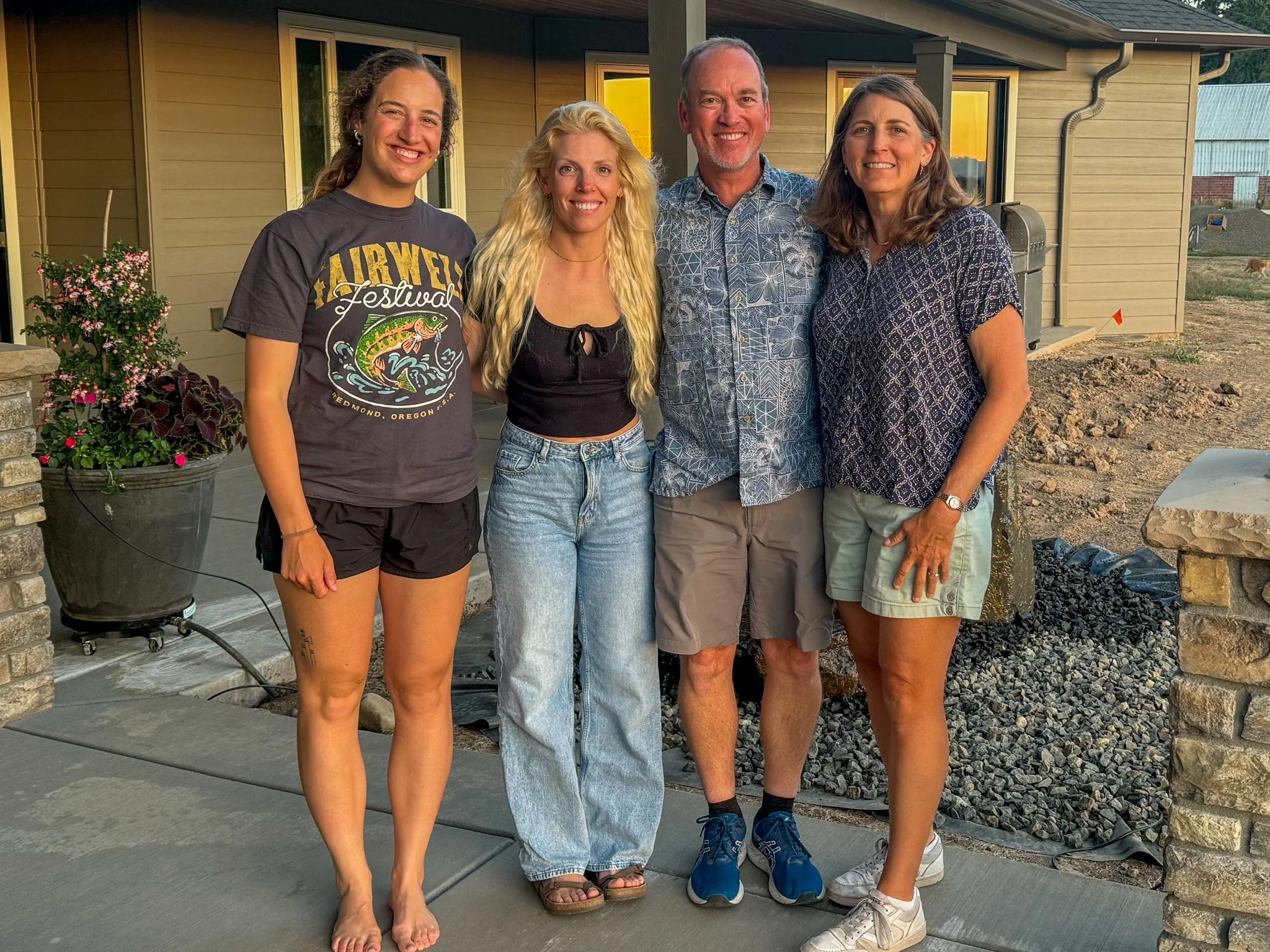
Seeing Bags again was wonderful and knowing we had two weeks of backpacking ahead of us was even more exciting. It happened to be that some of our other trail friends, Links and Wavy, were in the area as well - so we had a lovely dinner reminiscing. Even though folks you meet on trail come from all walks of life, you automatically have something in common. And thru-hiking through (literal) ups and downs brings you all closer together.
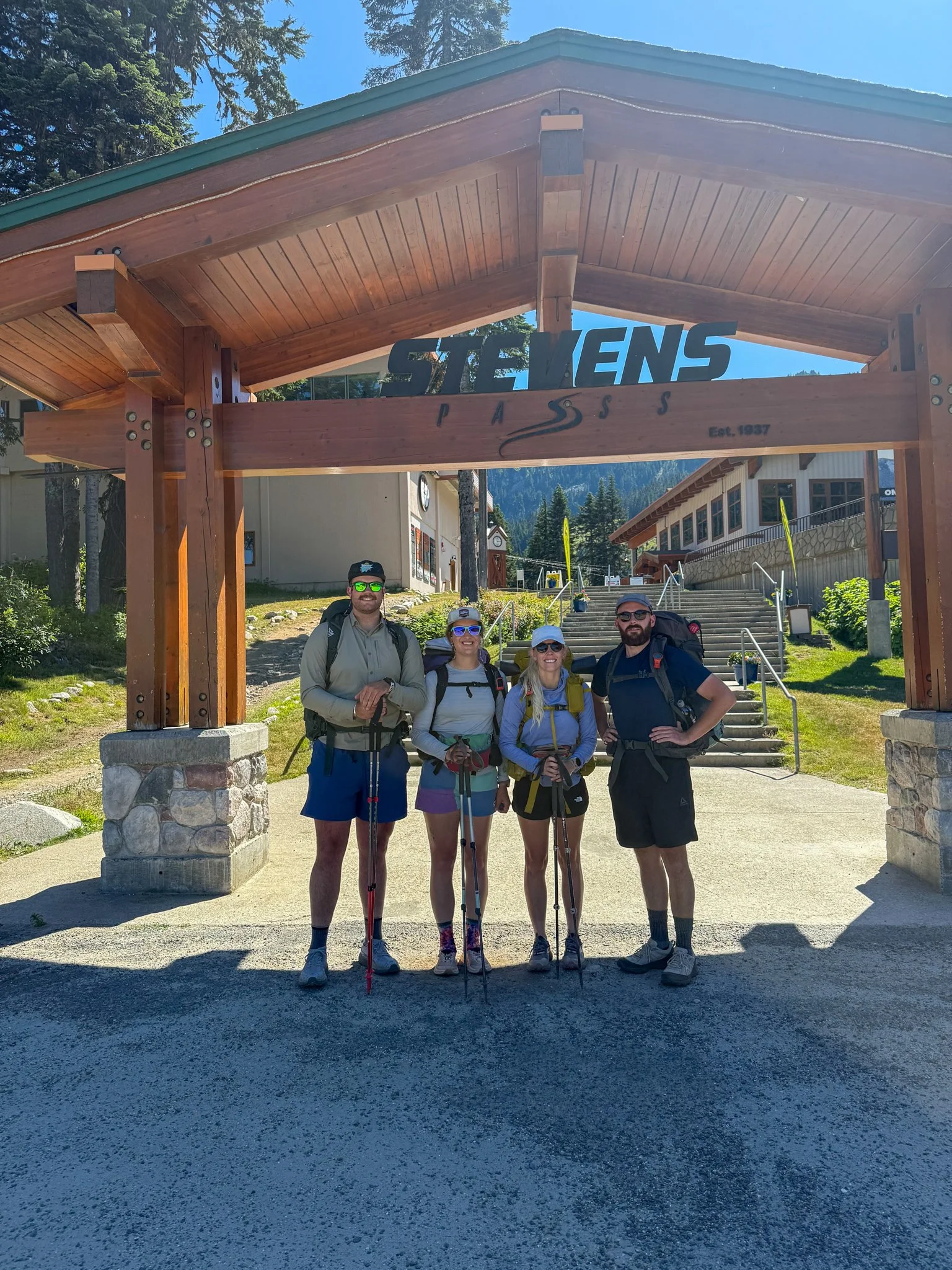
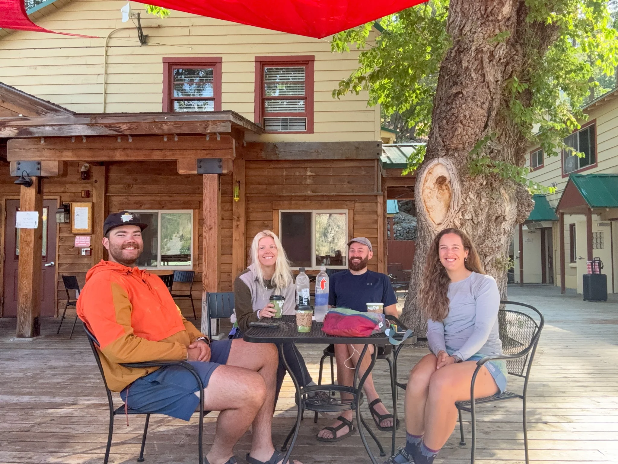
After dinner, Bags, myself, George, and Waterboy (Bags’ partner!) got ourselves packed and ready for the 220 miles ahead. We created resupply boxes to be sent ahead to our resupply point of Stehekin, Washington which we would arrive at in six days. This was Waterboy’s first major backpacking trip and wow what a commitment it was. He was the MVP of this section, hands down.
*I will note that after the Appalachian Trail, I seriously considered if I liked backpacking, hiking, or camping… at all. I had learned to love these activities while living in Colorado and hiking in the west (Rockies and further west). While on the AT, I learned that east coast hiking is not for me.
Luckily, my two weeks back on the PCT restored my interest in outdoor recreation.
PCT OR & WA Section K Summary
Statistics:
Days: 8
Full hiking days: 6
Zeroes: 0
Neroes: 2
Total Trail Miles Covered: 119.2
Total Elevation Gain: 25,515 ft
Total Elevation Loss: 26,734 ft
Highlights:
Reuniting with Bags, one of my dearest friends from the PCT, to finish up this section - from exactly where we left off on our thru hike in 2024!
Also reuniting with other PCT friends, Links and Wavy, at Bags’ home the night beforehand.
Bringing along two other wonderful friends to hike in the gorgeous state of Washington.
Completing a section that has been on my mind and list for years.
Stehekin. Need I say more?
Meeting other hikers from years past making up fire miles.
Lowlights:
Mosquitoes were more abundant than anticipated.
Another small wildfire broke out in the area. A sincere reminder of what kept us from this section last year and the impact that has on the local community.
PCT OR & WA Section K Detailed Version
Day 1: Mile 2467.3 - 2477.1
Trail Daily Miles: 9.8
Elevation Gain: 1734 ft
Elevation Loss: 1663 ft
Weather: Sun, Warm
Overall Day Sentiment: To be back on the PCT is to be in love
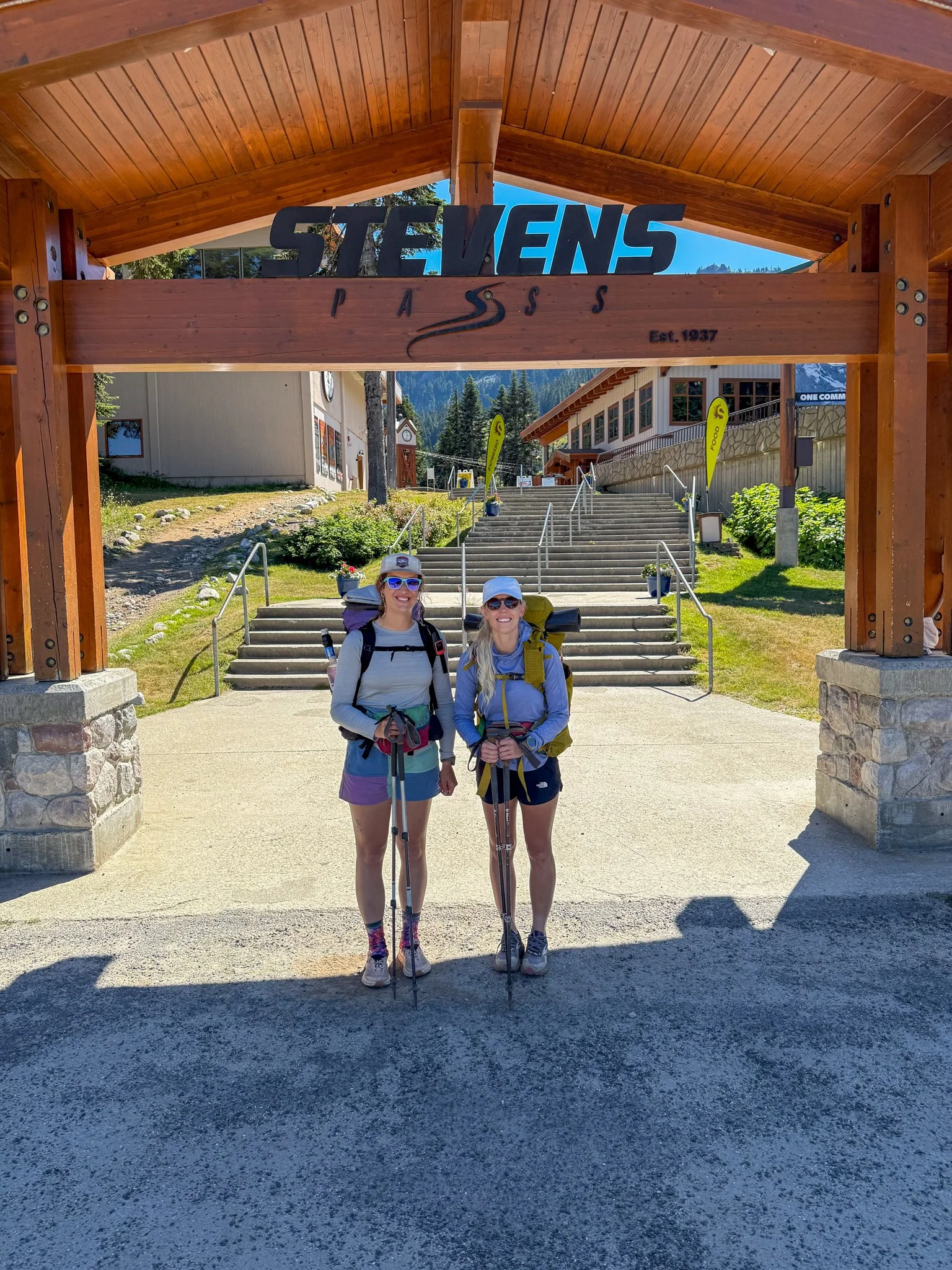
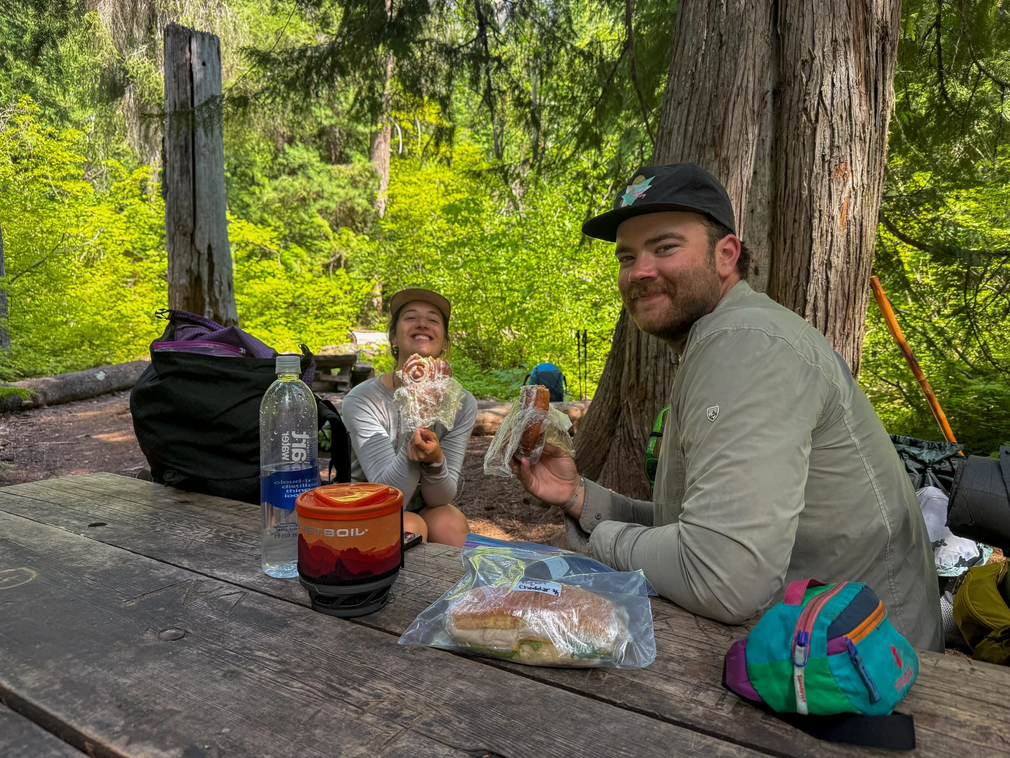
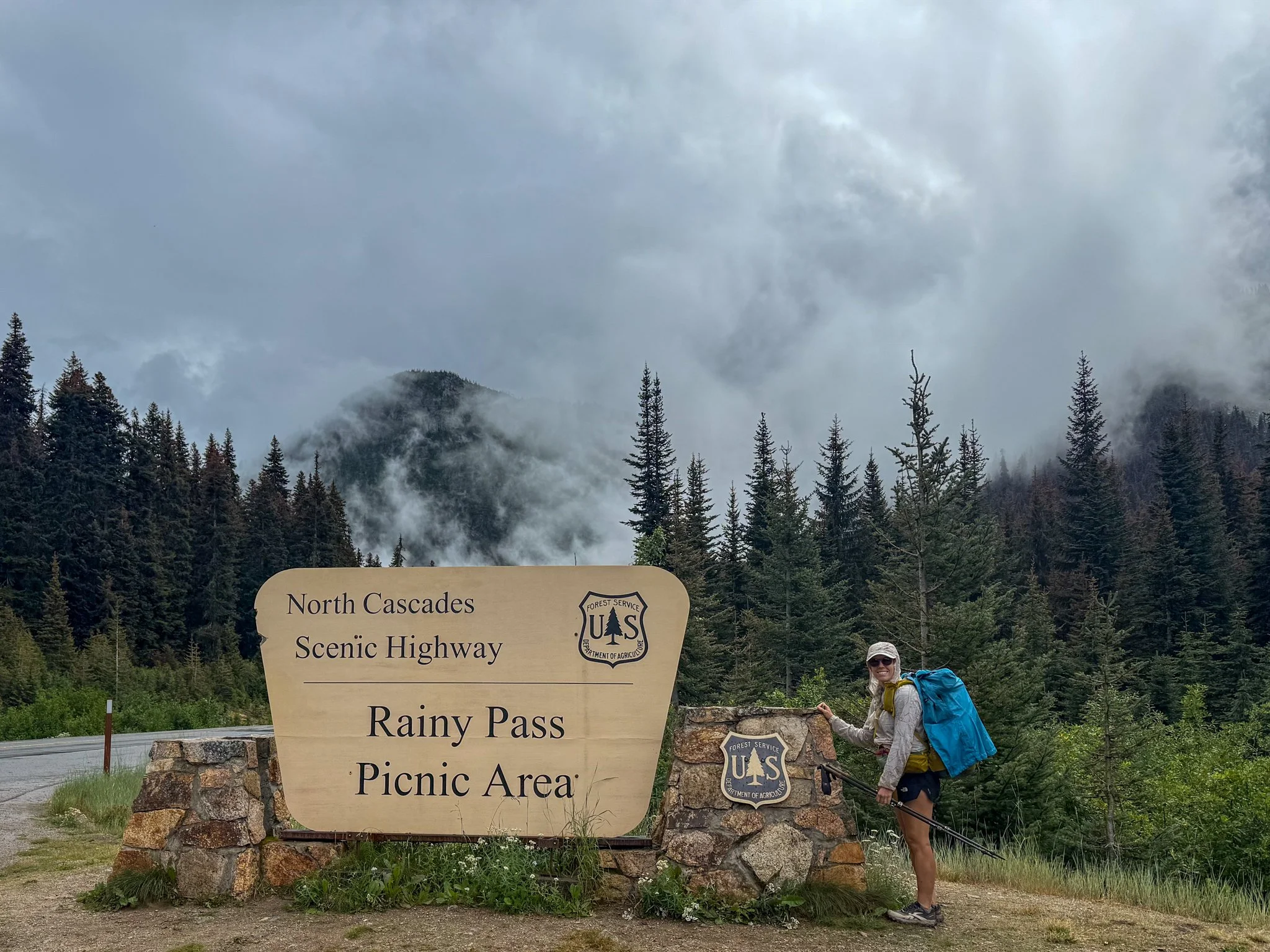
After a late night of getting packed and set up for two long stretches we finally hit the road. The drive from Bags’ is residence to Steven’s Pass was around five hours. Along the way we need to stop at a post office to send our resupply boxes to our midway resupply point of Stehekin. A quick pause in Castle Rock, Washington for our boxes, a last minute swerve to REI for remaining items, and a healthy hiker portioned lunch of Mexican food, we finally arrived.
Steven’s Pass must have dealt with thru-hikers doing a similar thing to what we were doing by filling in fire miles and using this area as the jumping off point. They allowed us to park for free for the full two weeks. The logistics of how to get back there were not a current thought - that was a later problem.
It was a surreal feeling to be back at Steven’s Pass with Bags just under a year later; to get back on the trail that transformed my life. Simultaneously. it felt like no time had passed and that it had been longer than a year. I’m so thankful that I was able to be in that place with those people at that moment.
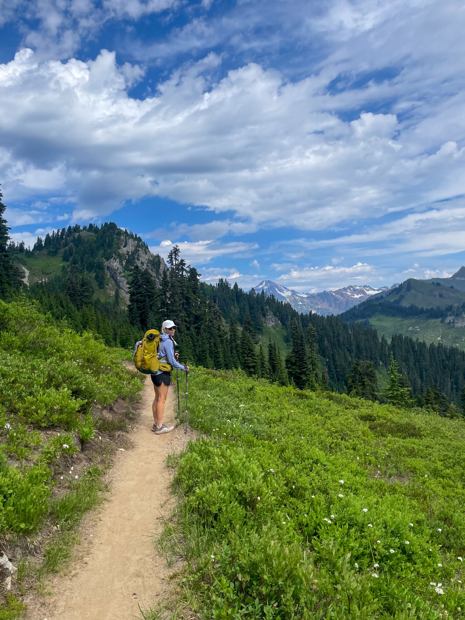
After crossing the highway heading north towards Canada, the climbing began quite readily. We were planning to go just under 10 miles to set us up for the amount of resupply days that we had planned for. Unfortunately, it was already around 3:30pm so we had to get moving at a quicker pace than we had hoped to beat the sunset.
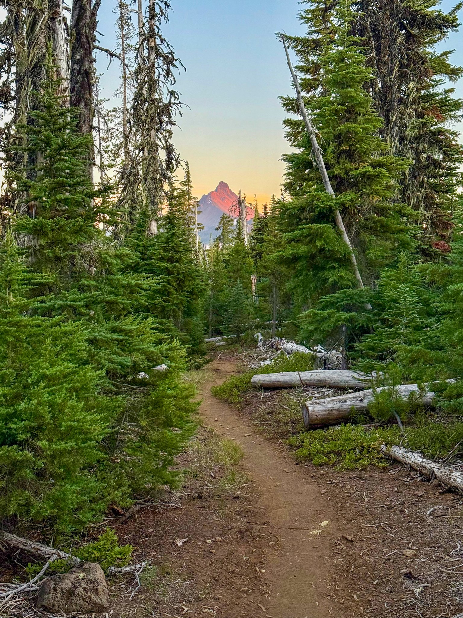
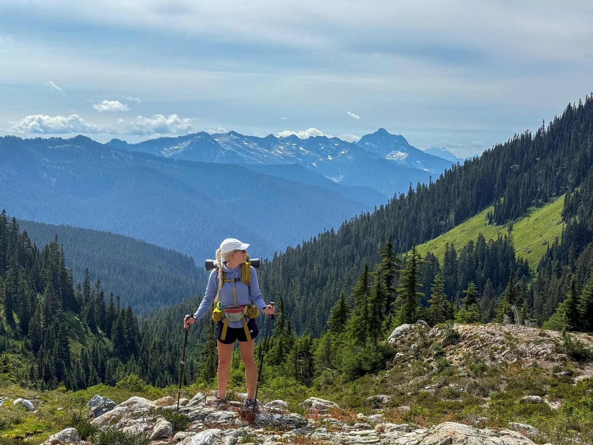
The jagged peaks of the North Cascade Mountains felt like coming home. Although this section was known for its climbing, the climbs always felt worth it. The initial climb out of Steven’s Pass began to offer beautiful views straight away. I was quickly reminded how relatively gentle the PCT climbs were as compared to my recent memories of the Appalachian Trail.
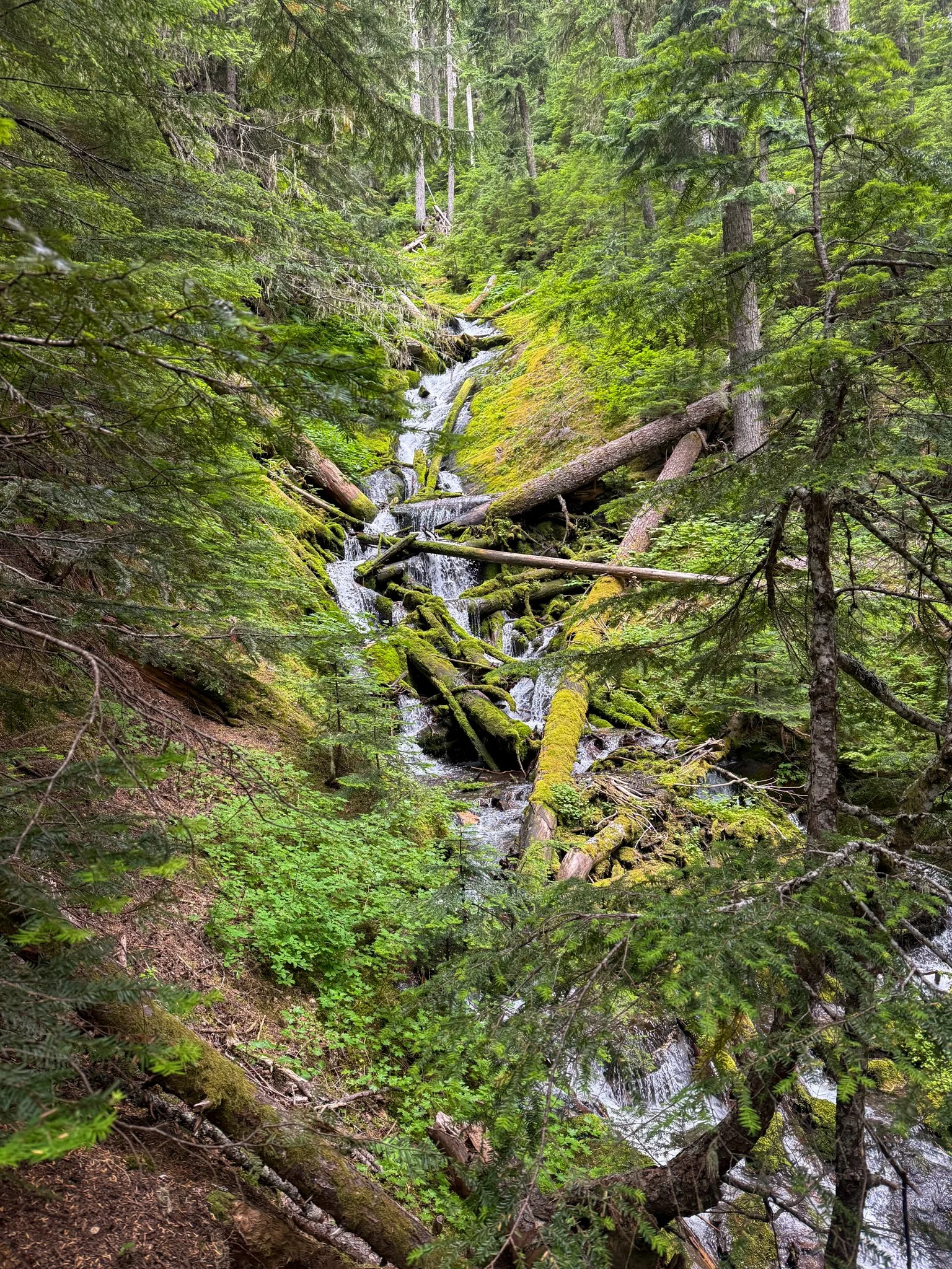
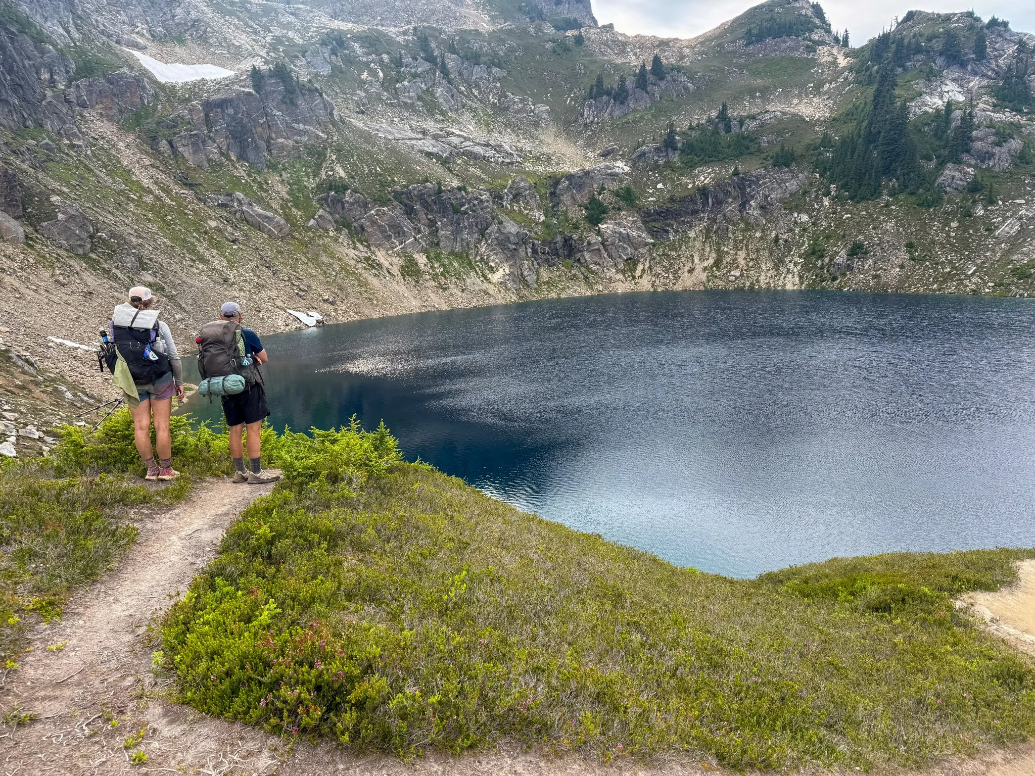
There were spectacular views from start to finish this day. The distinct peaks, lush vegetation on either side of the trail, the wild berries that were starting to be in their prime, and delicious looking Alpine lakes. The trail will passed Lake Valhalla and it looked absolutely delectable, but the trail was on a ridgeline around it so it was inaccessible.
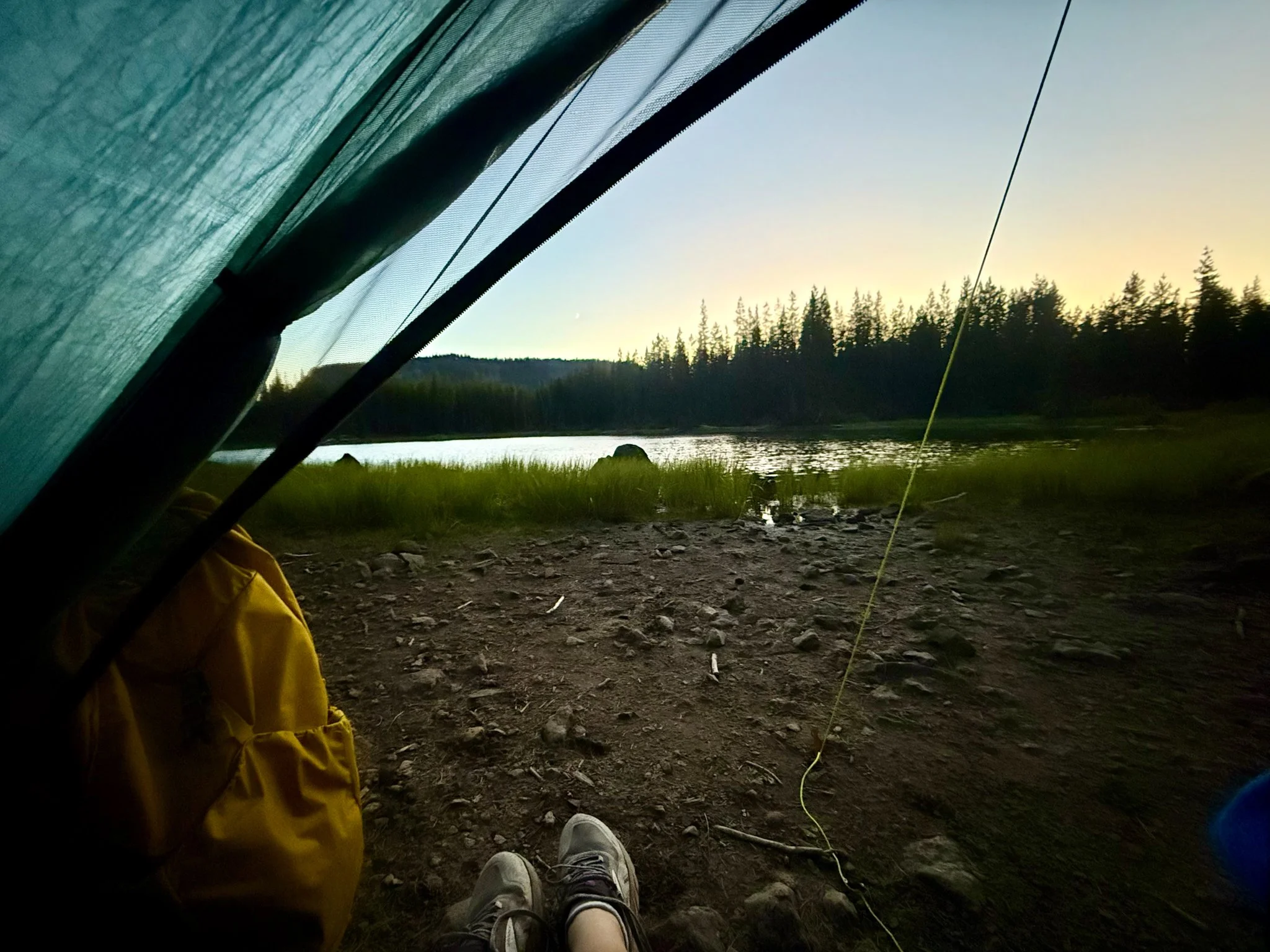
The day flew by quicker than I had expected and suddenly George and I reached our camping spot for the night at Lake Janus. Bags and Waterboy were not too far behind us but were pleased with the site we found. There were several hikers camped here as it was a great water source and had a lot of camping available. We found a spot to fit all of our tents and began to settle in.
Lake Janus was peaceful and stunning. Setting up camp, making dinner, and changing into sleeping clothes for the night felt very familiar. After dinner, we all went into the largest tent of our group to hide from bugs that had made their appearance around sunset. We giggled a lot and the whole day felt like an embrace I had been missing.
Day 2: Mile 2477.1 - 2492.5
Trail Daily Miles: 15.4
Elevation Gain: 3723 ft
Elevation Loss: 3664 ft
Weather: Sun, Hot
Overall Day Sentiment: Pristine alpine lakes are meant for midday swims
Late start at Lake Janus because of lower mileage, goal of the section was to enjoy it, climb up to grizzly peak was steep for PCT, snack time at the top could not be enjoyed because of the mosquitoes, had lunch with whole group at Pear Lake, swam off sweat - hot in the direct sun on the climbs, short day to the camp, near a small stream, was able to rinse off feet, a few other campers around
The goal of this section hike was to enjoy it. Just having come off the Appalachian Trail, George and I had strong trail legs. Bags and Waterboy got going a bit before both George and I did to give ample time for the amount of crimes that we had today. I got I left camp later than I typically would have but with a shorter mileage day I knew that I had ample time to not only arrive at the campsite for the night, but to also enjoy myself.
The climb from Lake Janice to grizzly Peak was a bit steeper than I had planned for. But with any time on that spent on the PCT 🌵, the trail was graded and clear. Once at the top of grizzly Peak, both George and I had stopped for a snack. But the fine insects, both mosquitoes and flies, proved too much to provide a relaxing snack spot. We both decided to move along and continue on.
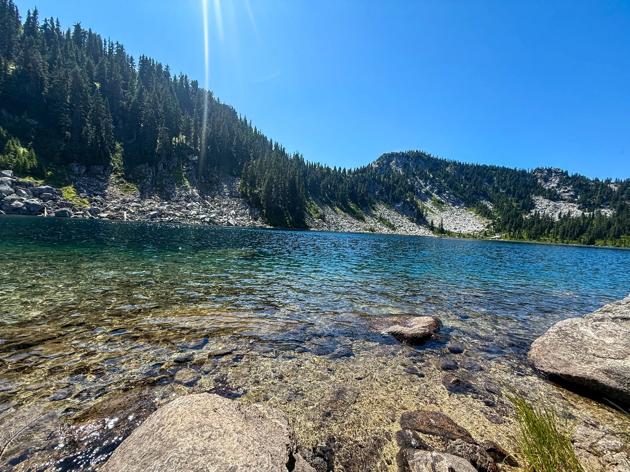
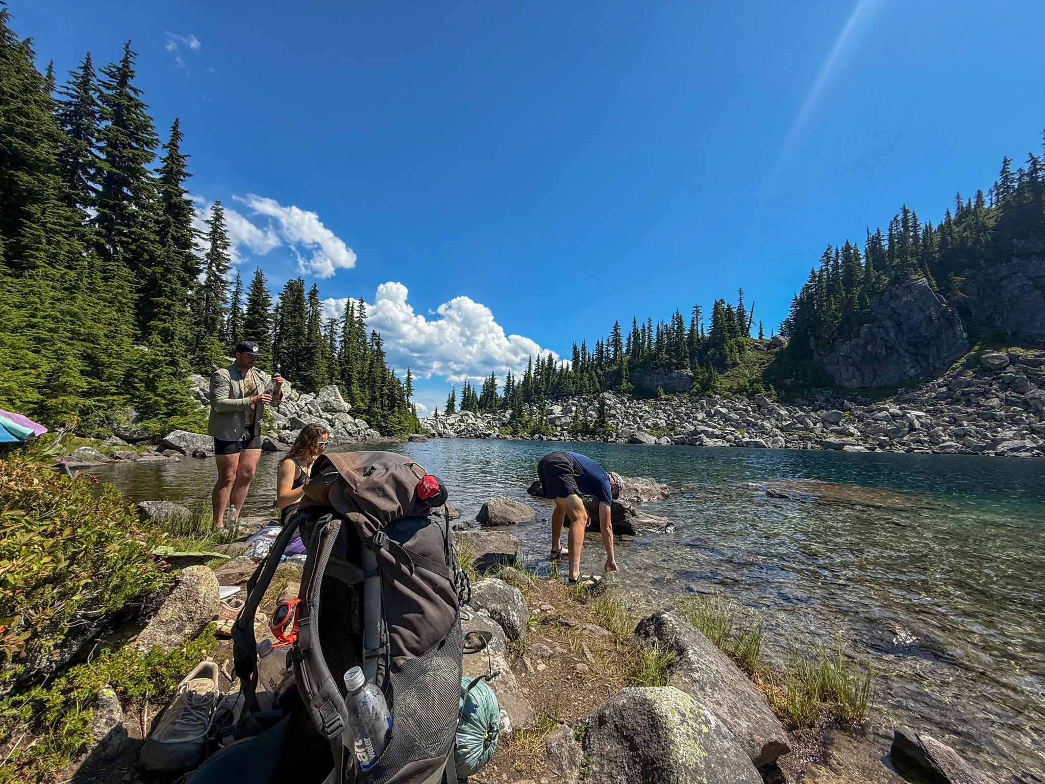
There was a beautiful Alpine Lake coming up right around when I had planned to stop for lunch based on mileage for the day. Bags and Waterboy were already there when George and I arrived. We all took a dip in the lake, which was wonderful because the final climb to this area was completely exposed in the sun and was hotter than I was expecting. After a quick cool down in the water, we all had lunch in marble at the beautiful weather.
The rest of the day was short to get to camp. We all camped near a stream that provided both a great water source, a place to cool off and rinse off my feet, and provided great white noise to fall asleep too. Before dinner, all four of us fell silent in our respective tense for at least an hour. I woke up very discombobulated after an impromptu nap, and discovered that all four of us had done the exact same thing. We all ate dinner later than the night before, and also immediately fell asleep again.
Despite the short mileage day time in the sun, being out of a backpacking routine, and being active outdoors, all day does take it out of you
Day 3: Mile 2492.5 - 2510
Trail Daily Miles: 17.5
Elevation Gain: 4255 ft
Elevation Loss: 3544 ft
Weather: Sun, Warm
Overall Day Sentiment: Glacier Peak Wilderness is already stunning
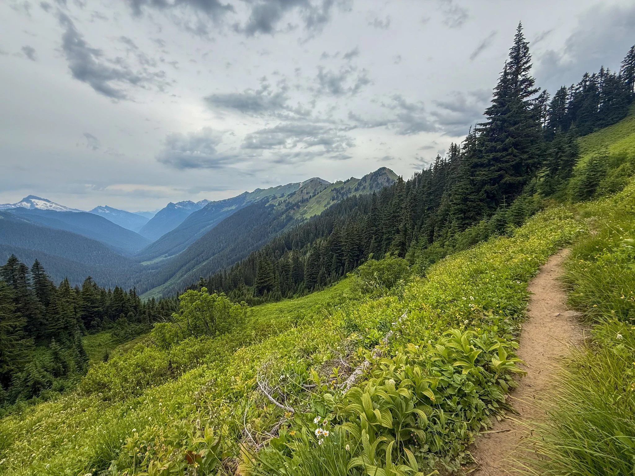
A lot of climbing for only 17 miles - feeling like the AT, ran into guide for hiking groups around the Cady Ridge junction, learned a lot about bringing in groups/size limits/ideal scenario for later in life, passed 2500 miles!, Entered Galcier Peak Wilderness, been hearing a lot about this section due to the blowdowns, wildfires have closed this specific section for several years in a row, next several days would be circumnavigating around Glacier Peak, camped alongside river, hard to access water but several other folks were in the more convenient spots
My day got started earlier than the day before because our mileage was a bit longer, and the elevation gain was also increased. And although some of the climbs felt reminiscent of the Appalachian Trail overall I was rewarded with open views as a prize for getting through those climbs.
At one point, we all ran into a hiking guide along the trail. We had been seen several groups of older hikers who did not have backpacks on and were confused at the logistics of how they arrived so deep in the backcountry. The hiking guide informed us that they took a different junction in. cat Ridge Junction and that they had a bass camp that they would go to do day hikes to and from. She also mentioned that a lot of the supplies was brought in with Mues. I could see my future in this type of hiking when I am 60+.
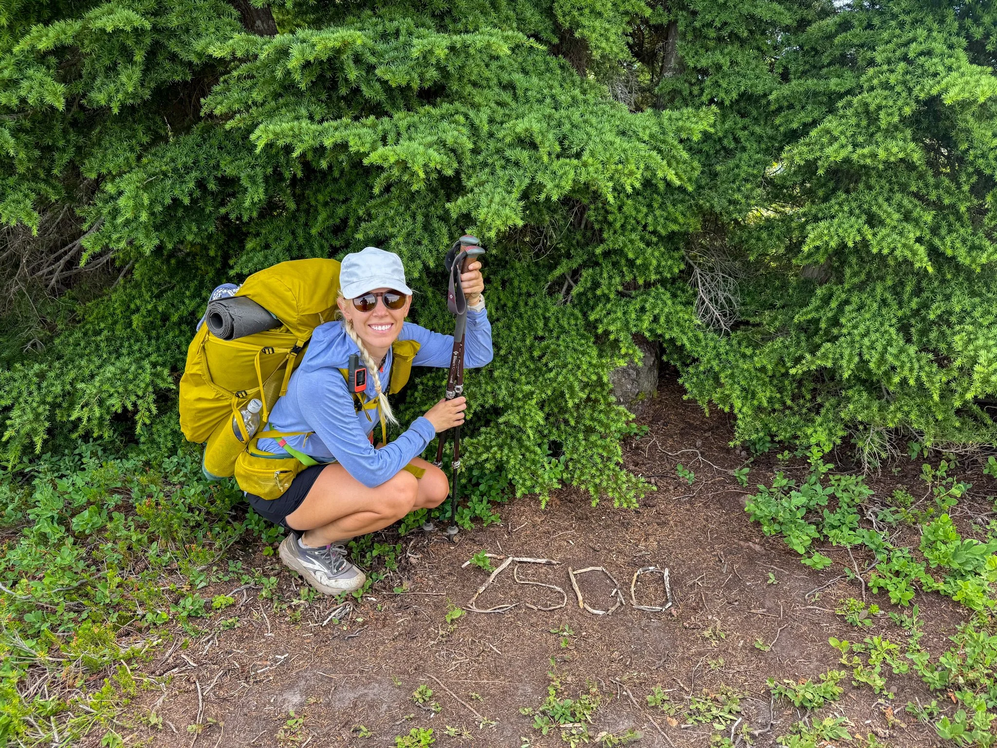
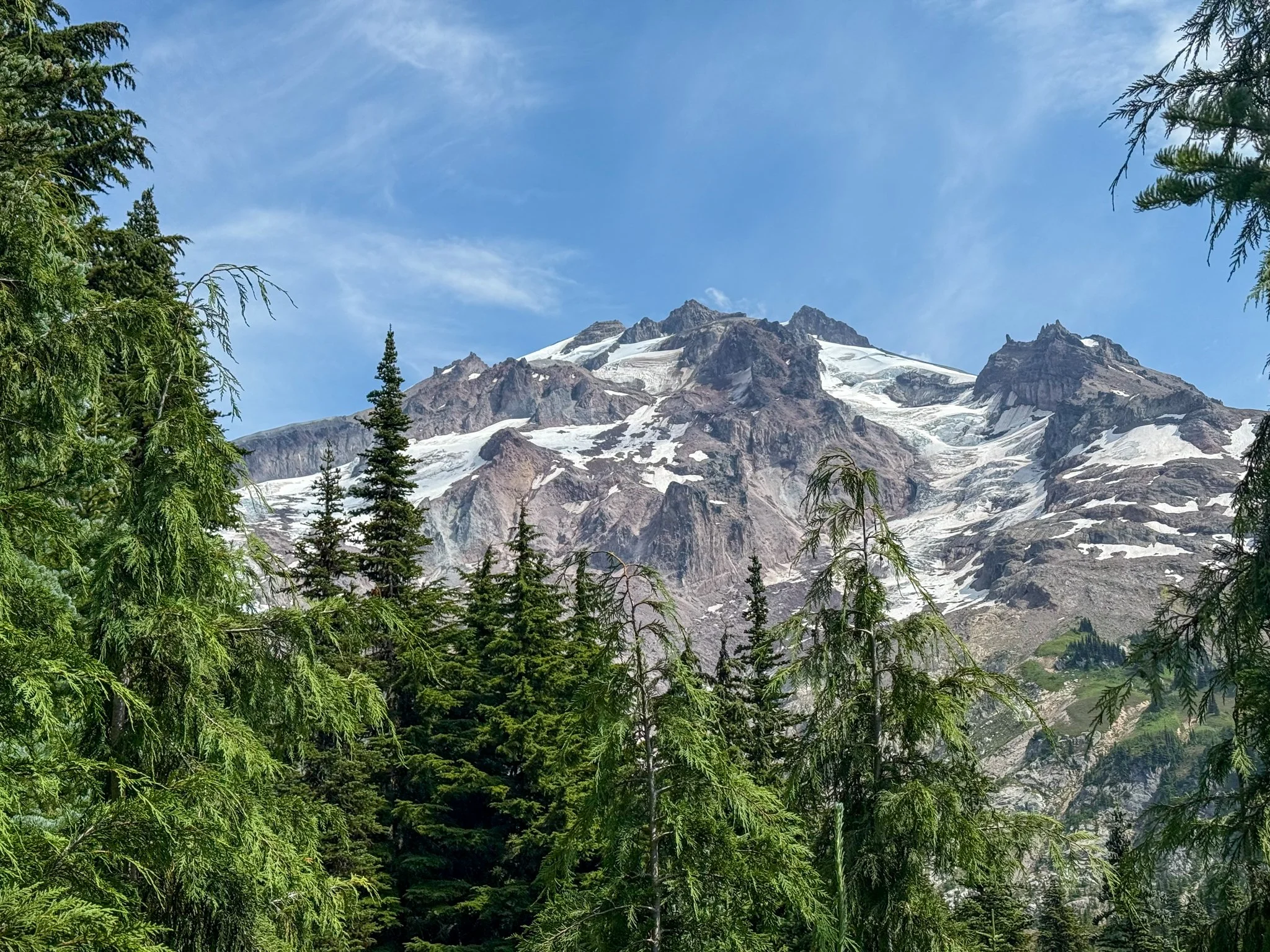
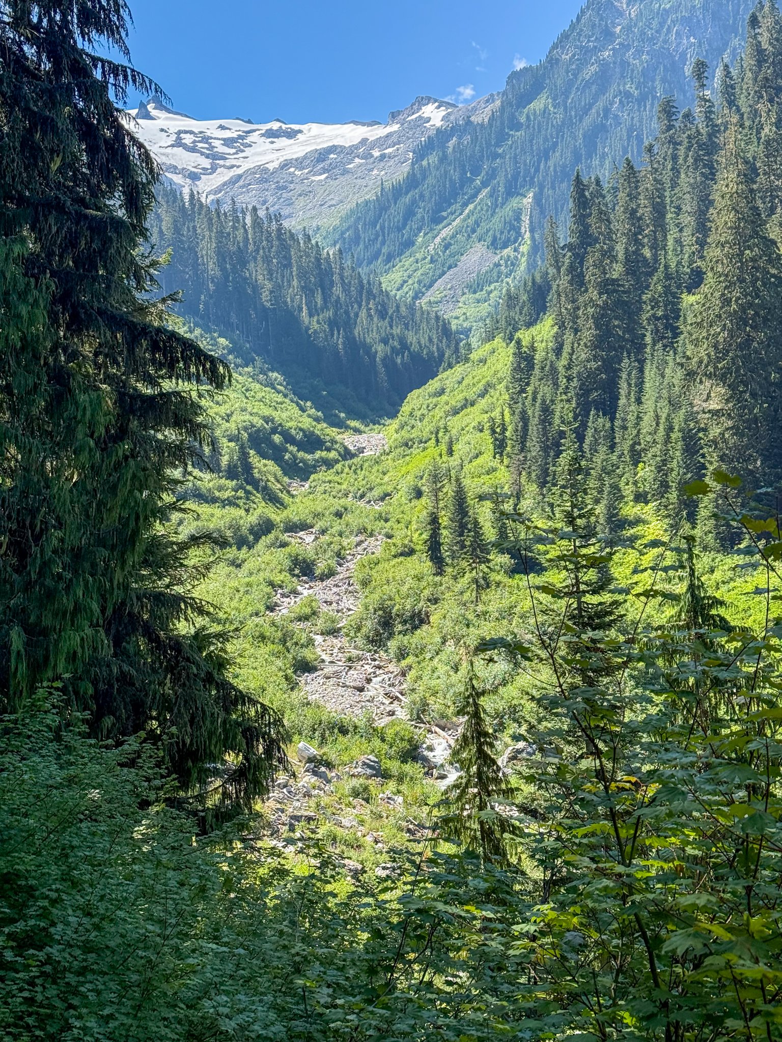
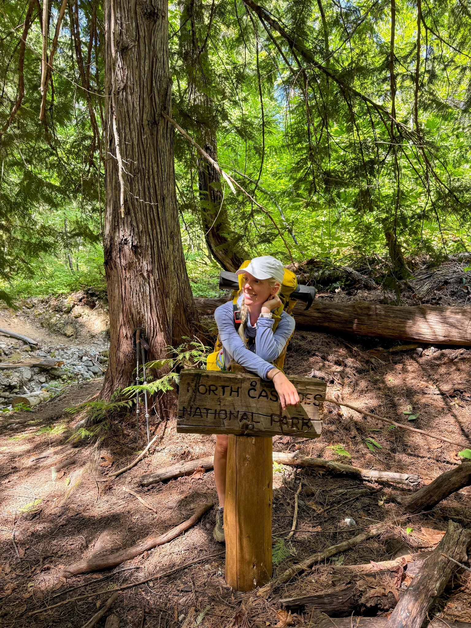
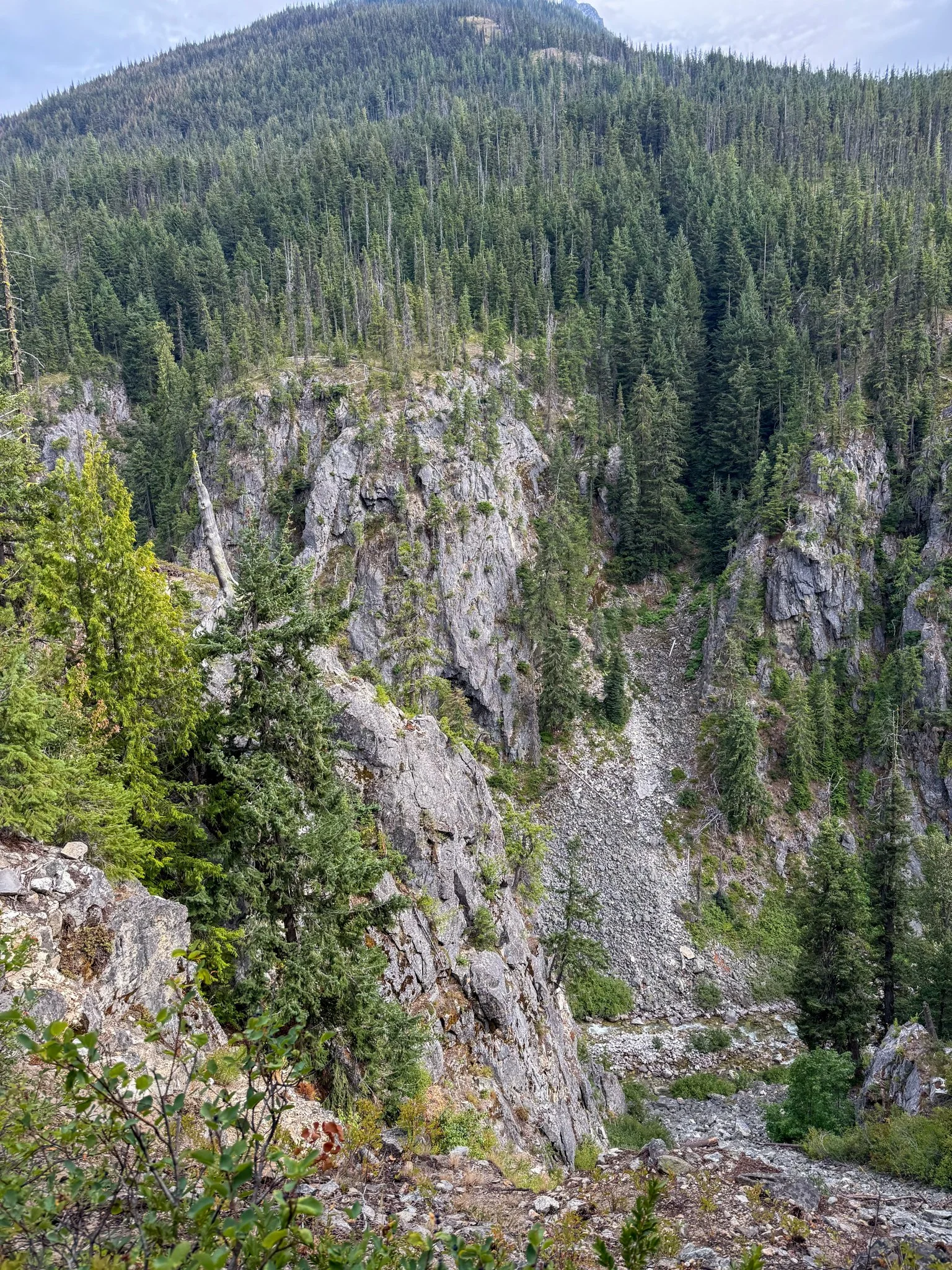
What felt like soon into the day I passed a huge milestone, the 2500 mile mark on the trail. And I do consider my 2024 through hike as a complete completed through hike. I know that I missed several hundred miles along the way due to closures. Running into this previously closed sections large milestone of 2500 miles was exciting to see. It was also near the boundary line for glacier Peak wilderness area. This area has been inundated with the forces of nature in recent years. Whether it be severe storms that cause huge blow downs, a lot of snow that cause small avalanches, or the most prevalent has been wildfires. This section as stated above has been one of the most closed sections of the entire Pacific crest Trail in recent years because of these things. It was a section that I had been looking forward to previously because it is known for its views that I didn’t know if I would ever be able to hike in. And now that I was here, I was excited to see what this wilderness area served up.
For the next several days, our group would be essentially circumnavigating glacier Peak itself. As its name suggests, this peak is inundated with different glaciers. This section also had a bit of fear mongering associated with it regarding what the trail conditions were like, and how many actual blowdown’s were across the trail. So though our group was excited to see the beauty of this region, there was a bit of trepidation for what obstacles may lay ahead.
George and I scooted along quicker to get a campsite for our group. This area had a bit of a campsite drought for spots that could house more than one tent. Eventually, we found a spot large enough for all of our tents near a river again, similar to the night prior. This site, though close to the water the water was a bit inaccessible and required a decent along a steep embankment. We got one load of water that would get us through the night and then within a half a mile down trail. The trail would actually cross this river so we could fill up for the day in the morning. None of us could be motivated to go an extra mile out of our way down an incline, and therefore then back up to where our tents were located.
Another beautiful day on the trail followed by another relaxed, beautiful evening with lovely people.
Day 4: Mile 2510 - 2524.6
Trail Daily Miles: 14.6
Elevation Gain: 3892 ft
Elevation Loss: 3758 ft
Weather: Sun, Hot
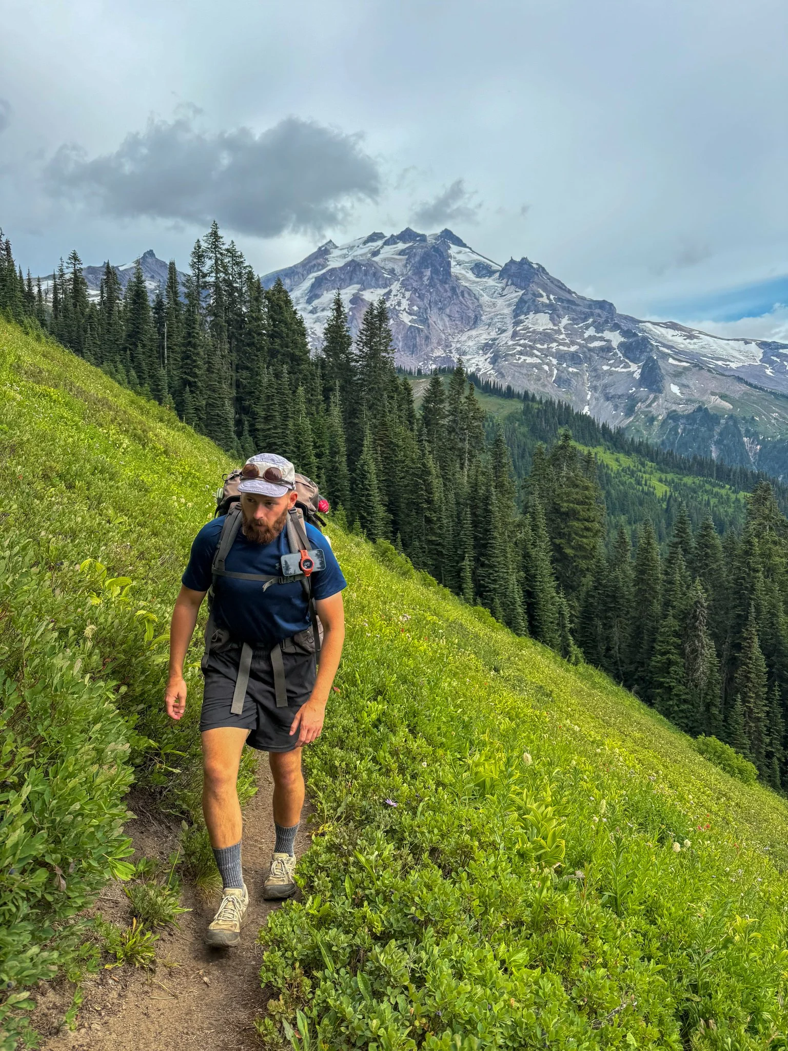
Overall Day Sentiment: Glacier Peak was stunning!
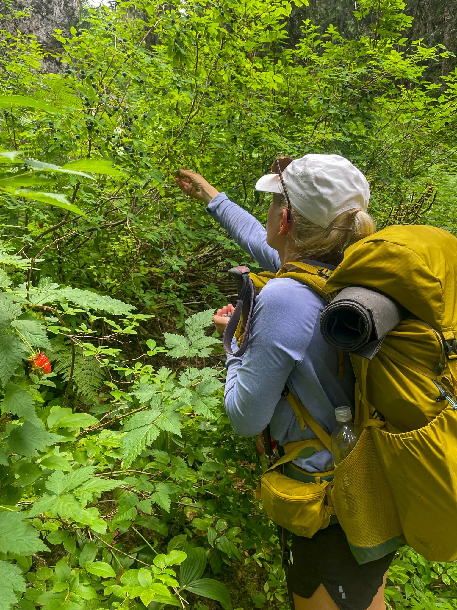
This was another lower mileage day, but did have a decent amount of incline for the short mileage. The day began completing the descent from the day before towards two large creeks that thankfully had bridges across them. In these low, lush valleys and canyons the berries were a plenty. Not only in volume, but also in variety. On this day, I had huckleberries, raspberries, Marion berries, blackberries, and blueberries. The truncated mileage day did not motivate me enough to walk past these berries – I emulated the year before and ate perhaps too many.
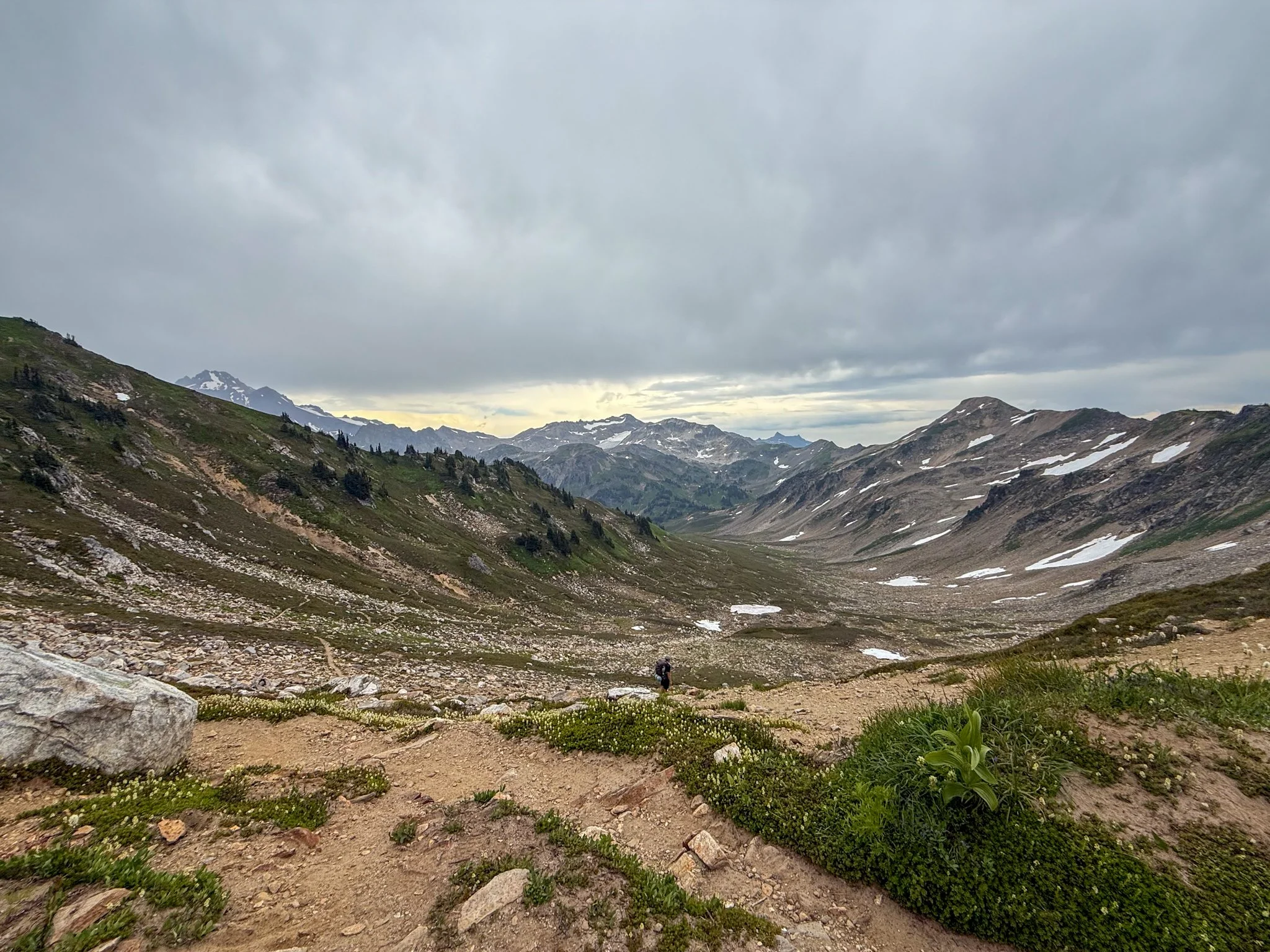
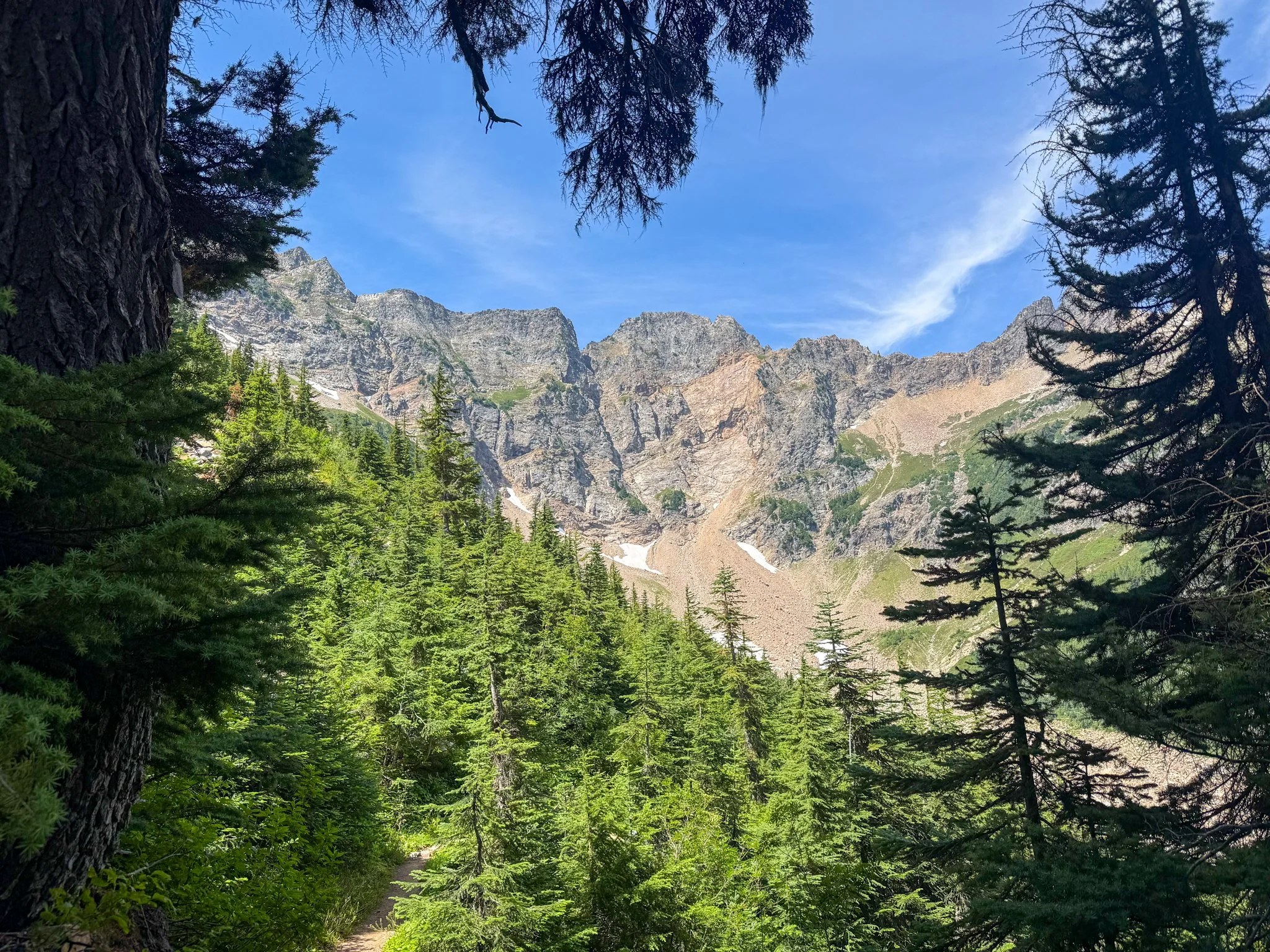
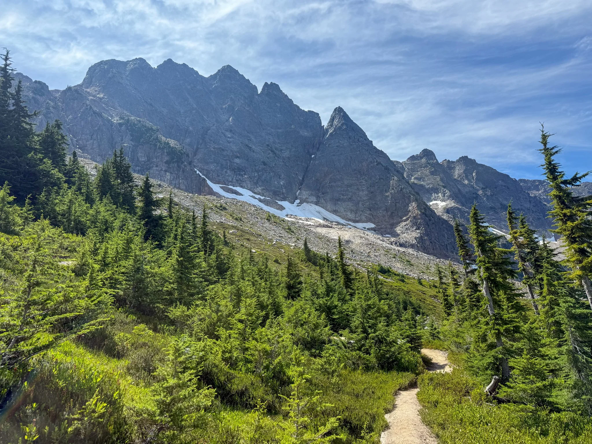
I was luckily able to break up the most sincere climb of the day with a lunch break by a river. And although this day did have a lot of climbing, once out of the dense woods, I could once again see Glacier Peak closer. Because of this I was able to take account of all of the varied glaciers at different altitudes. Every 15 minutes the view of the mountain changed because it would make its own weather. One moment it was clear and sunny at this 10,000+ foot peak (read: volcano) and an hour later it had made its own set of clouds from the quickly evaporating snow and ice that the peak held.
The remaining large climb of the day was towards Fire Creek pass and it was one of the steepest consistent climbs of this entire section. It was exposed and hot, but planned our camping not too far on the other side of this so the day was wrapping up.
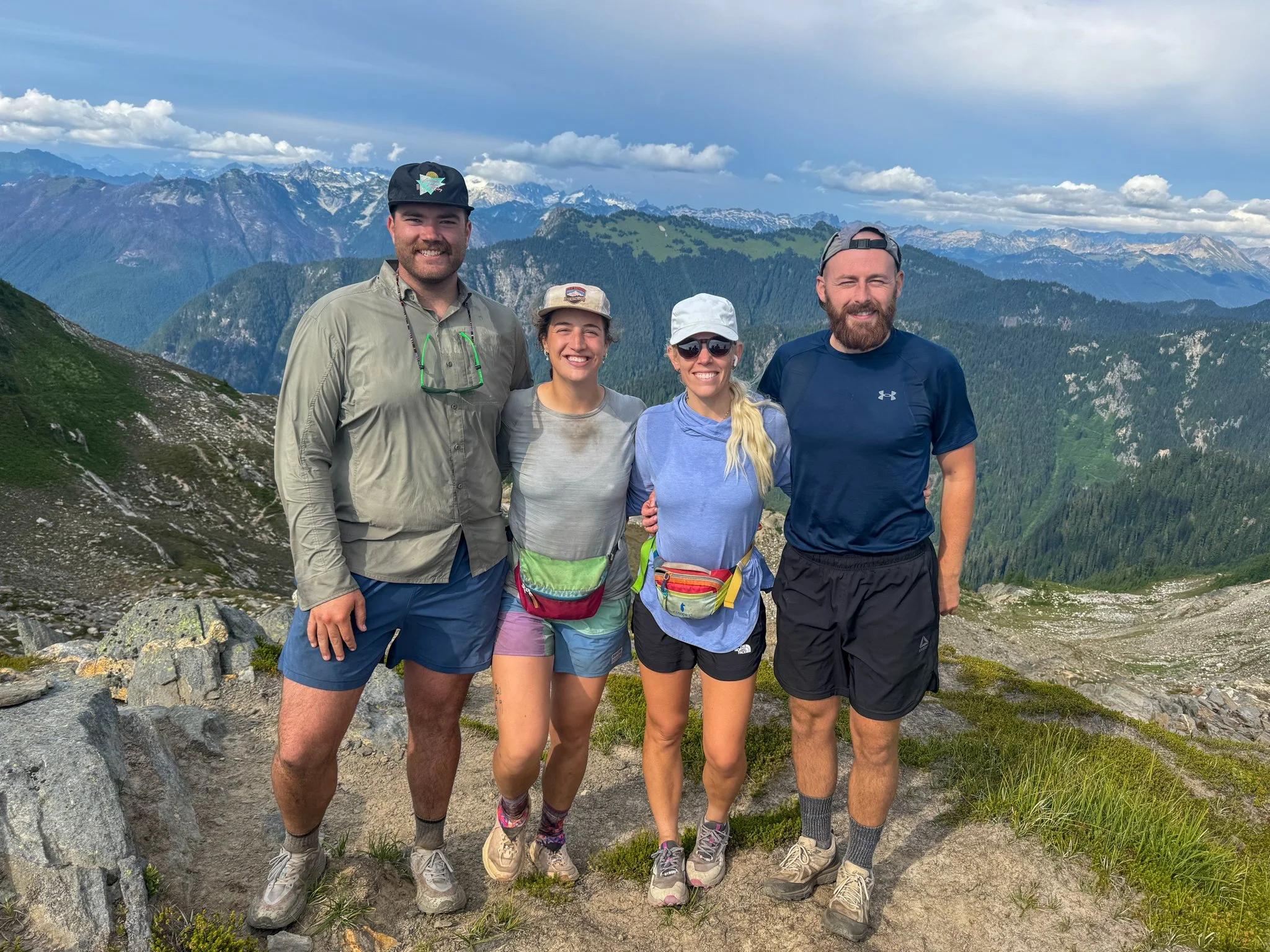
Once at the top, all four of us made it and celebrated with expansive views. We ran into another group of four older gentlemen, who were North Cascade Professionals. They had done and peak bagged many of the spots we were looking around at. I’m thankful they were up there not only for the camaraderie and stories, but they were able to grab a picture of our entire group though sweaty as we may be.
We started our descent and got distracted by a beautiful lake that turned into some quick stone skimming on. That’s where we had originally thought we would camp, but there just wasn’t enough open spots for our amount of tents. We continued on not much further hiking in a group of four and quickly made it halfway down to another stream in which they were open fields.
There were a few other groups hiked in this area too; a mix of section hikers and former thru-hikers filling in fire miles. Despite an active day, I struggled to sleep.
Day 5: Mile 2524.6 - 2543.8
Trail Daily Miles: 19.2
Elevation Gain: 2974 ft
Elevation Loss: 5843 ft
Weather: Sun, Warm
Overall Day Sentiment: Blowdowns are nature’s jungle gym
We embarked on our longest mileage day yet because there was a limited amount of ascent as compared to today as prior. Of which, the majority of the days ascent was all housed within one climb.
The remaining descent towards Milk Creek was rumored to be one of the areas with the worst blowdowns of the entire section. And while we did stumble upon several blow downs, this was absolutely nothing compared to what Bags and I had encountered in Northern California. On one specific day, Bags and I originally started out counting how many blowdowns there were on the trail and we stopped when we got into the several hundreds. This section was nowhere near as bad predicted as there had been a decent amount of trail crew work. I do note that some of these blow downs were worse than the Northern California section as these were huge tree systems rather than a singular tree. It turned into a nature jungle gym at some point.
At one point, George and I missed a turn and got cliffed out with soft sand and sediment to work with. This brought us back to a month prior when we were in the White Mountains in New Hampshire on the Appalachian Trail intentionally getting cliffed out by those trail designers. Once we found the simple turn that we originally missed,the trail became a lot easier to follow.
It was a relatively steep, hot, and humid climb out of the Milk Creek area. This was one of those climbs that you just need to focus in and chug along at a consistent pace. Going quickly and then stopping is going to take much longer than just going a moderate but steady pace. A real life tortoise in the hare, if you will. I turned on some podcasts and the hours seemingly flew by.
At the top of the climb, we met up with Bags and Waterboy and had a wonderful lunch near a tiny stream with some of the most expansive views I have encountered. What’s great about the lack of humidity in the summer in this area is that we were all able to take off our hiking shirts and dried out from all of the sweat. And because we had a relatively smooth day, henceforth we took our time at lunch.
The remainder of the day we all descended towards another large creek that we were camping near. It took a little bit of thought for water source/water situation because this creek was known for being silty and not a viable drinking source. I carried a full water carry for just under 2 miles to camp. This proved worth it because the water source was as bad as I had feared.. The final mile of the day was through old growth forests with huge trees. It reminded me of some of the trees in the Kings Canyon/Sequoia area or a previous road trip of Redwoods National Park. They were not not as big as those trees, but the age of this forest was inspiring.
Once we were all set up at the expansive space near the creek, there was also a fire pit area and some makeshift log benches that became our communal dinner area. Of course we did not have a campfire, as this section again has all been plagued by wildfires, and I would not contribute to that. With the creek providing ambient sound, I fell asleep very quickly.
Day 6: Mile 2543.8 - 2565.6
Trail Daily Miles: 21.8
Elevation Gain: 5072 ft
Elevation Loss: 4550 ft
Weather: Sun, Hot, Buggy
Overall Day Sentiment: Wildfires are humbling
This was our most ambitious day thus far with quite a lot of elevation gain and mileage. I wanted to go this ambitious distance because it would make the following day into to Stehekin (our resupply point) much shorter. This meant I could enjoy more time of the day in to Stehekin/have more time for chores. Having just come off the Appalachian Trail, George and I were prepped for a 22 mile/5000 feet of gain day, which was an average day on the AT. Bags and Waterboy had a backup plan in case they were feeling tapped out, though we hoped that they would make it to where we had planned to camp.
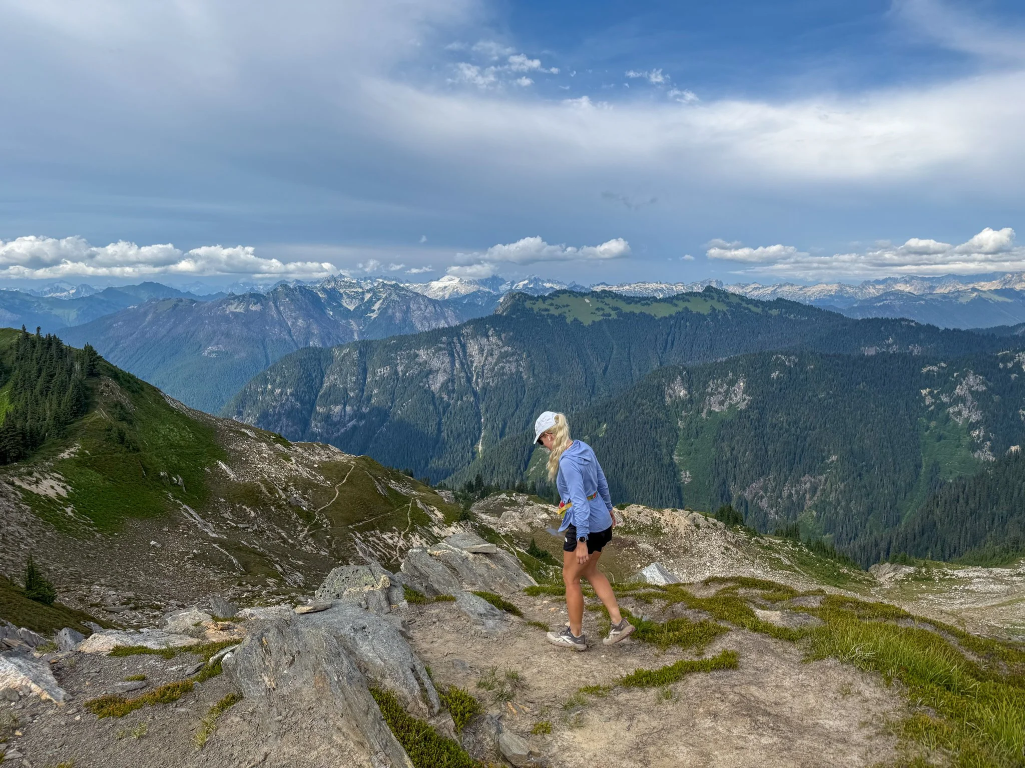
The climbs were constant throughout the day and this was once again one of those days where you just need to put your head down and go. The major pass of the day was Cloud Pass - misnomer because it was in fact completely sunny, quite exposed, and therefore quite hot. George and I eventually found an area past pika laden rock fields in the shade to have lunch. Though there were a few mosquitoes out at this time of day, black flies chose to fill that space. Within a 30 minute lunch, I smacked 62 black flies off of my body. I was not moving particularly fast to get these flies so I’m unsure why they were so lethargic. And I would not have minded so much with flying insects, but these ones were biting me and leaving huge welts with a bit of pain, making them potentially more annoying than mosquitoes.
The last few miles of the day were a bit complicated because the trail wound through a bit of an old burn zone. We were winding along a river, so at least there was plenty of water that we didn’t need to consider for a water source overnight. But in a burn scar you need to be mindful about dead trees around your tents. These sort of trees are called widowmakers and if there is a strong gust of wind in the night, these can fall over and land on tents. There have been some Pacific Crest Trail thru-hiker fatalities in Washington because of this.
Eventually, George and I found a spot that could house all of our tents with what looked like safe trees around us. The nearby river meant I was able to take a full dip in in one of the side eddies. Though this was cold, it had been a very hot and sweaty day so this felt divine. While sitting in the river, I began to hear a helicopter. I eventually saw that it was a medical helicopter, but was carrying something that looked much larger than a person. Turns out it was a medical helicopter that was carrying a load of water because a small wildfire had broken out in the area. I had been smelling smoke, but I had assumed it was because we were walking through a burn scar, therefore kicking up soot and burnt bits. I crossed my fingers that this was not going to get out of control because there were many hikers in this section that would be hard to evacuate and the area had already been devastated by wildfires so much in the past few years.
Eventually, George and I are tucked into our tents and we hear footsteps approaching and Bags and Waterboy appeared! As a reminder, this was Waterboy‘s first major backpacking trip and this was a long one to commit to. So for him to do a such a big day with elevation gain, it was something to be extremely proud of.
All of us talked of Stehekin, showers, laundry, and more importantly, the bakery that is trail famous in the area. With less than 10 miles to where the shuttle picks up to bring you into town I did not have to get up very early, but my excitement kept me up later than I wanted.
Day 7: Mile 2565.6 - 2575.1
Trail Daily Miles: 9.5
Elevation Gain: 962 ft
Elevation Loss: 2276 ft
Weather: Sun, Warm
Overall Day Sentiment: A perfect town day.
It was a relatively short day into Stehekin and I could barely contain myself. I am well-versed in packing the exact correct amount of food that my body needs for each day on trail. But what I did not take into consideration, is that on the Appalachian Trail, I was arriving into a town roughly every three days. Therefore going out to eat at restaurants and giving my body a proper “refeed“. But six days in one resupply with no town foods to supplement? I was painfully hungry. Even after dinner, with the combination of a full dinner and snacks my stomach was just in pain. So I planned to rectify that today while in town.
I stumbled upon trail maintenance crews cleaning up the area from any blow downs, but truthfully, this day was nearly clear of blow downs. I ran into a group of teenagers that were backpacking heading southbound (the opposite direction of us) and they had emphasized how terrible some of the blowdowns coming up. I also referred to them information about the direction from which I was coming from and how although there were blowdowns, everything was manageable. And this is exemplifies why trail information is so subjective. I believe I stepped over seven trees in total, not climbing, but just stepping. And if they thought those steps were bad, they were going to have a very bad time getting to Steven’s Pass on some of the aforementioned jungle gym blow downs.
I arrived at North Cascades National Park High Bridge area, where the shuttle picks us up and found there were a lot of other people waiting. My whole group showed up and I could not be more proud everyone, but of Waterboy specifically. That was a tough section of about 110 miles and he was a vision of positivity pretty much the whole time, even though he was dealing with some trail ailments.
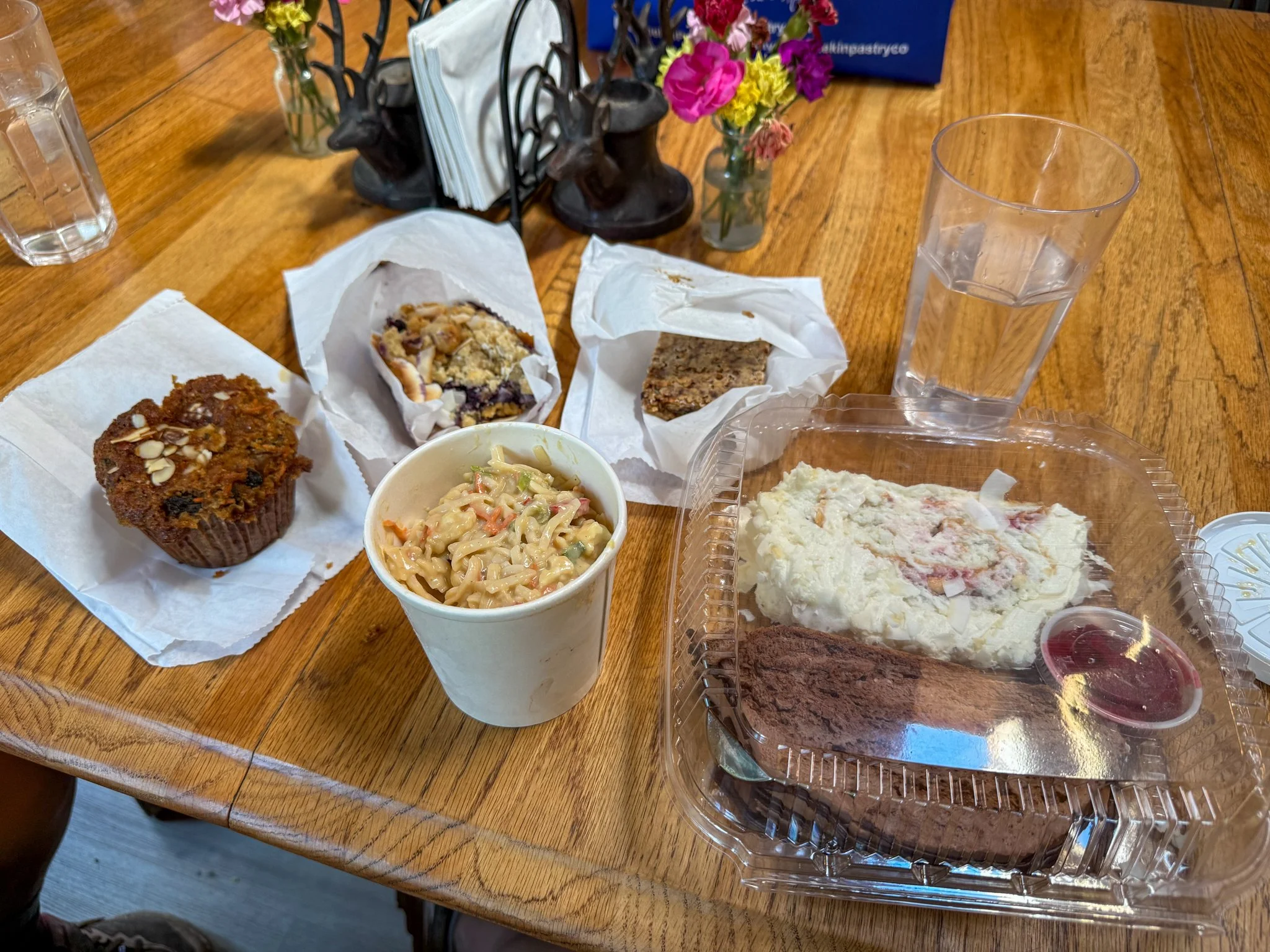
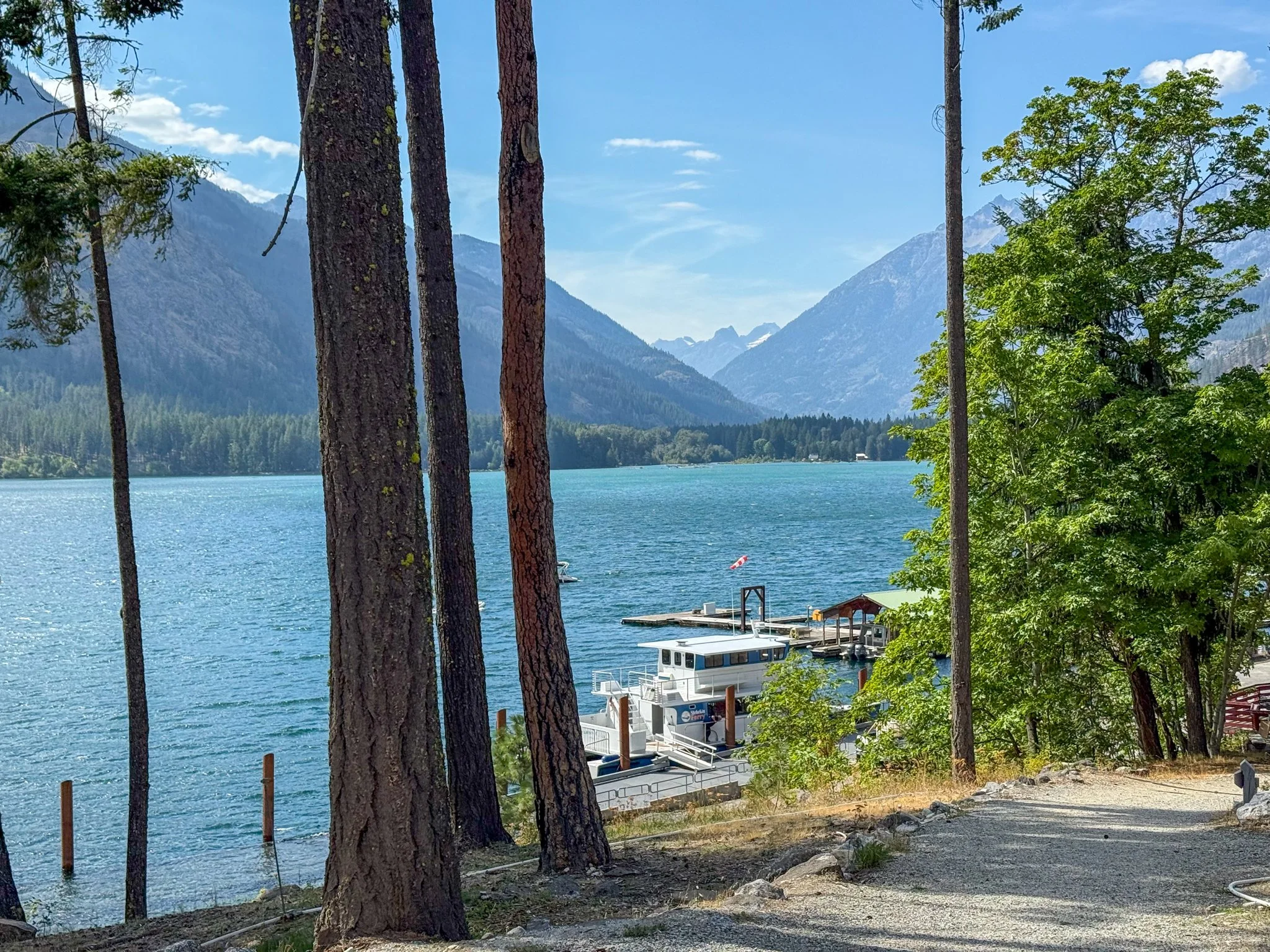
The Shuttle grabbed took us into town in a converted school bus and gave us essentially a tour of the miles in between the trail into the town of Stehekin. The shuttle stops at the bakery, which is outside of town for 10 to 20 minutes, depending on what the queue looks like. I quickly grabbed an inordinate amount of spoils as they had an amazing gluten-free section. Once in Stehekin proper, there is a camping area for hikers up a very steep climb, but still close enough in town that it works. All of us set up our tents in this area and then we headed back into town to grab brief resupply boxes from the post office partake in the public showers and public laundry. The shower felt phenomenal - even though the PCT is much less humid than the Appalachian Trail, a shower after six days and 110 miles of backpacking feels heavenly.
Dinner at the restaurant was sufficient and I continued to snack on my stick bakery goods throughout the evening. Though there is advertised wifi at a few spots, do not count on it. Rather think of it as a treat if it does work. Also, do not depend on the general store for a full resupply. Even though they had all the items a hiker could want - the prices were insane (Ex: Instant Mashed Potatoes: $5)
We all turned in relatively early because it just felt nice to be in clean clothes while freshly showered, just relaxing.
Day 8: Mile 2575.1 - 2586.4
Trail Daily Miles: 11.3
Elevation Gain: 2903 ft
Elevation Loss: 1436 ft
Weather: Sun, Warm
Overall Day Sentiment: Do I have to leave Stehekin?
My circadian rhythm had been reset and I woke up at a decently early hour - of course, very hungry. I got up and headed to the only restaurant in Stehekin. A large breakfast and a large coffee later, the four of us sat out on the deck taking in the beautiful view before we took the shuttle back to trail.
I very begrudgingly left to Stehekin, but was thankful that the shuttle stopped at the bakery once again in which I stocked up on even more items to bring back to trail.
We had planned for a shortish day of around 11 miles. Because we were in the North Cascades National Park, there were limited areas that allowed camping. The goal of this is to lessen the impact of backpackers, tents, etc., on vegetation. This 11 miles was a bit harder than I want to admit. We had all repacked our packs with another six days worth of food, which is always shocking after your pack slowly begins to get lighter over the course of a resupply. There was also a decent amount of elevation gain in these miles that was exposed to the sun and through canyons.
Eventually, we got to the specified camping area and it was packed with backpackers. There were just enough spots to fit our groups’ tents and we were already uncomfortably close to everyone else. Though everyone welcomed us with open arms, I would have to have guessed that there were at least a dozen other tents with at a minimum 20 people at this site. Luckily, we were the last group to arrive - otherwise I’m not sure anyone else would have fit.
There was a great water source there and I was armed with treats from the bakery. These groups did not go to sleep early as people were talking past hiker midnight (9:00pm). I did a lot of stretching in my tent this evening because my legs were feeling a bit fatigued and that proved to be helpful in days forthcoming.
On to Section L and the Canadian Border!