Pacific Crest Trail Hike: OR & WA Section L -Mile 2593 - 2653
Pacific Crest Trail Hike: OR & WA Section L - Mile 2593 - 2653
I’m so very thankful I was able to spend two weeks on the Pacific Crest Trail in 2025 to fill in some of the mileage missed due to wildfires from my 2024 thru-hike. In total, I completed 160 new PCT miles and enjoyed a victory lap of another 60.
The Appalachian Trail took joy out of hiking and outdoor recreation to me. I understand the value of putting in hard work for thru-hikes, but I don’t enjoy being miserable (sue me!). This really induced an existential crisis for me wondering if I liked backpacking, hiking, camping at all? These two weeks became a full palate cleanser for me and restored my faith in outdoor recreation.
PCT OR & WA Section L Summary
Statistics:
Days: 5
Full hiking days: 5
Zeroes: 0
Neros: 0
Total Trail Miles Covered: 100.8
Total Elevation Gain: 20,409 ft
Total Elevation Loss: 16,730 ft
Highlights:
Touching the Canadian border again! With Bags!
Completing Section L and 160 new PCT miles in total.
Mazama: store, brewery, and the Lion’s Den Hostel
Lowlights:
Rain, trail overgrowth, wind, sandblasting.
but hey, that is thru-hiking?
Leaving the Pacific Crest Trail :(
PCT OR & WA Section L Detailed Version
Day 9: Mile 2586.4 - 2604.3
Trail Daily Miles: 17.9
Elevation Gain: 4615 ft
Elevation Loss: 1488 ft
Weather: Rain, Mist, Storms
Overall Day Sentiment: On to Section L, that last one of the PCT!
The busy campsite within North Cascades National Park was full of people the night before therefore full of people who liked to get up at 5:30am in the morning. These folks decided to make full breakfasts, plan full days, and have full conversations mere feet away from my tent. Even though it was an average mileage and elevation gain day, I was not motivated to get out of my tent once the campsite calmed down around 6:30am. I decided for a lazy morning and fell back asleep for a few more hours and finally left camp at 9:00am.
I began to see many more groups of hikers in the area, including people who were not backpacking. Rainy pass is the northernmost highway crossing along the PCT, which makes it accessible to day and weekend hikers. I ran into a family backpacking with four children that had a bag of treats for long-distance hikers to give out trail magic. The oldest of the children had read hiking books recently and wanted to be a Trail Angel while she was on trail. I took a photo with them and accepted a rice crispy treat nearly the size of my head.
Just before Rainy Pass, George and I took a wrong turn while we were gabbing and it added nearly a mile to the day. We got to Rainy Pass, where we were greeted with a comically timed downpour. We quickly ate lunch and hid in a privy as it looked like some of the weather was going to blow over. Eventually, I emerged from the protection of a roof and we continued on. It ended up misting on and off for the rest of the day.
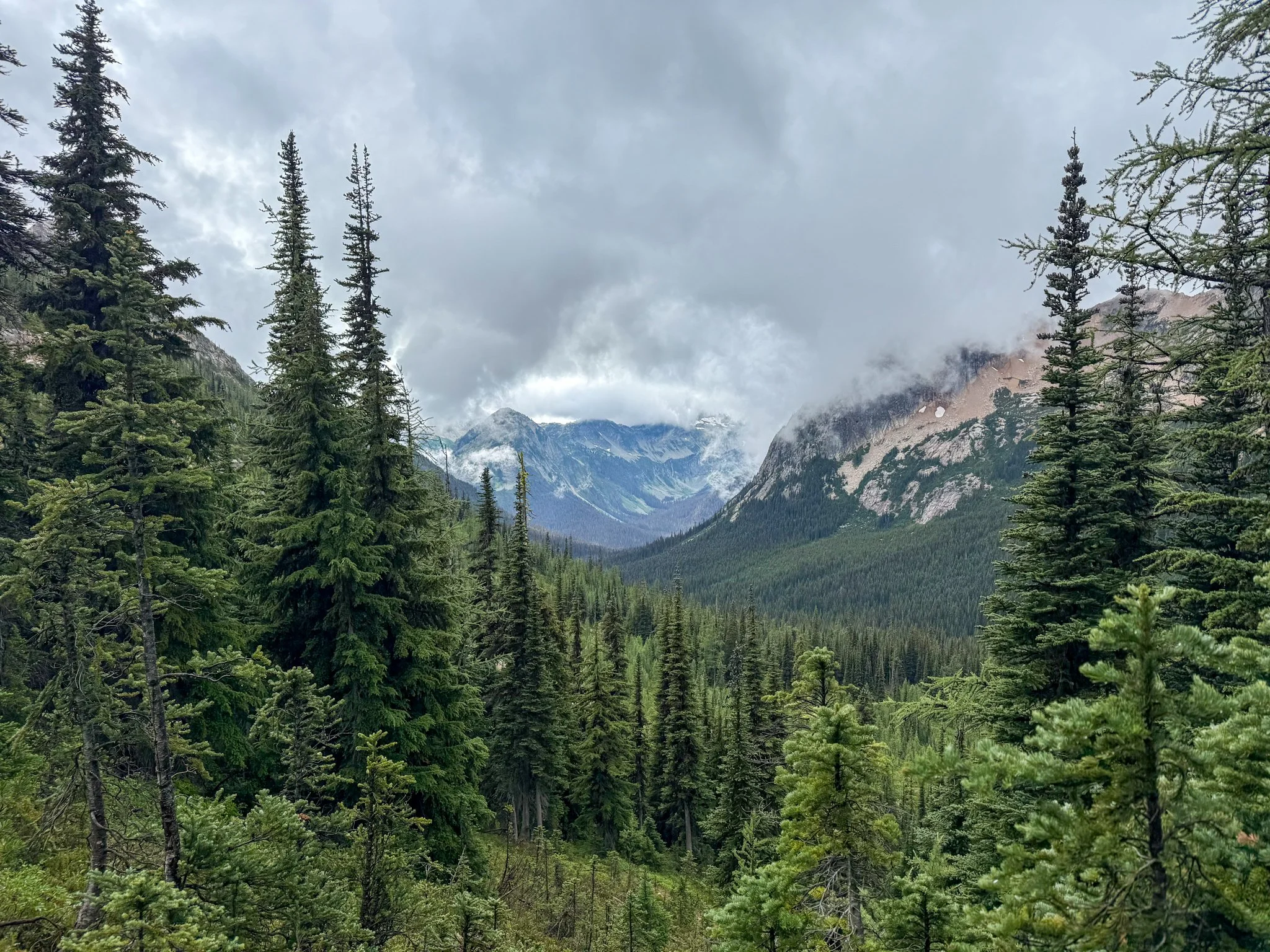
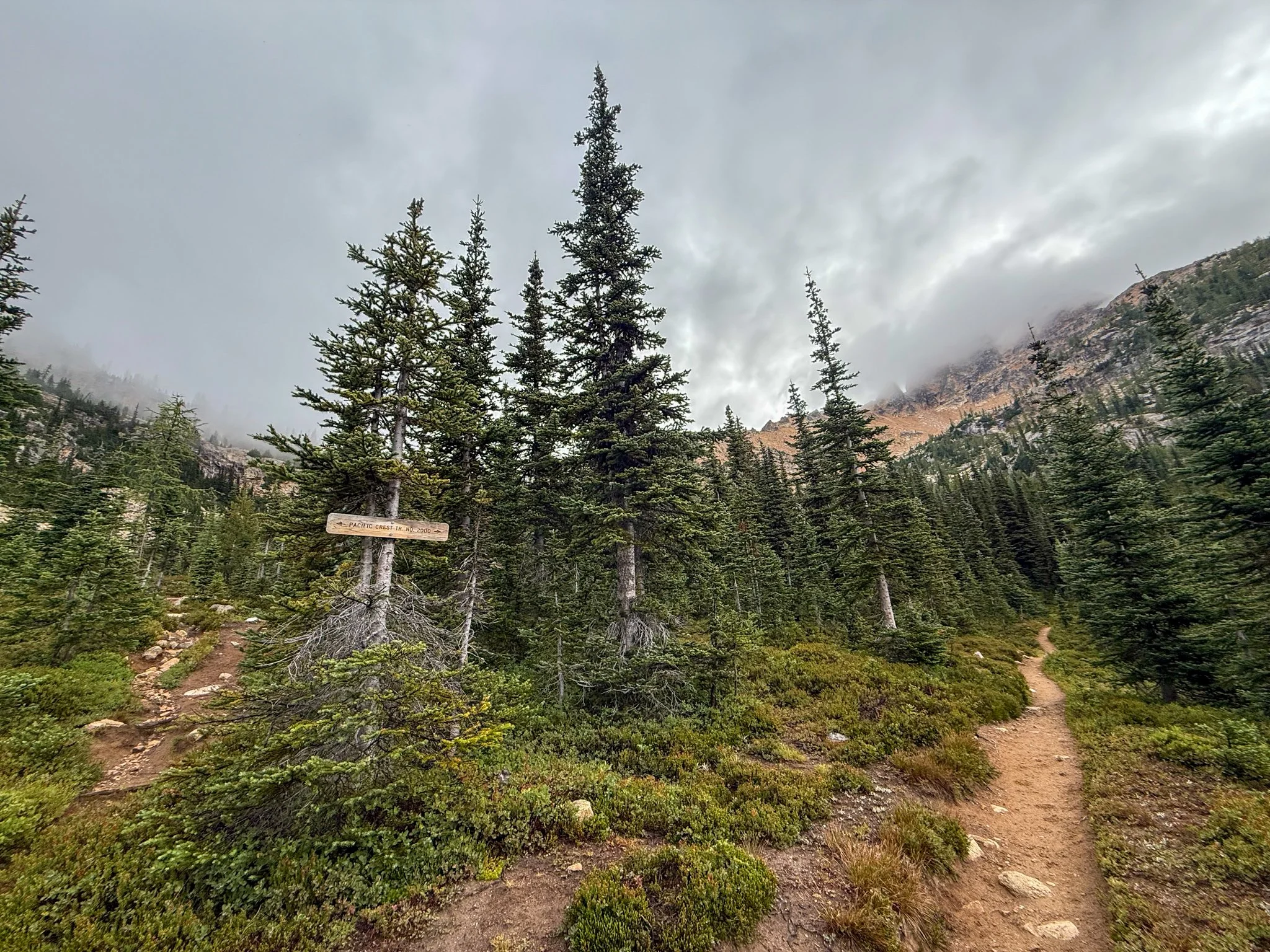
Once we crossed the street into the official last section of the trail, section L, we began to see posters around the parking areas for a missing/wanted man that had committed serious, heinous crimes. They had last seen him in the area a few weeks prior, so this was not a surprise that there was a lot of warning and commotion around this. The forest service had actually closed part of the PCT at some point while they were searching for this person. (His remains would go on to be in a few months).
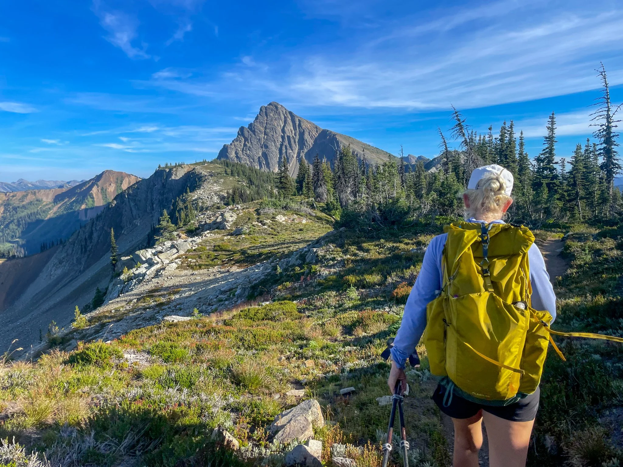
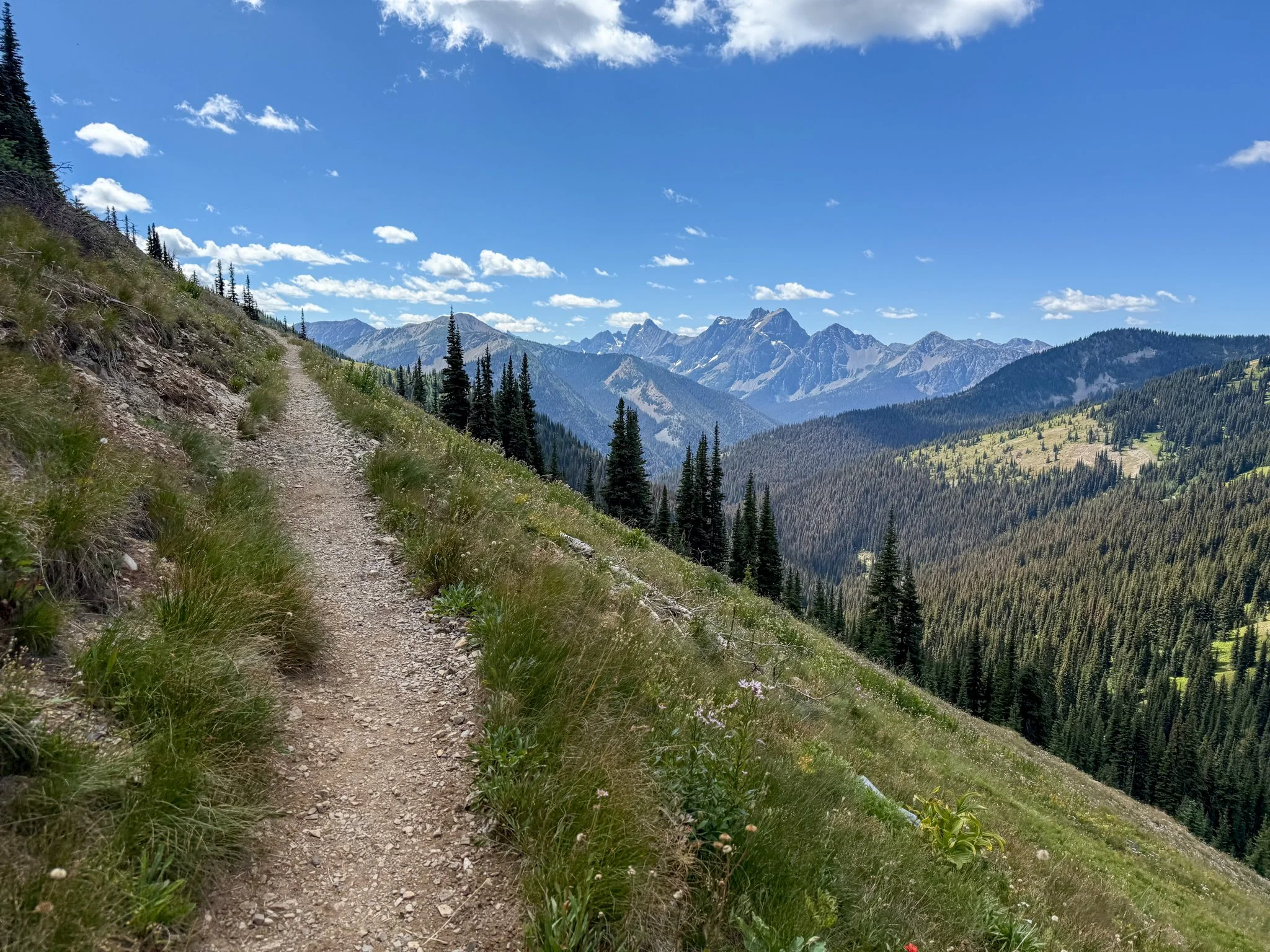
The climbs for the remainder of the day were manageable, and once out of the dense forest, the trail opened up. The weather was moody, delivering moments of clear sunny skies that quickly shifted to a cloud currently forming around us. The weather was rolling in while George and I were hiking on very rocky exposed sections. And although this translated to beautiful expanse of views, I was happy to arrive into camp where Bags and Waterboy had already set up. I would hate to be in such an exposed area while a potential thunderstorm is coming through.
We had all set up our tents in a rare open/flat area that had a water source, but was in the saddle in between two peaks. This meant that it was a bit windy and a clouds continued to form and float away around us. I would occasionally look outside of my tent throughout the evening and it would vacillate between a beautiful view of a canyon in front of me to the inability to see more than two feet in front of my face. Welcome to the mountains?
Day 10: Mile 2604.3 - 2625.8
Trail Daily Miles: 21.5
Elevation Gain: 3827 ft
Elevation Loss: 3794 ft
Weather: Mist, Windy, Chilly
Overall Day Sentiment: Proud to finish new miles.
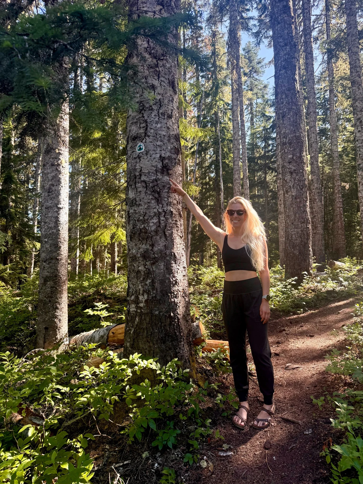
I woke up and it was still a bit misty, everything covered in dew, but the inside of my tent was bone dry. I am thankful for my waterproof tent that survived the AT. Overgrowth would be the obstacle of the day. With recent rains, all the bushes and foliage were wet. And when you are walking through an overgrown trail in which these bushes cover the trail, you then get wet. I may as well been dumping cups of water on my socks and shoes. I also have pretty sensitive skin so some of this foliage induced a minor allergic reaction in which my skin was itching or stinging. Some of this overgrowth would be handled just by the sheer amount of hikers that we’re going to walk through this area when the “bubble “came through. Our group was just a few weeks before large masses were slated to descend.
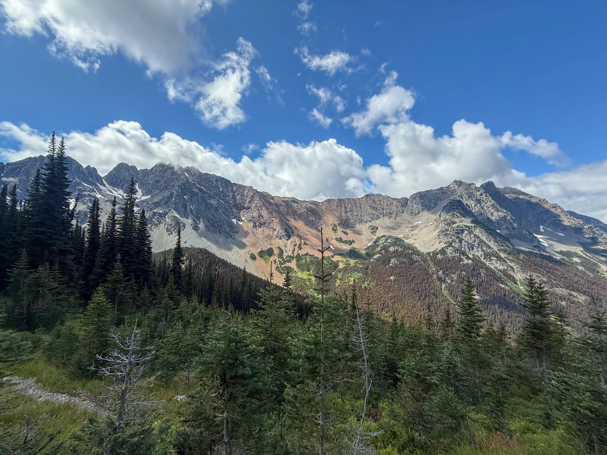
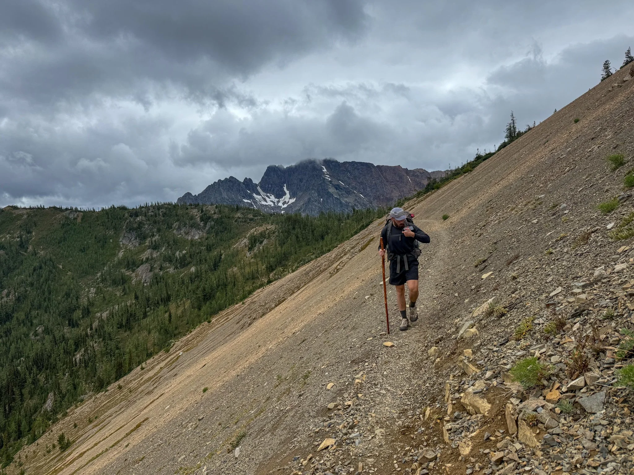
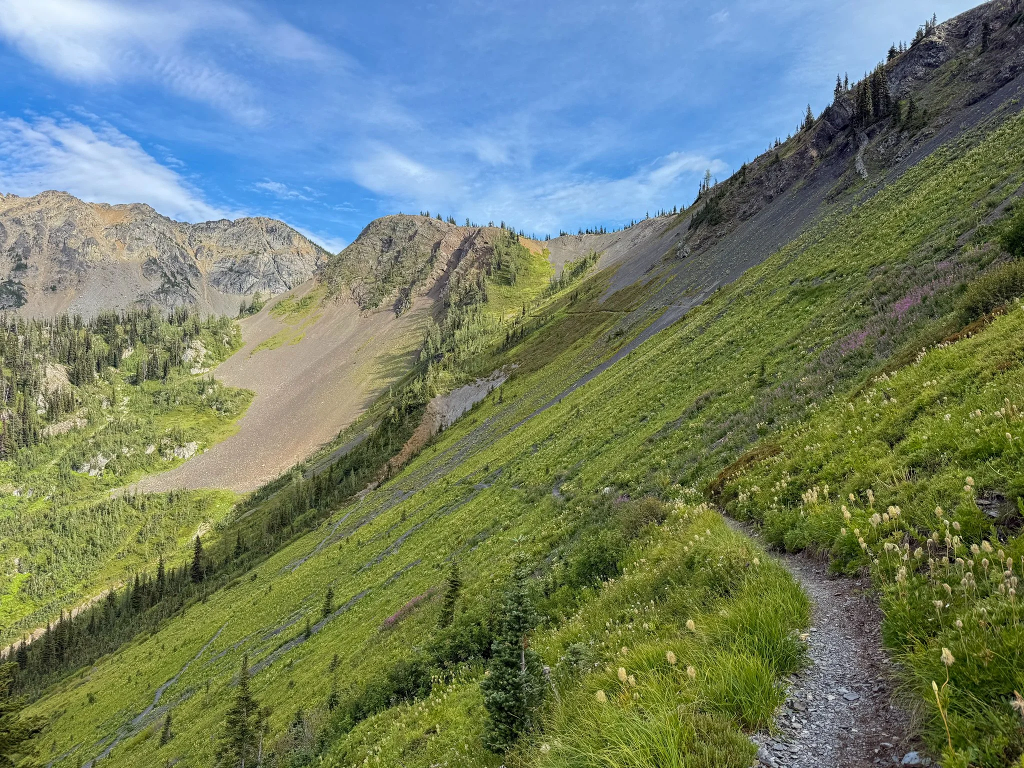
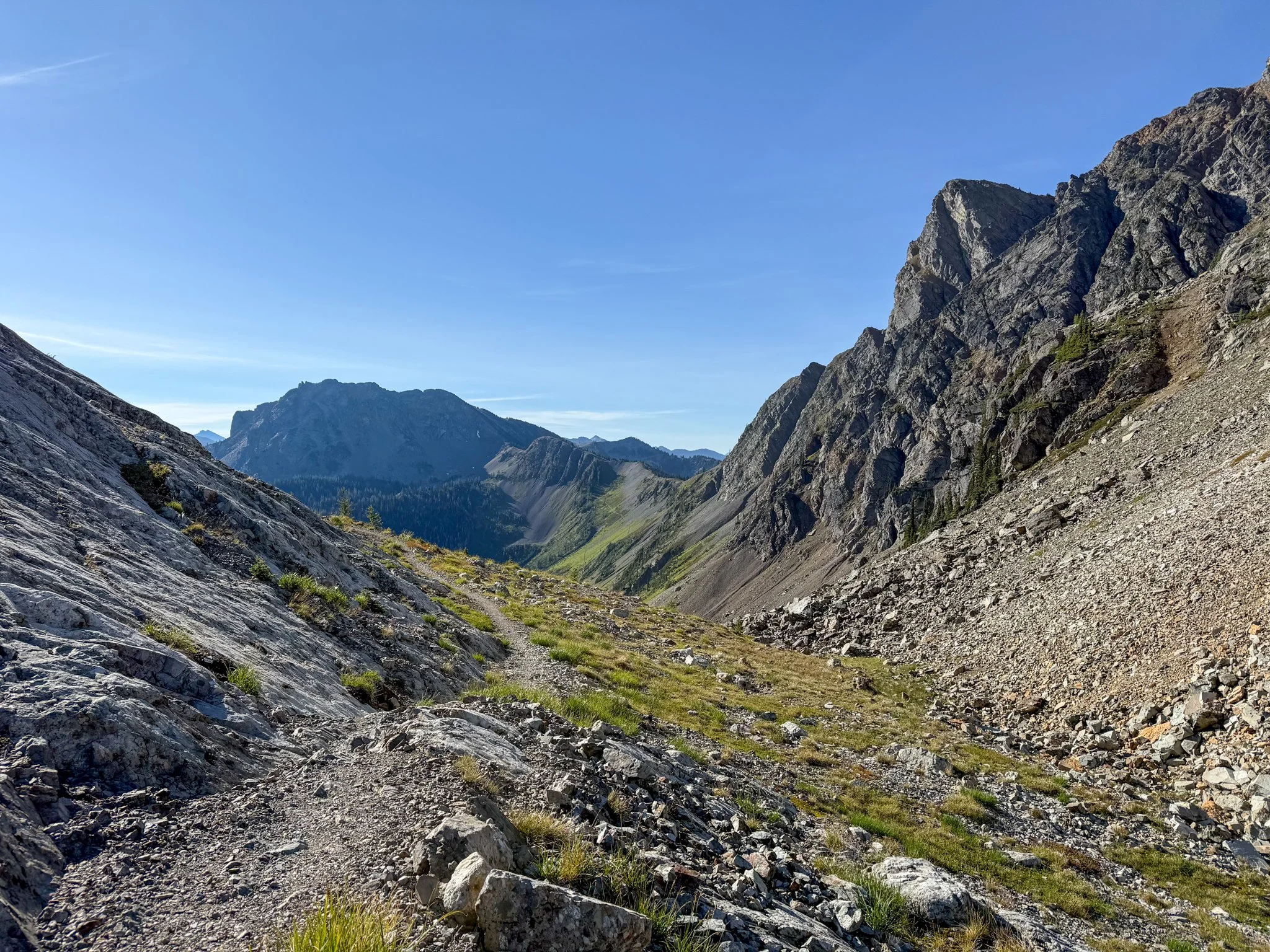
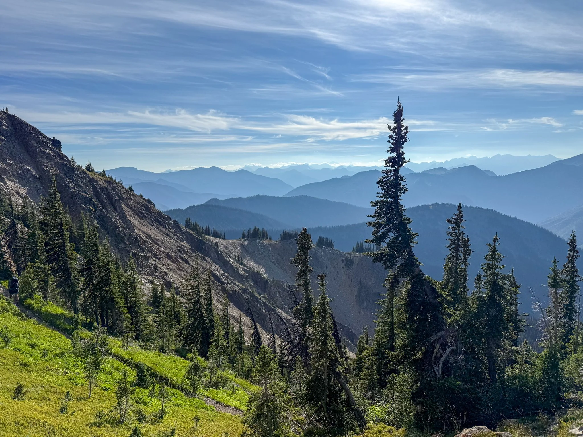
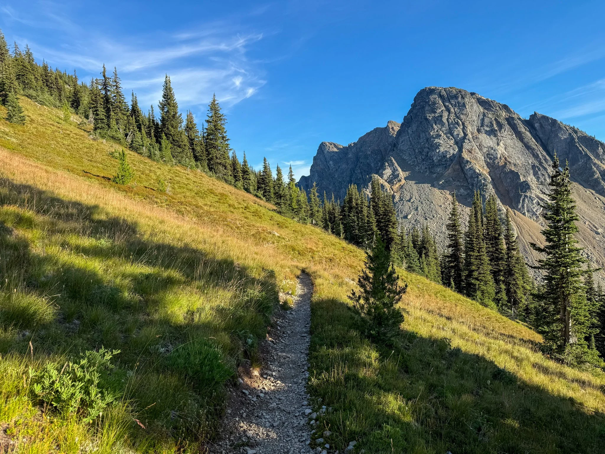
There was one significant climb of the day to Grasshopper Pass. I stopped for a lot lunch halfway up once out of the majority of the overgrowth. I wanted to dry out my shoes and socks as much as possible. The remaining climb up Grasshopper Pass was rocky with sweeping views that looked much like the moon. It continued to mist on and off because the clouds and relative high elevation were coming through. Also add in wind during the final bit of gain.
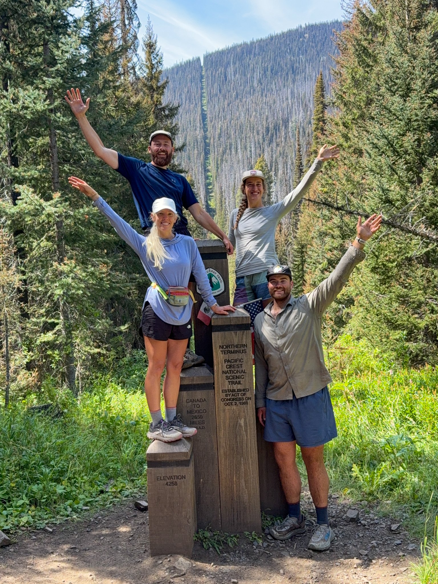
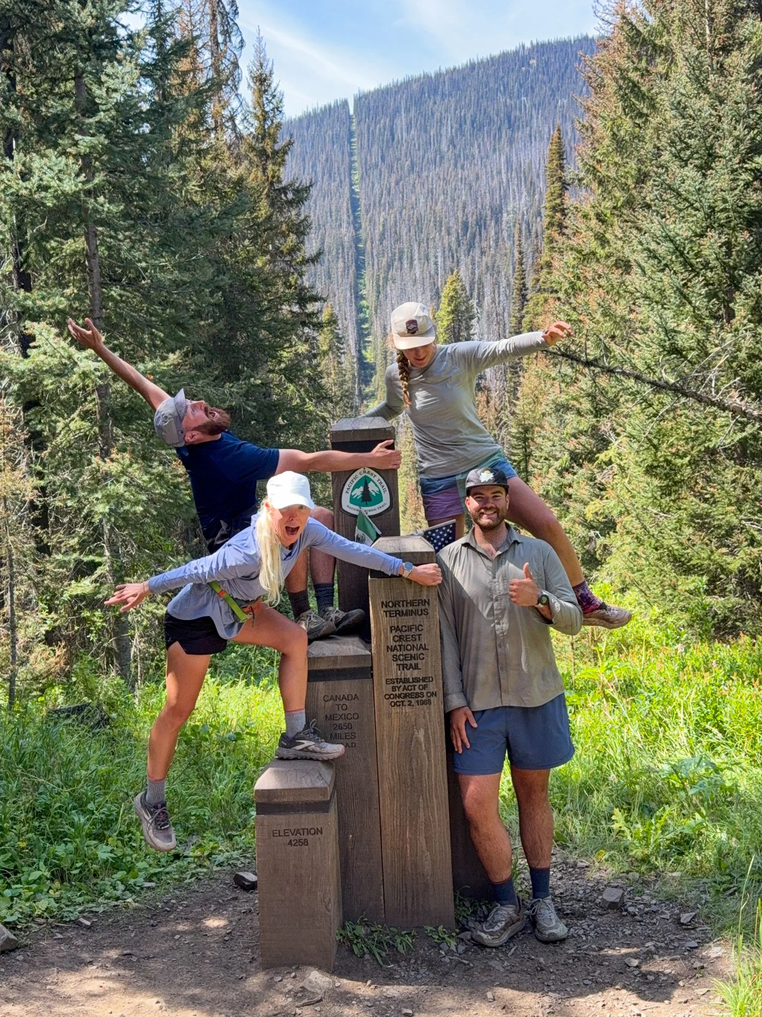
Eventually, George caught up with me and then we caught up to Bags and Waterboy a few miles before we reached Hart’s Pass. Bags and I laughed and giggled when we reached Hart’s Pass again as we had done the year prior. This officially marked the end of our new miles on the ~ 160 total. This next portion was a 60 mile section that we had done before. 30 miles in to touch the Canadian border and then 30 miles out back to Hart’s Pass. In fact, Bags had done it twice at this point! We signed the trail log and saw many hikers from previous years listed.
The main campground that we had been planning on in the area was closed due to falling trees, but we found a spot just north of Hart’s pass not too far from water. Once we set up all of our tents, we played games again going back-and-forth between the tents. 20 questions was the game of choice for the evening and George infuriatingly stumped us with the word “laminator”.
Day 11: Mile 2625.8 - 2644.8
Trail Daily Miles: 19
Elevation Gain: 3706 ft
Elevation Loss: 3402 ft
Weather: Sun, Warm, Wind
Overall Day Sentiment: Thankful to be back in this beautiful section
The day held both a moderate amount of miles in a moderate amount of elevation gain and loss. Therefore I did not get moving too quickly this morning because I knew what the terrain was going to hold as this section was familiar. The climbs might’ve been consistent, but everything was graded appropriately and the views made up for any effort you put in. There were not a lot of water sources in the area so it took a bit of planning of when to get water throughout the day and to only partially trust the water source information that was on our mapping application. At this point in the season, mid August, water sources can dry up within three days if there’s not a consistent amount of rain so it’s best to fill up where there is water and make have just a bit extra.
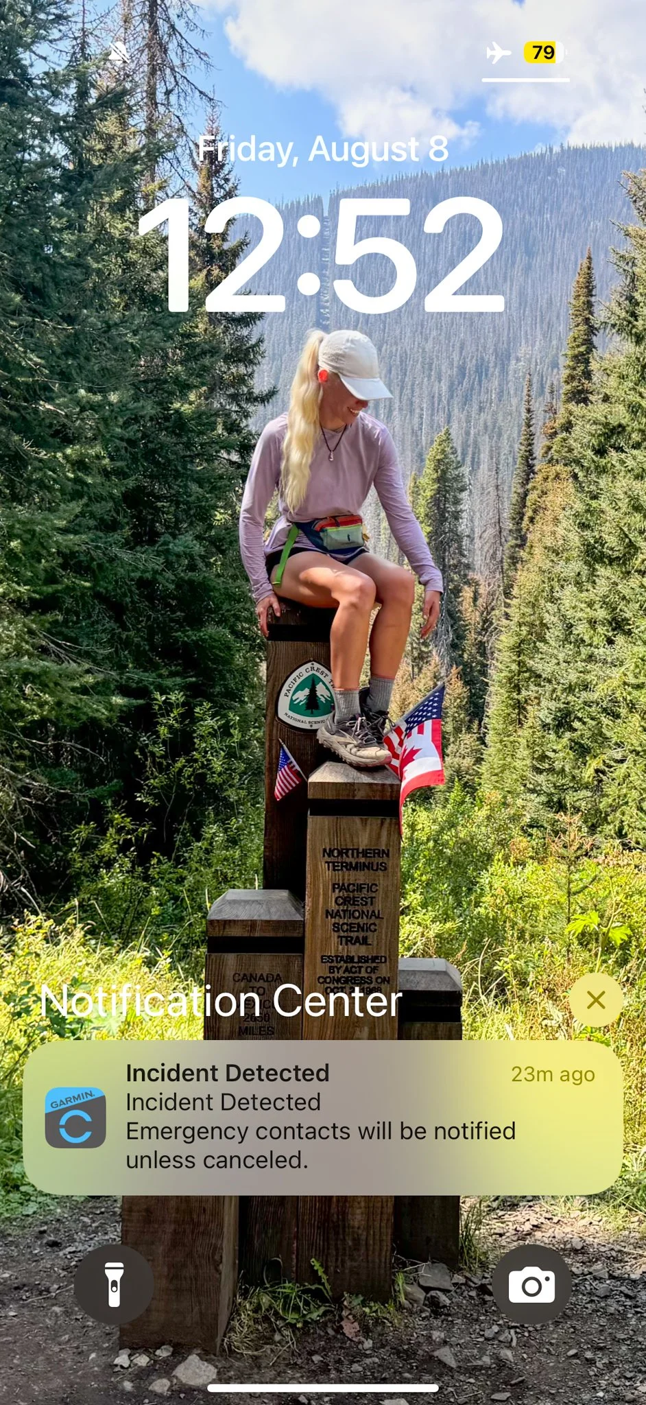
While on these long hikes, I enjoy camping with other people. In fact, I hate camping alone. But I mostly prefer to hike alone. This is when I do a lot of internal work, processing, and find a sense of peace. I do my best thinking when I’m alone on trail with decent grades and views. While hiking alone, I tend to go quickly - sometimes without realizing. Because I was in trail shape at this point, I was going quicker than the terrain should have allowed with ample loose gravel. I ended up taking one of the most dramatic falls I have ever taken. I’m unsure how I still have my front teeth because of how hard my face slammed under the ground. My AirPods flew out of my ears in different directions all while I hear my Garmin watch started playing a near siren. This is the sound of “incident detected“ from Garmin, which is meant to be a fail safe in case the wearer falls - it contacts your emergency contact. You have about 10 seconds to turn this feature off before my Garmin would reach out to my emergency contacts. While I’m laying faced down in the gravel. I’m trying to turn off my watch alarm to say “Hey I am OK. Do not contact anyone”. I pick myself up look around to make sure no one saw me and then just get into an absolute giggle fit. The next time I checked my phone I had an alert from the Garmin Connect app stating there was an “incident detected”. A picture is included below because it absolutely hit my funny bone though it was not planned.
Eventually, we all stopped at a beautiful water source for lunch that was overrun with butterflies and wildflowers. From there, we hiked together as a group of four nearly the remainder of the way to where we camped. This section crosses the Pacific Northwest Trail, another national scenic trail, as overlap for a few miles. And based on how beautiful this section is, I can only imagine that that trail is equally as gorgeous.
Bags and Waterboy went ahead and found a campsite for the night while George and I were just behind them. We were camped at Woody Pass and this would be our home for two nights. We were planning to do an out and back hike from this site in order to slackpack to the border. Then we would back to this site again for the following evening. Reminder that a slackpack is where you hike with less items in your bag (in this case our entire sleep system). The site was an open sandy spot, which was great in theory until the wind picked up and it felt like there were sand dunes whipping into the tents. I know that I ended up just tucking my head inside my quilt and hiding from the dermabrasion sandblasting. This was reminiscent of the desert on the PCT in some inopportune campsites. As with most other nights in this section we’ve played games between tents and it just sent us all into giggle fits. It felt like a sleepover in elementary school.
Day 12: Mile 2644.8 - 2644.8
Trail Daily Miles: 22.8
Elevation Gain: 4154 ft
Elevation Loss: 4154 ft
Weather: Sun, Warm
Overall Day Sentiment: Reaching Canada again was a gift.
It was Canada today! The Slack pack truly makes a difference with how quickly I move throughout the day and how much better my back feels when I’m not fully weighed down. Though this was going to be our longest day out of the entire two weeks with a real amount of elevation gain and loss, it felt much better with a lighter pack.
The day went smoothly and after the initial few miles, it was a long descent to the border. The last 6 miles or so is nearly completely tucked into trees and so when you do stumble upon the Canadian border, it seemingly pops up out of nowhere. We had all planned to have lunch at the Canadian border wiyj the monument. Bags and Carson got moving quicker than George and I did in the morning so they beat us there.
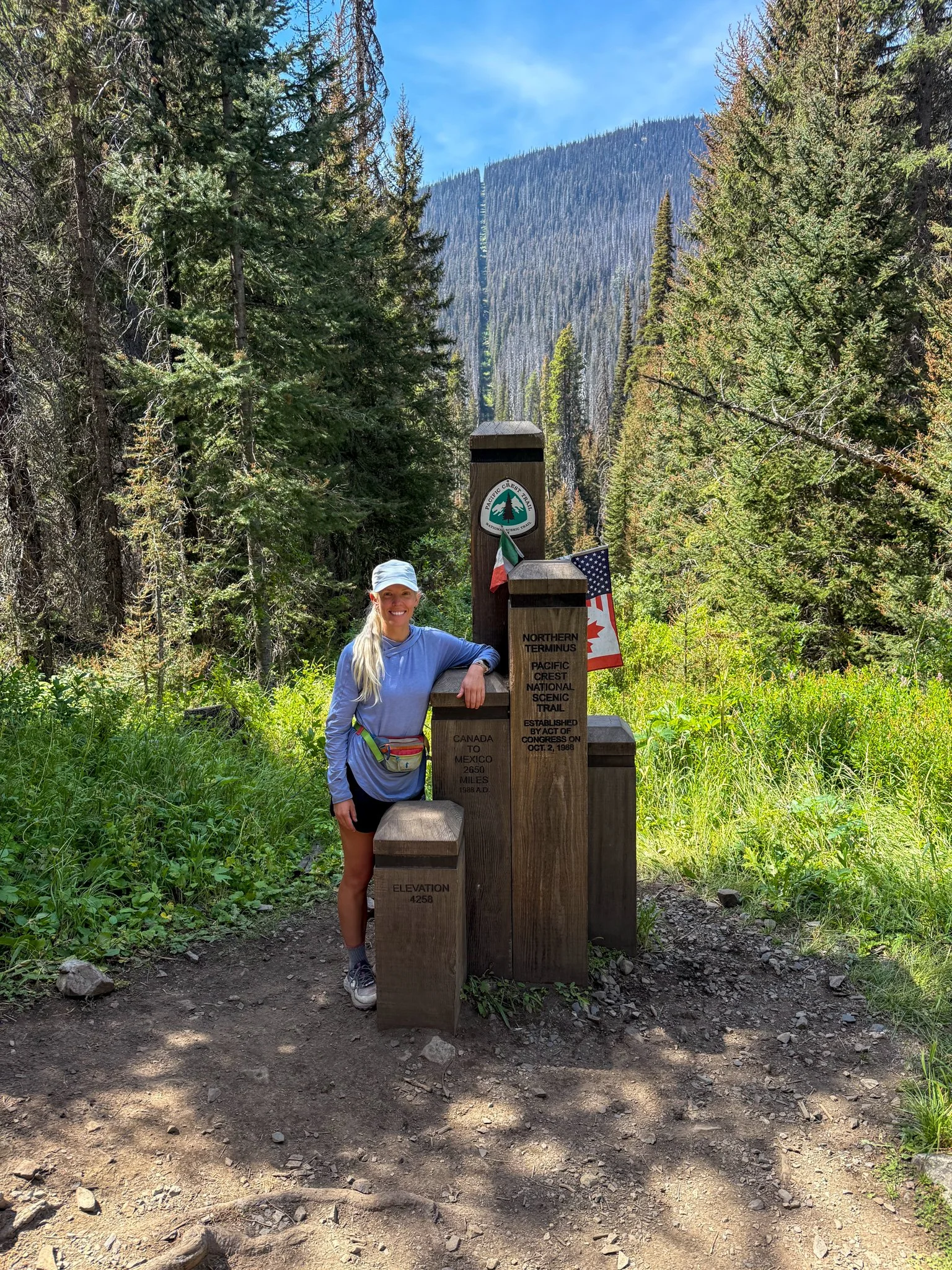
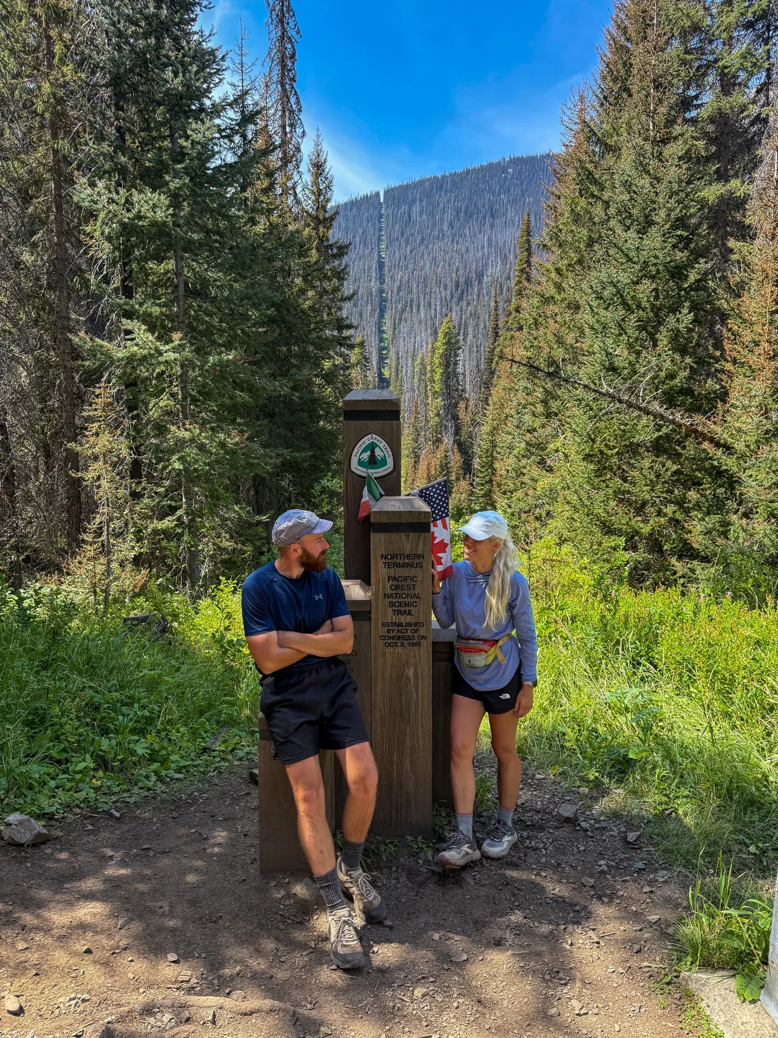
It was a surreal experience to be back at Canadian border on the Pacific Crest Trail, specifically with Bags who I shared this moment with a year prior. There were some section hikers there when we all arrived and as we were leaving, thru-hikers were arriving! What a beautiful end to a hopefully beautiful journey for them.
When you finish something as monumental as a long thru-hike like this, there are of course joyful moments, but then there are moments of mourning. Moments of mourning that you may never be in the same spot again and definitely not with the same people. And when hiking in the backcountry, specifically somewhere so remote, it is truthfully unlikely you would be back in the same location ever again. It takes a lot of logistics and effort to reach a spot like the Canadian border and I’m so thankful that I was able to touch the monument again. It was exactly 4 weeks after I had summited Mount Katahdin, finishing up my Appalachian Trail thru-hike. This was also surreal because when I finished the Pacific Crest Trail, I had no intention of through hiking the Appalachian Trail or had any other long trail on my mind. And finally, the last time I was at the monument, my father was still alive. It may have been exactly a calendar year, but as with the theme of my life during this period of time, the only constant is change.
Even though I could stay at the monument for hours, we had about 11 miles back to the campsite. And as the descent was towards the border, getting back to the campsite was overall a slow ascent. There was a beautiful lake a few miles before camp that all of us decided to stop at for both the water source and to go swimming. Because we did not need to set up our tentsor sleep systems ready, there was extra time. There were several groups of people at this lake and we’re quite shocked when some in our group went full skinny-dipping. In fact, one person who forgot how well sound travels over water screamed “Oh my god that guy is butt naked!” To which we responded with a chorus of laughter which tied in beautifully to the melody of the pikas cheeping around us.
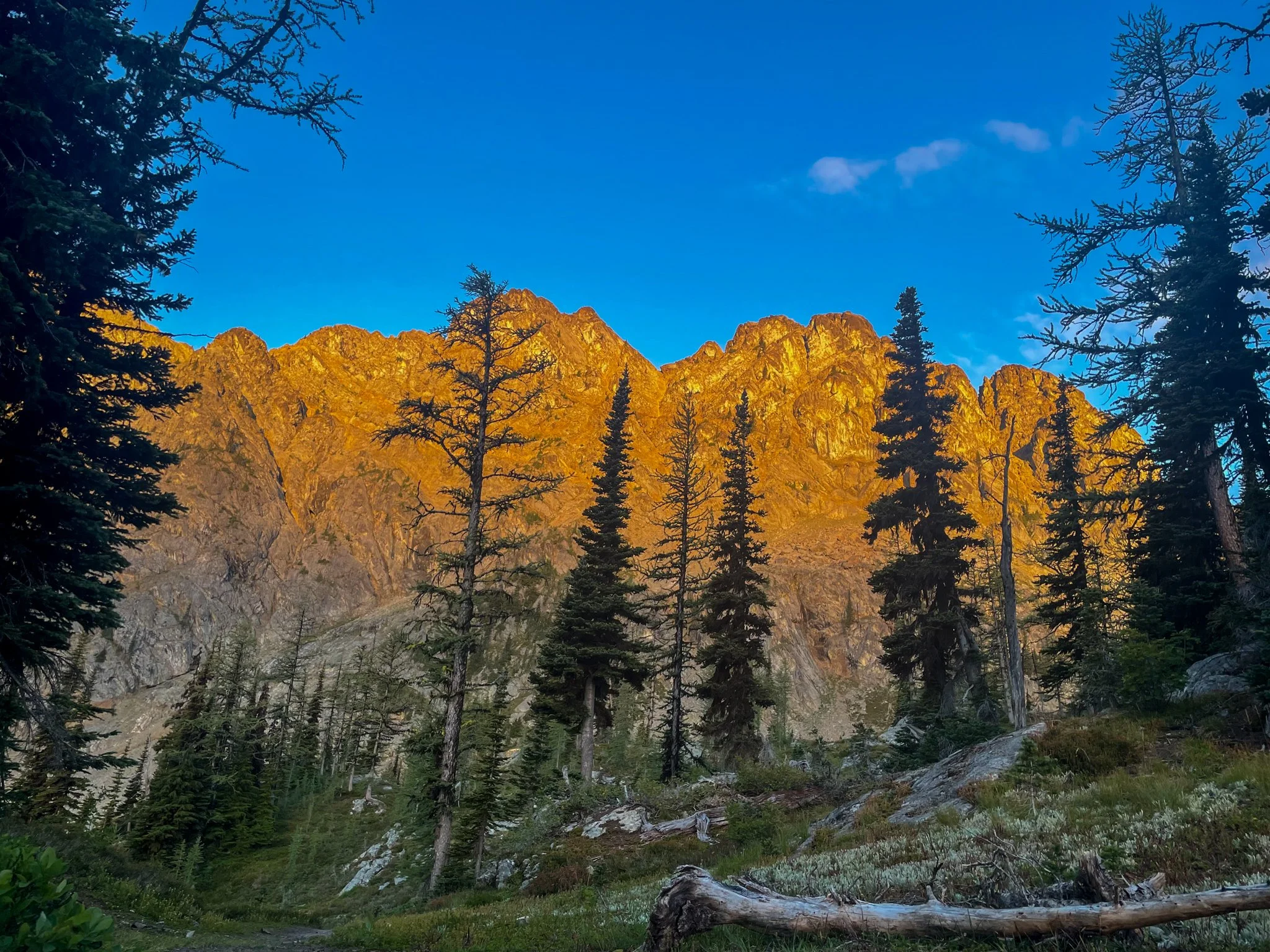
After a dip we made our way back to our campsite for the night just as the sun was starting to get low in the sky. Some of my favorite photographs that I have taken in my life are in this specific section between the lake and Woody Pass.
Once back at camp, thankfully, all of our stuff was intact. We tidied up, got things reinflated and cleared out of sand. Because so much sand blew into my tent the night before I configured my clothing and coats and items blocking any openings that I had around my tent in hopes to quell the sand dunes inside my tent.
After dinner, we once again played games in between the tents and this evening we tried to name as many dog breeds as possible, which was all fun and games until Bags started naming very specific birding dog breeds that only she would know. She very much won.
Day 13: Mile 2644.8 - 2625.2
Trail Daily Miles: 19.6
Elevation Gain: 4107 ft
Elevation Loss: 3892 ft
Weather: Sun
Overall Day Sentiment: A dreamy end to a dreamy trip
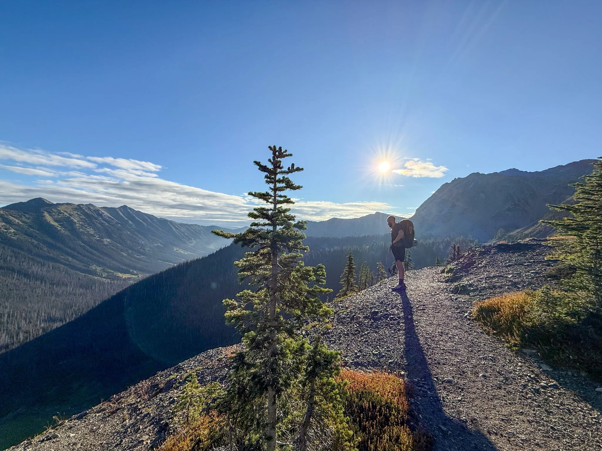
It was a relatively long hiking day today and we had to hitch to Mazama, which is the closest town to Hart’s Pass. Meaning, I got up and moving just at sunrise (pictured below) and this was the earliest I had gotten up in the last two weeks. The remaining 19 miles of the day from where I camped to Hart’s somewhat flew by. Of course it felt familiar because this was now the fourth time that I was walking this specific miles of the PCT. But it did contain a bit more ascent than I remember. The last few miles before the Hart’s Pass campground and parking lot just kept going up? It was a slight enough grade that I did not notice that the gift of descent while heading towards the Canadian border, but heading back out I could really feel the ascent. I think it was also felt because this was our 13th day of hiking in a row with no zero days.
George and I were moving just a bit faster than Bags and Waterboy so we arrived at the Hart’s Pass parking lot before them. We ran into a nice couple that was finishing up a weekend loop and offered to give us a ride to Mazama. We had already discussed with Bags and Waterboy that whichever hikers got to the parking lot first just take the hitch and then we would all meet at the Mazama Store. This couple was wonderful and had so many adventures of their own that made the 50 minute ride down the mountain go by quickly.
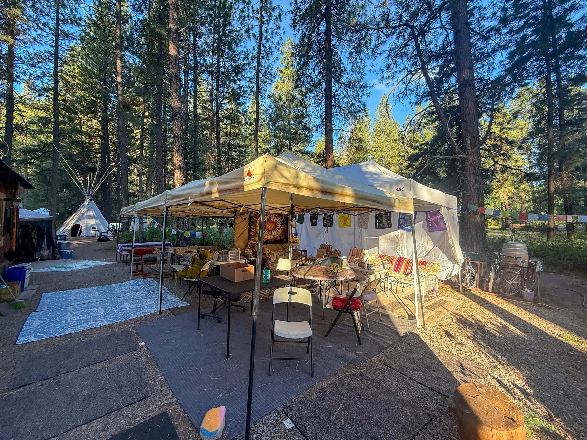
Once at the Mazama store that I had only briefly been to in 2024, it was heavenly. There was a bakery onsite that had gluten-free goods in addition to good vibes. As much water as we could drink along with picnic tables in the shade. This was a place where all hikers meet up. Eventually Bags and Waterboy got a ride down along with several other thru-hikers that had recently finished. We were all spending time together at the picnic tables and then headed over to our accommodation for the night the Lions Den hostel.
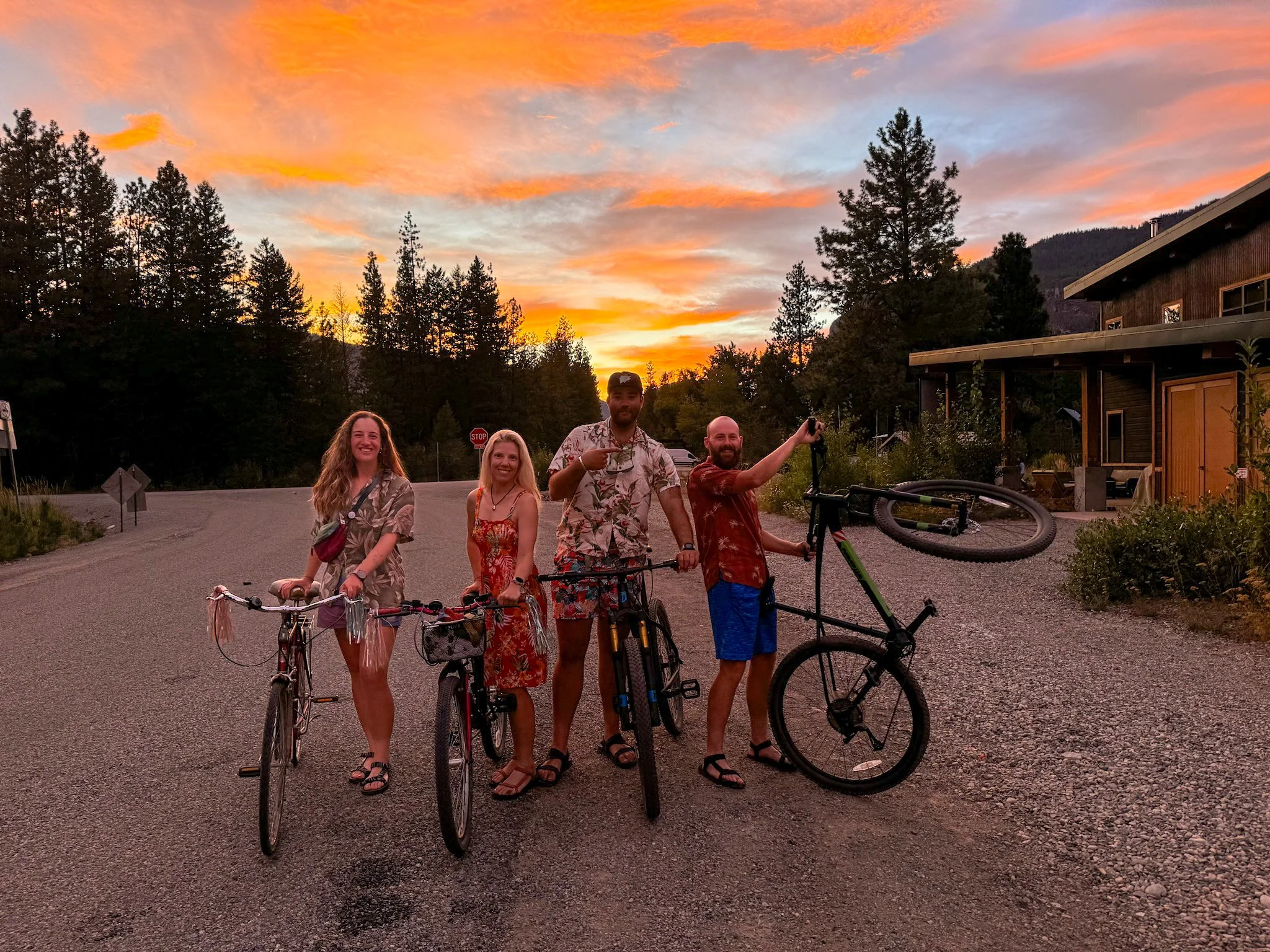
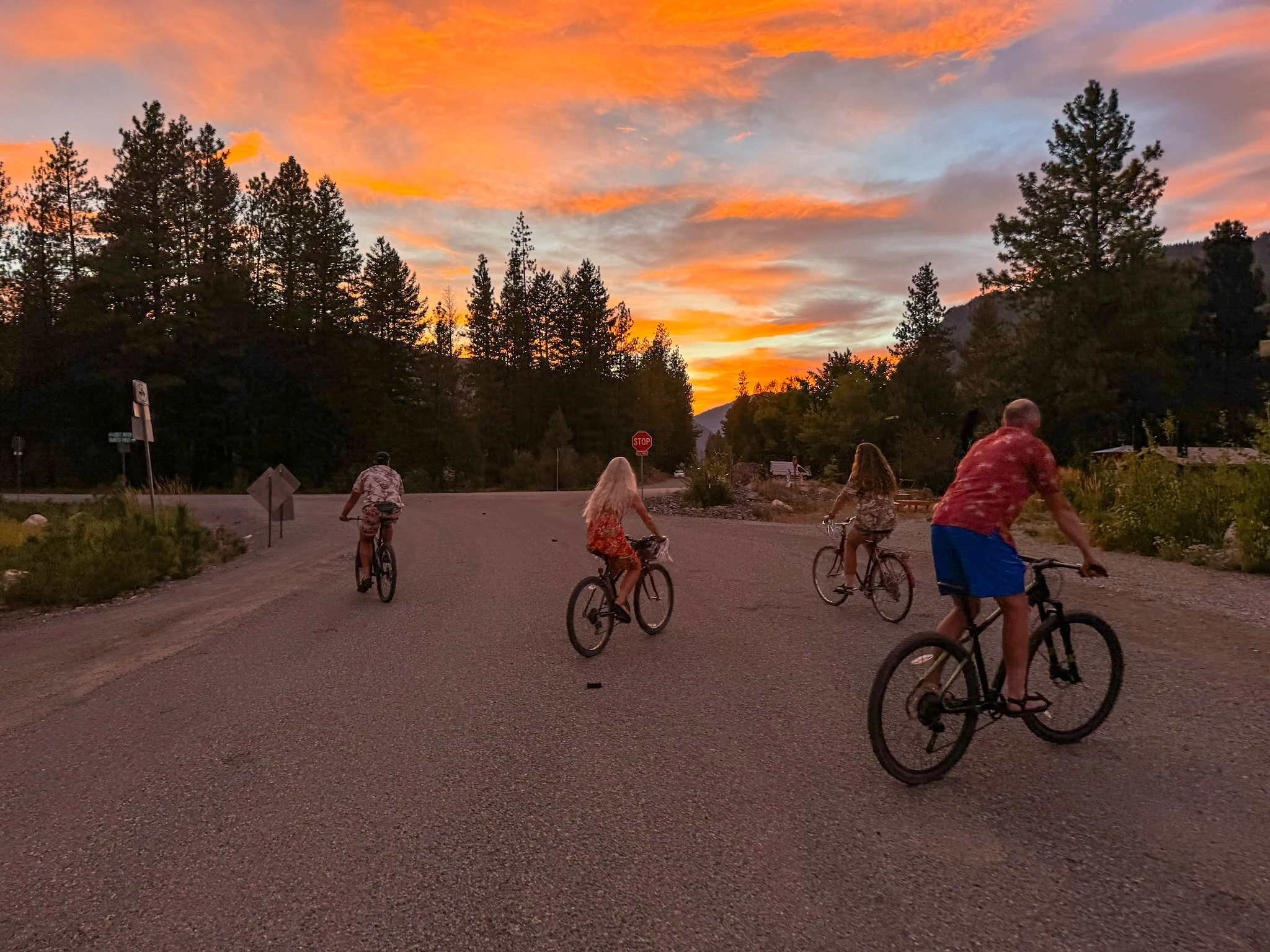
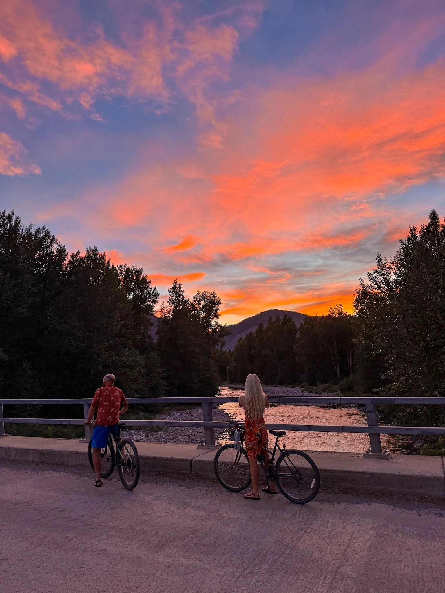
I had not stayed at this hostel in 2024 but Bags did. This Trail Angel is in fact an angel and Mary has the perfect set up for hikers to come and go on their last/first stop with the trail, depending on direction of hiking. A quick shower and Hawaiian themed loaner clothes and I felt very fresh. This hostel had bicycles that we could take into town as well. The large group of us went to the brewery for dinner. So at least 10 raggedy hikers who are freshly showered, in Hawaiian shirts and dresses, on cruiser bikes landing at this brewery – it was a sight to see.
After a delicious dinner, we made our way back to the hostel as a large group. But we’re greeted with one of the most beautiful sunsets I’ve ever seen in my entire life. In the pictures below, you’ll see my wonderful group of four that created such a special two weeks with a beautiful backdrop of the sunset and our great bikes. It was a dreamy moment.
There was a great evening ambience at the hostel and they were quite rigid about the bedtime - hallelujah. Sometimes at hostels (definitely at hostels on the AT) there can be a partying mentality, but by between 9:00pm - 10:00pm, everything shut down and it is quiet hours. It was a perfect end to a beautiful day of hiking one of my favorite sections on the entire PCT.
Day 14:
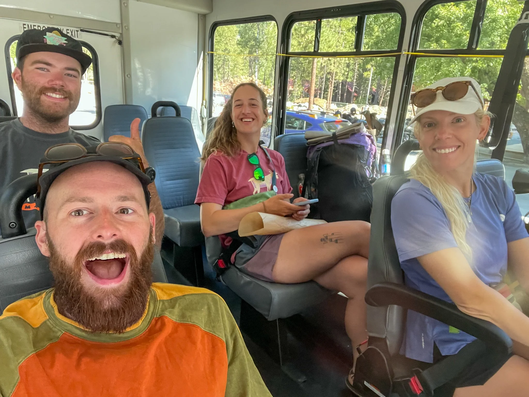
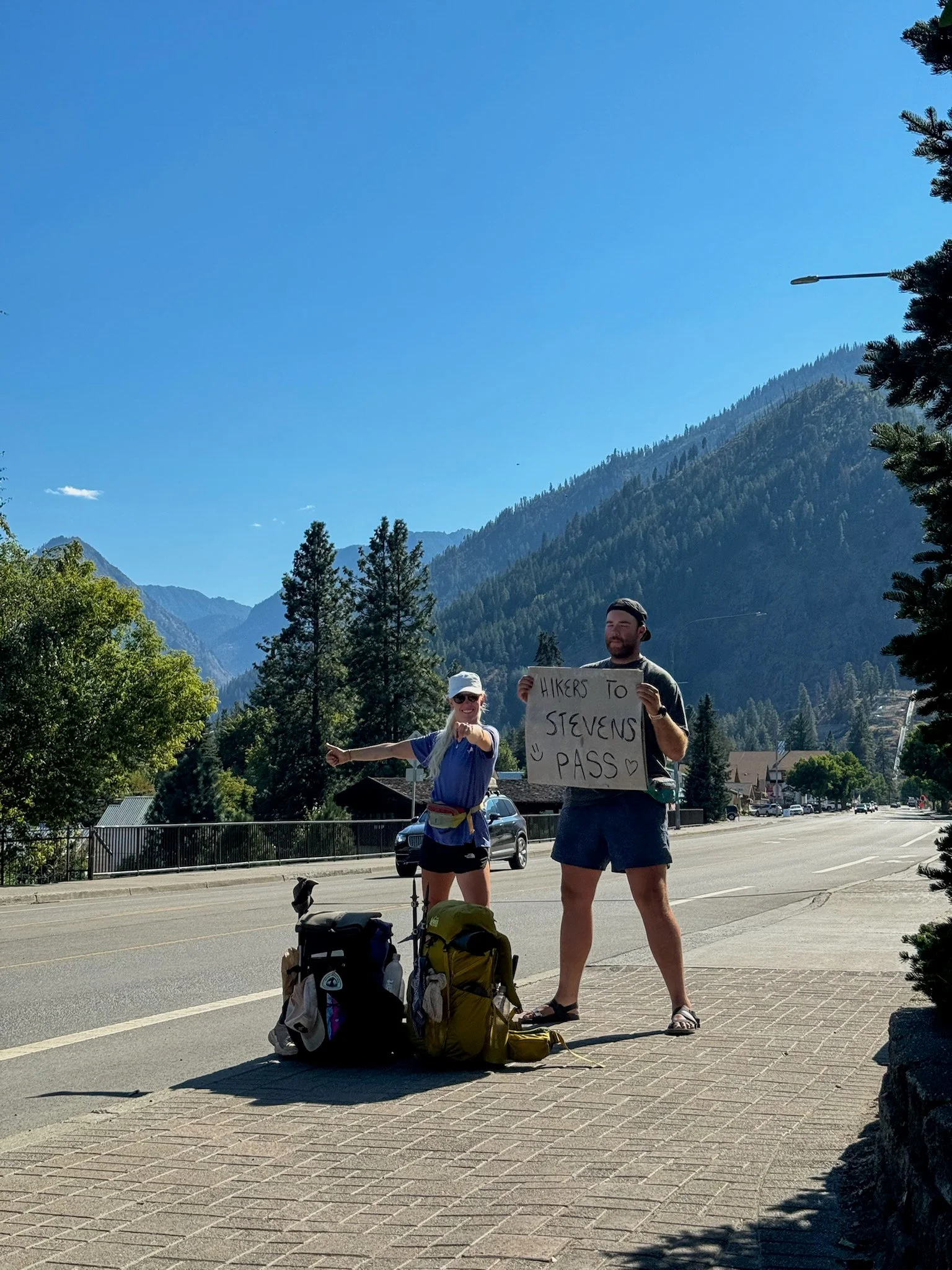
If you all remember from the last post, we had originally parked Bags‘ car at Steven’s Pass. We told ourselves that we would figure out how to get back at some point. This was that point. Much to our surprise, there was a bus system that connected to several cities along the way that would get us to Leavenworth, which is the closest town to Steven’s Pass. In August, they were doing free bus services so instead of hitching the four of us were able to get free bus rides across four different bus systems to our destination. The drivers of these buses were very coordinated and helped assist us along this way.
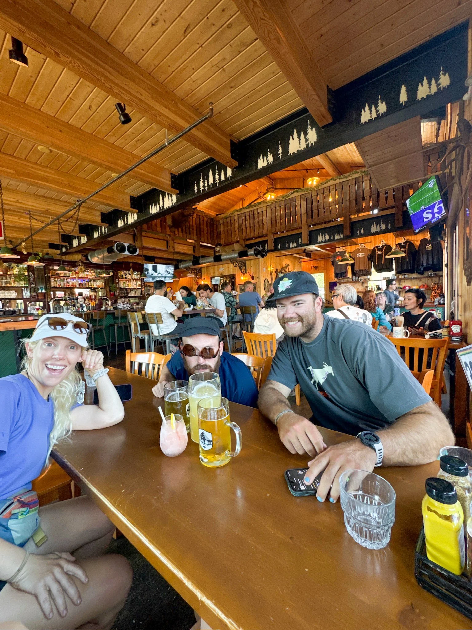
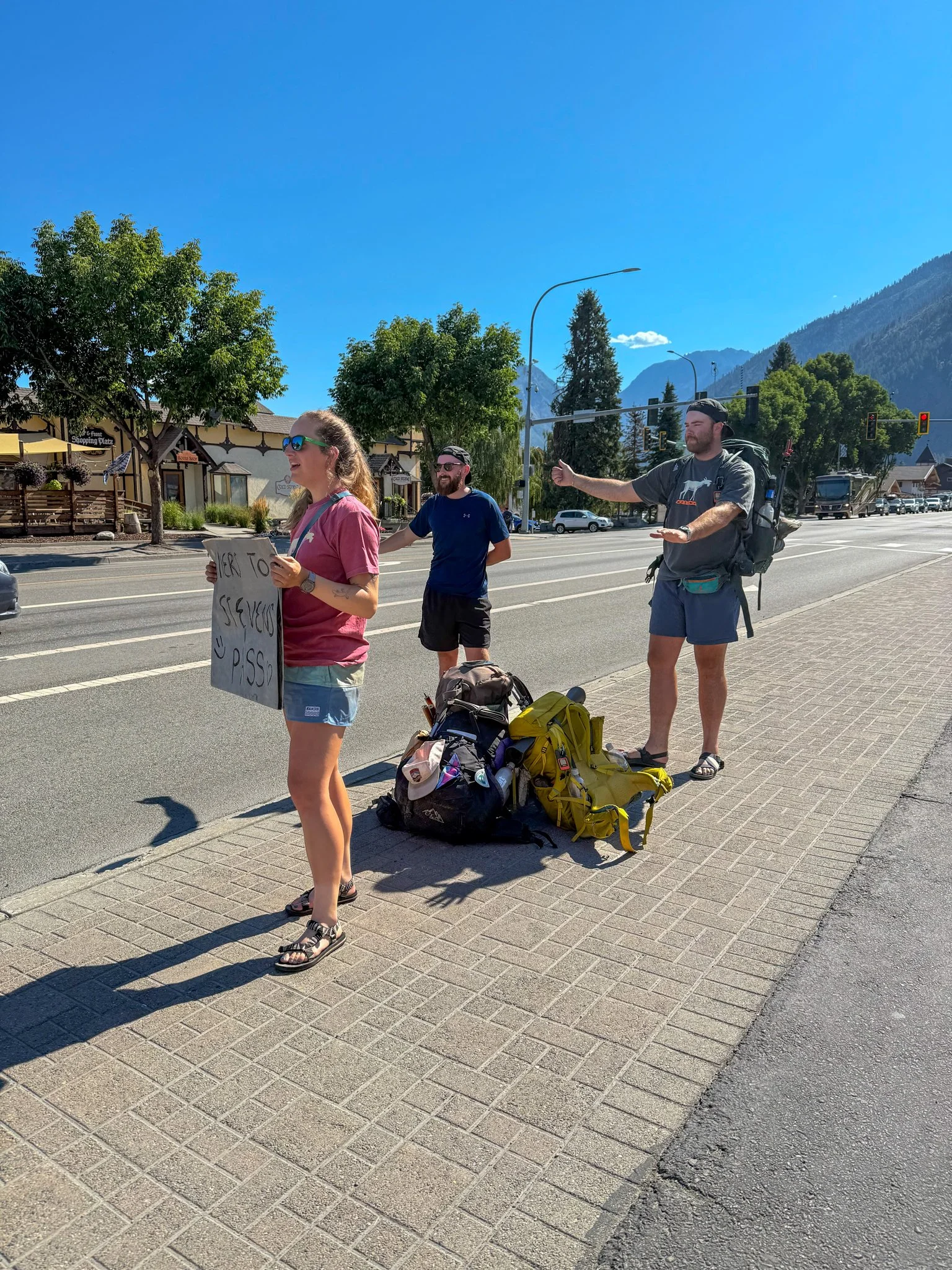
Once in Leavenworth, we knew that we were not going to catch the official bus heading from Leavenworth to Steven’s Pass so we settled in for lunch. Reminder that Leavenworth, Washington is a Bavarian themed town; beer and tubular meats reign supreme. It was a blisteringly hot day when you got down out of the mountains 95f/36c. So after being an air conditioning of the restaurant, then going to the curb to attempt to get a hitch the 30 minutes to the pass was a task. Eventually, after a lot of dancing and creating signs on Bags’ tent footprint, Bags and Waterboy got a hitch all the way up to her car. George and I eventually got a hitch about halfway up which saved a bit of time.
The decision was to drive back to Oregon - about five hours. Once we arrived at Bags‘ house, all four of us crashed hard. I specifically remember falling asleep while in the middle of a sentence.
It was a magical two weeks being back on the Pacific Crest Trail. 160 new miles and 220 miles total while touching the Canadian border. The group of the four of us worked well together and had fun along the way because that was the primary goal. I was able to see the great trail towns of Stehekin and Mazama and the beauty of these two sections provided.
After this, I had another adventure scheduled for the summer. Stay tuned.